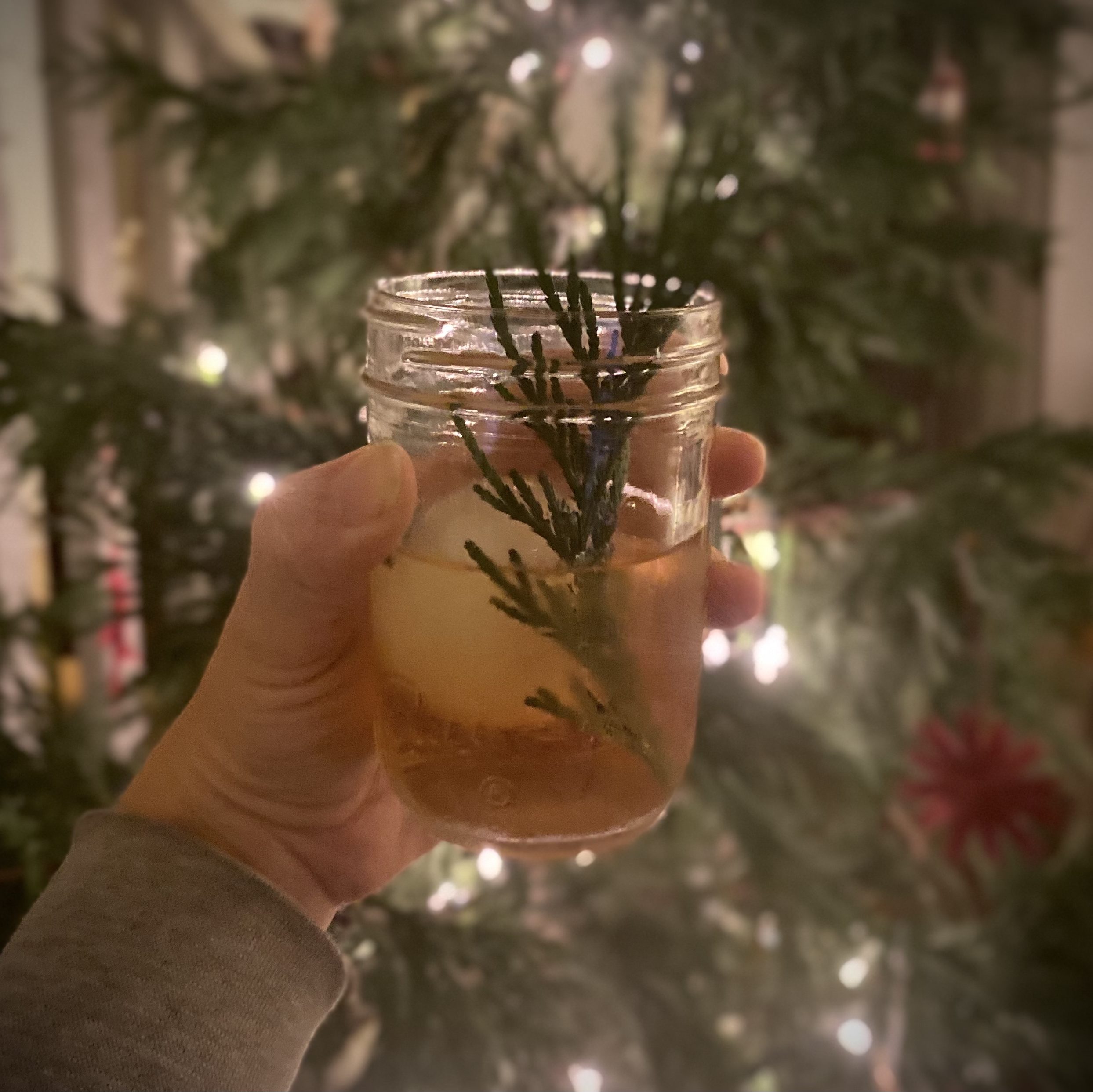
The winter solstice in the northern hemisphere marks the moment when the northern pole of the Earth’s axis is directed farthest from the sun. There is more darkness on this day than any other, but there is also the promise of new light.
As our region hunkers down into a new Stay-at-Home order, we invite you to cozy up with this Solstice Sip. Powered by the evergreen qualities of the conifers around you, whether from a neighborhood redwood tree or a douglas fir you’ve recently brought inside and covered in twinkle lights, this classic twist on an old fashioned will remind you of the light to come and the light that still flickers, even in these dark times.
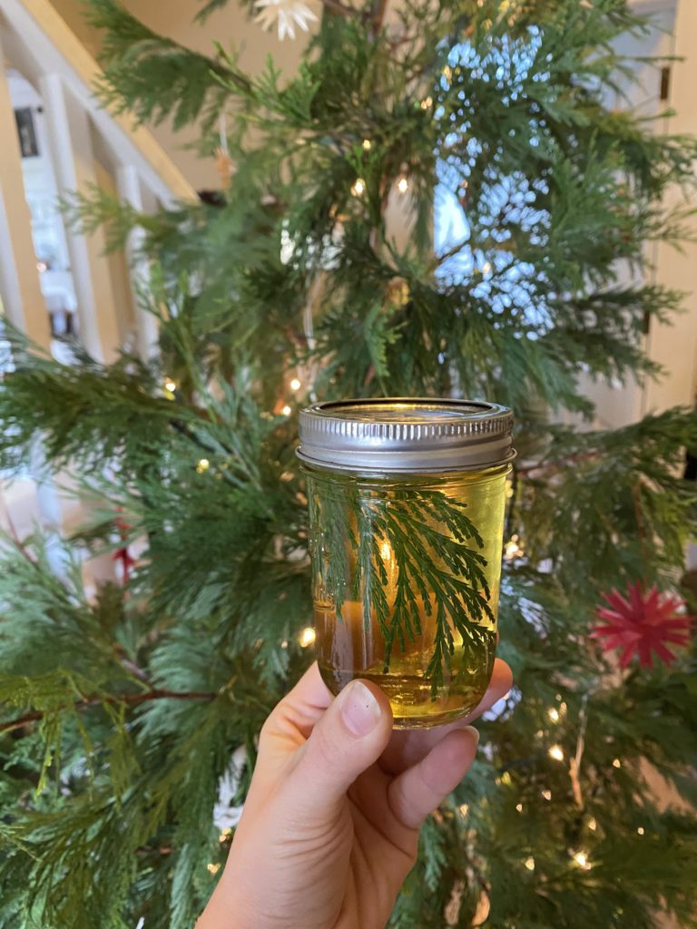
**The example shown here features incense cedar (Calocedrus decurrens) harvested from a Christmas tree, but other options readily available in Santa Cruz are coast redwood (Sequoia sempervirens) and Douglas fir (Pseudotsuga menziesii). The fresher the growth of the sprigs, the richer the flavor. Make sure to properly identify your tree before harvesting because some coniferous may be toxic if ingested (i.e. ponderosa pine or pacific yew).
Ingredients
Evergreen Simple Syrup:
A few sprigs from a conifer** (about 1/2 cup)
1 cup of water
1 cup of sugar
The Solstice Sip cocktail:
1 1/2 oz Bourbon or Rye whiskey
1 tsp Evergreen Simple Syrup
2 dashes Angostura bitters
Instructions
To make the Evergreen Simple Syrup:
Add water, sugar, and conifer sprigs to a small pot and heat over low for 15 minutes.
Remove from heat and let sit for another 15 minutes.
Strain out sprigs and store in a jar in the refrigerator for up to two weeks.
To make the Solstice Sip cocktail:
Combine simple syrup and bitters in a glass.
Fill glass halfway with ice, then stir about a dozen times.
By Graham Edwards and Gavin Piccione (aka the Geology Gents)
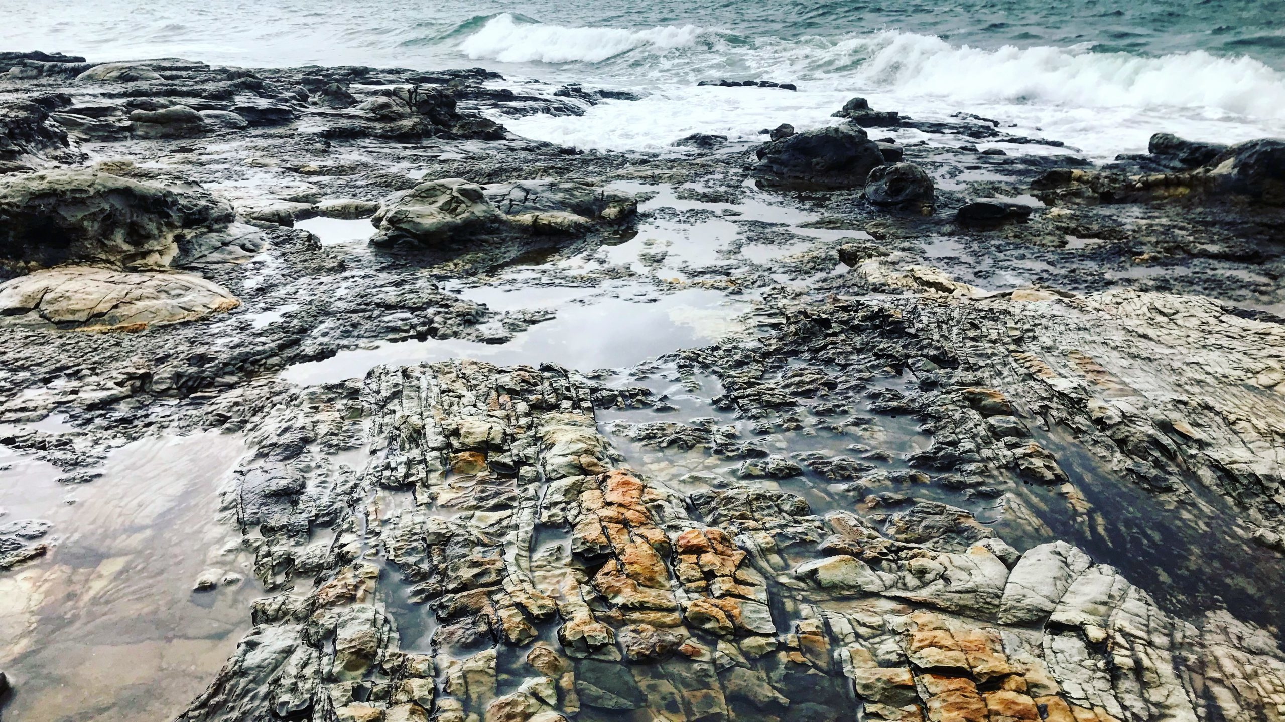
Santa Cruz is an ideal place to explore marine and coastal geology, with millions of years worth of geologic history exposed along its sea cliffs. One of the Gent’s favorite outcrops in Santa Cruz is along the cliff face on West Cliff Drive, at the end of Swift Street.
Getting to the outcrop
Park at the end of Swift Street and cross West Cliff Drive. Take one of the paths through the ice plant and walk down onto the coastal platform. Be careful, in some areas the path down to the outcrop can be steep.
To find the Swift outcrop on a map, the latitude and longitude are: 36˚56’58.72” N 122˚02’49.22” W
The Swift Street outcrop contains over 9 million years worth of geologic history of the coast of Santa Cruz. Familiar formations found at Swift Street include the Purisima sandstone and the Santa Cruz mudstone, along with younger beach deposits that make up the top layer of the outcrop (pictured right). Each of these layers are separated by sharp erosional contacts (geologists call these disconformities) that represent missing time and material in the rock record.
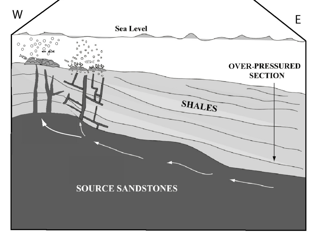
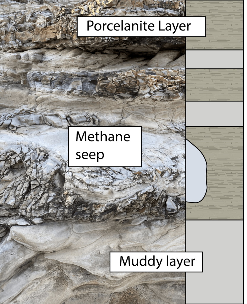
Ancient Methane seeps within the Santa Cruz mudstone
The bulbous, light-colored features found at and near the Swift Street outcrop are the geologic remnants of methane seeps, also known as “cold seeps” (pictured below).
Bulbous fossilized “cold seeps” at the Swift Street outcrop.
These formed while the Santa Cruz Mudstone was still mud in deep waters off the coast of California between 7-9 million years ago. The rock accumulated as sediments, including the bodies of perished sea critters, fell to the sea floor. As the bodies of phytoplankton and other marine microorganisms decayed in this mud, they released gases that slowly worked their way up to the surface. As these gasses followed cracks in the firmly packed sediment, they gradually widened these conduits and cemented the walls with carbonate minerals (the same thing limestone, chalk, and marble are made of), creating a sort of chimney to release these gases and fluids out of the seafloor.
Diagram of how the fluids and methane seeped their way from deep below the seafloor up through mudstones like the Santa Cruz mudstone. The original research on these fossilized methane seeps was done by UC Santa Cruz researchers and students! (Image source: http://citeseerx.ist.psu.edu/viewdoc/download?doi=10.1.1.151.216&rep=rep1&type=pdf)
Seeps like these that bring methane gas and fluids from deep below the seafloor can be found today out in the deep regions of Monterey Bay. In millions of years from now, these same chimneys may find themselves on a new coastal outcrop!
Seafloor methane seeps like the ones preserved at Swift Street occur in the Monterey Submarine Canyon today, providing nutrients for mini ecosystems on the seafloor, like these red-orange microbes that form mats around the seeps. (Image from the Monterey Bay Aquarium Research Institute)
Layers of the Santa Cruz Mudstone
While the fossilized cold seeps tend to get a lot of the attention, the tough Santa Cruz Mudstone around them is itself a fascinating piece of rock. In this area, the Santa Cruz Mudstone hosts alternating layers of pale mud and blocky porcellanite (pictured right), a rock that gets its name from its close resemblance to unglazed porcelain. This rock is very similar to chert, a glassy rock formed at the seafloor from the accumulation of the glassy skeletons of diatoms. Porcellanite, like that found at the Swift Street outcrop, has a bit more clay and calcite (probably from critters that make chalky skeletons) giving it its more porcelain-like appearance.
The layers of porcellanites have a distinctively blocky texture. This results from the very brittle nature of the rock type. Just like pieces of porcelain, when these were squeezed and warped by tectonic pressure, rather than bending like the softer, more ductile mud layers, the porcellanite essentially shattered in response to those forces. Yet, even in its shattered state, the porcelanite rock is remarkably strong and durable. For this reason, Santa Cruz Mudstone with its rugged porcellanite layers makes up many of the flat bases of the sea cliffs around West Cliff as it stands up against the erosive force of the waves that more easily cuts into the sands and sandstones of the overlying cliffs.
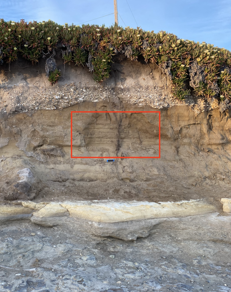
The highest visible layer of the Santa Cruz Mudstone is a thick (almost 1 foot-thick) light-colored mud layer (pictured left), that has old clam burrows on its surface and is overlain by Purisima formation with large chunks of porcellanite from the mudstones below. This tells us that before the sands of the Purisima Formation were laid down atop the mudstone, it spent some time being eroded by waves. Those clam burrows are a testament to the time it spent as a rocky seafloor bottom over 6 million years ago.
The chunks of porcellanite just above the contact tell the story of the earliest history of the Purisima Formation as powerful waves broke down and churned up rocks that were incorporated into the first layers of the Purisima sands.
The Purisima Sandstone Formation
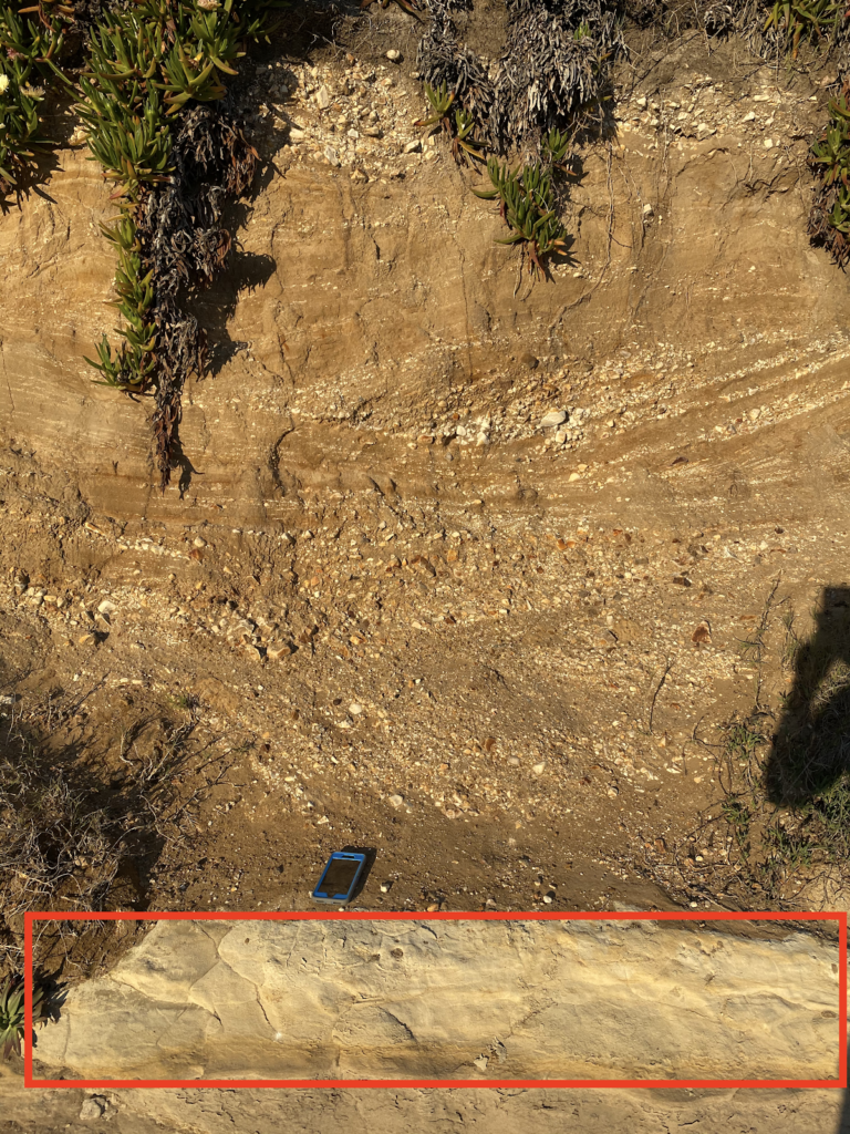
Above the Santa Cruz mudstone lies the Purisima sandstone, a rock formation known throughout Santa Cruz for its abundance of stark white fossils of ancient shells. Swift Street contains only a relatively small section of the Purisima Formation, but several areas within it exhibit amazing sedimentary textures. Up on the cliff, sections of the Purisima are a flat brown, with no visible fossils, and parallel “beds” or ancient sediment layers (pictured right). These areas represent long periods of constant sediment deposition, with no major storms or changes to the environment.
Elsewhere in the outcrop, shell-rich layers and features called “cross-beds” (pictured below) tell us that at other times between 7 and 2.6Ma, this area experienced large storms that created strong ocean currents. The jagged contact between the Purisima formation and the above Quaternary-aged sediments represents nearly two million years of lost time in the rock record.
Erosion and deposition of sands on top in the last 100,000 years
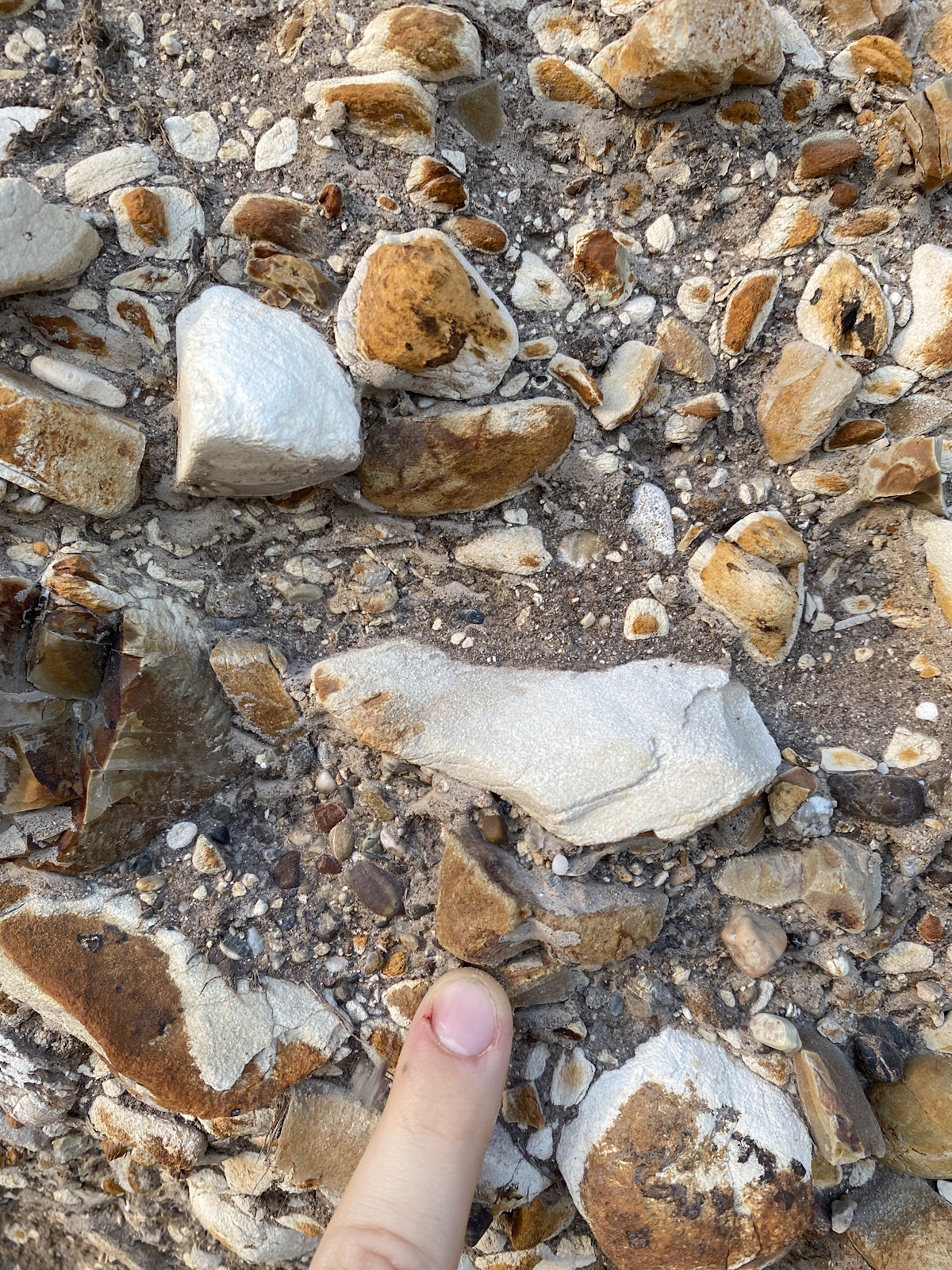
The base of the uppermost layer of the Swift Street outcrop is made up of an unconsolidated matrix of fine sand surrounding large, cobble-sized pieces of the underlying sedimentary rocks (pictured right), as well as abundant shell fragments. Because this layer is made up of fairly loose sediments, as opposed to rock, we know that it has not experienced long periods of burial required to turn sediment into rock (or lithification in geologist jargon.) For large cobbles to be ripped-up from the underlying layers and deposited here, requires high-energy wave systems like those found on the modern coast. Therefore, the transition from the underlying Purisima sandstone to these sediments likely represents a time where the Santa Cruz coast shifted from deep water to a coastal zone, likely as a result of sea level fall and tectonic uplift.
Rock Record is a monthly blog featuring musings on the mineral world from Gavin Piccione and Graham Edwards.
Graham Edwards and Gavin Piccione are PhD candidates in geochronology with the Department of Earth and Planetary Sciences at UC Santa Cruz. They also host our monthly Rockin’ Pop-Ups as “The Geology Gents”.
The Santa Cruz Sandhills are a rare habitat in the Santa Cruz mountains that support a very specific niche of plants and animals. Many of our endemic species in the County are limited specifically to the Sandhills. Join us for an overview of this habitat’s geologic history, rare plants and animals, and the human impacts that have added to its scarcity. This is a great class for budding naturalists and those looking to revisit the basics.
We are excited to be joined this month by paleontologist, science teacher, and Sandhills-local Wayne Thompson who will help us dig deeper into the geology of the habitat by showing off his fossil finds.
About the series: Join fellow nature enthusiasts for monthly explorations of the biodiversity of Santa Cruz County. Each month, our Public Programs Manager Marisa Gomez will share the stories of a specific Santa Cruz habitat as we develop our skills as naturalists.
This series will feature a presentation as well as an interactive session and is in partnership with Santa Cruz Public Libraries. Come prepared to share and to learn alongside naturalists deep in their journey and just starting out.
Take the plunge into the interactive world of our intertidal touch pool exhibit, which has provided visitors with an intimate look at the interior world of the sea outside our doors for decades.
Museum staff explore the history of these hands-on exhibits, from beachside Victorian tubs to today’s collecting permits. We further investigate the care of these seaworthy collections, including the practical challenges of creating intertidal conditions, and their special capacity to connect people to nature.
About the series: Zoom into the stories, secrets, and science of our collections during monthly webinars with Collections Manager Kathleen Aston. This live event is an extension of our monthly Collections Close-Up blog, with added insights and intrigue. Members are invited to participate in this program before it is made available to the general public as well as ask questions directly of Kathleen.
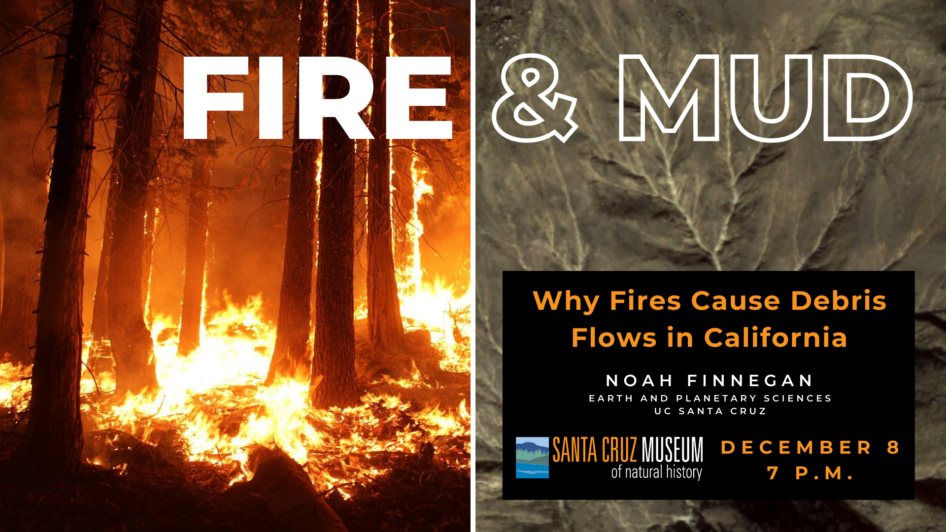
Geomorphologist Noah Finnegan provides an overview of the science linking wildfires and debris flows in California, including lessons learned from the 2009 Lockheed Fire in the Santa Cruz mountains. Particular emphasis is paid to how residents impacted by the CZU Lightning Complex can navigate resources to better understand their debris-flow risks.
Resources
Below are resources referred to in the presentation and major take-aways from Noah Finnegan:
Debris flows are possible within the Santa Cruz Mountains this winter. The USGS Landslide Hazards Program has numerous resources geared at helping the public understand post-fire hazard: landslides.usgs.gov/hazards/postfire_debrisflow/
The National Weather Service SF Office is very focused on post-fire debris flow hazards. Their forecasters and forecast products can help you anticipate upcoming storms that may pose a hazard because of rainfall intensity: www.weather.gov/mtr/
Noah Finnegan is a professor in Earth and Planetary Sciences at UC Santa Cruz. Noah’s research and teaching are focused on processes of erosion and sediment transport on hill slopes and in river channels.
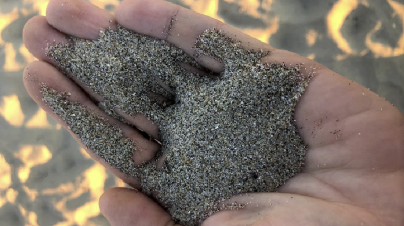
Even the smallest and most seemingly ordinary rock tells a story about the processes that have shaped the area in which it is found. From this point of view, beaches are a massive archive of the geologic history of a landscape that contains tiny samples of all the rocks that make up the surrounding area.
In this installment of Rock Record, the Geology Gents (Graham and Gavin) spend a day at the beach exploring the natural history of Santa Cruz looking only at the sand and rocks that fit in the palm of their hand.
Join the “conversation” below, as the Geology Gents chat about what they see when they look at the sand.
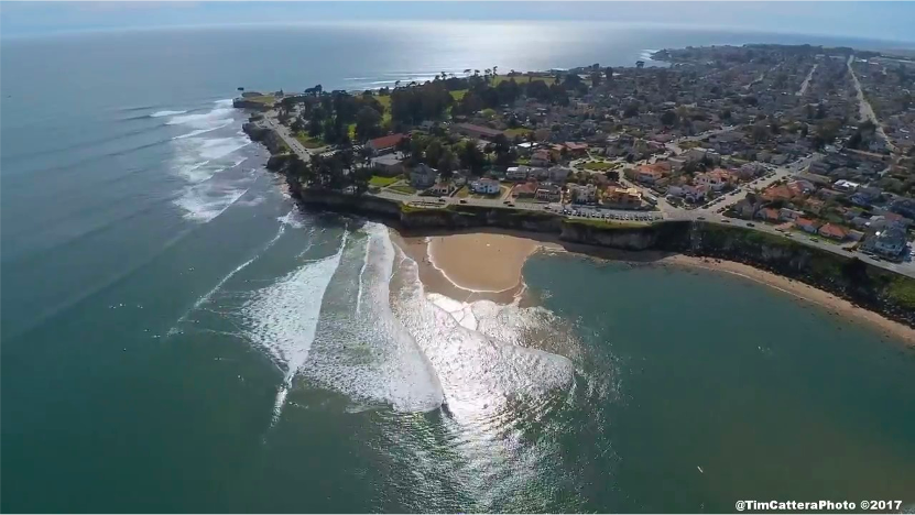
Building Beaches through Erosion and Transport
Graham: For all of the attention that beaches get as beautiful places to go lay in the Sun, they really are interesting geologically.
Gavin: We usually think of beaches as a geomorphic landscape: a product of the movement of wind and water and how it shapes and transports geologic material. We don’t usually talk about them as geologic.
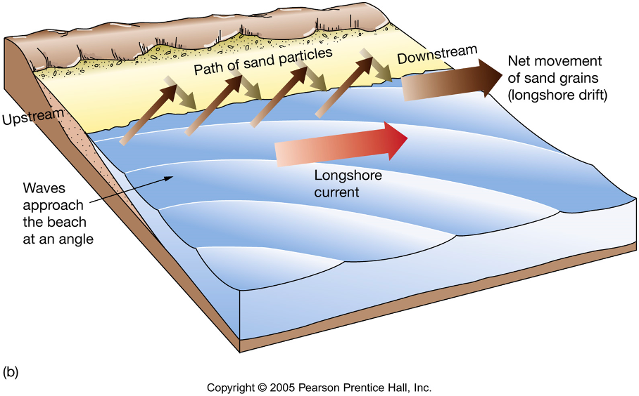
Graham: We talk about sea cliff erosion and longshore currents that move sands from these cliffs, as well as nearby rivers and streams. The longshore currents carry their sediment load along the coastlines, and pile them up in certain “low-energy” places, that we call beaches.
Gavin: Ah, yes, I remember we spent some time chatting about this in one of our Rockin’ Pop-ups about Coastal Geology.
A Far-Reaching Collection of Rocks
Graham: But for all our talk of beaches as products of weathering (the breakdown of geologic material) and erosion (the transport of geologic material from one place to another), are they not, my friend, still rocks and something of lithologic interest?
Gavin: Lithology: the study of the characteristics of different rocks and rock types. Well, this sand is made up of rocks, and if we can identify the rock types and note their other properties, then we might be able to determine some interesting things about the geologic origins, or provenance, of these sands, as we often do with larger rocks.
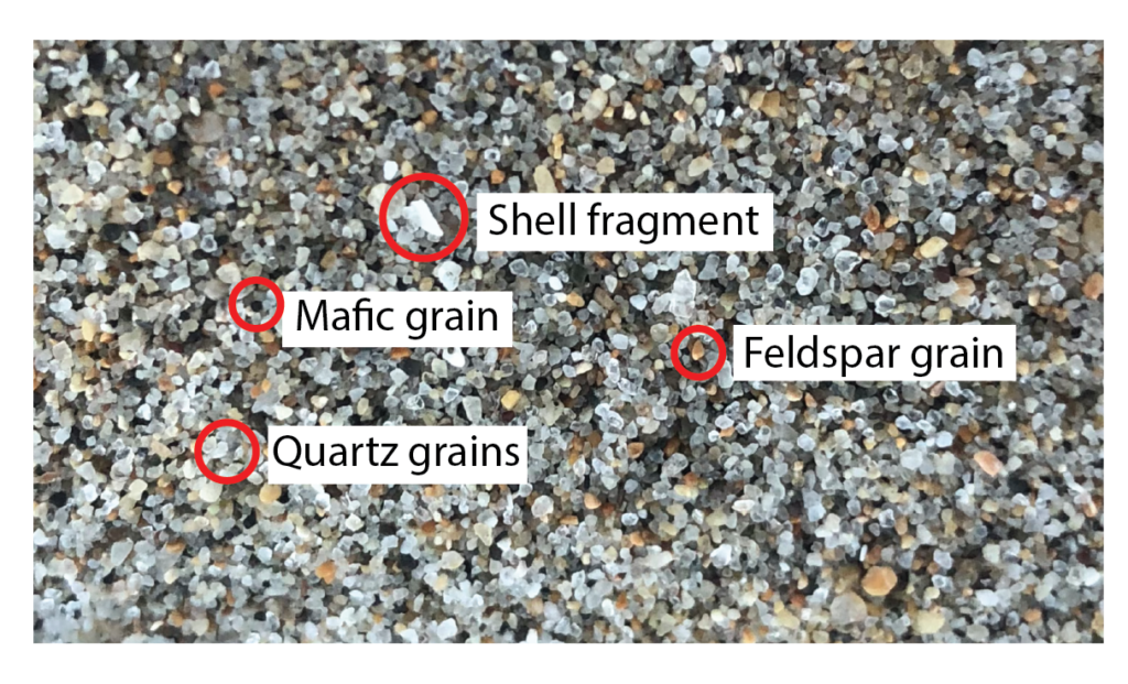
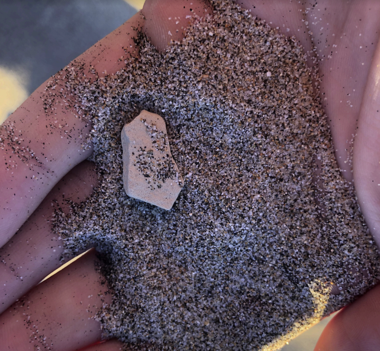
Graham: Let’s take a handful then and look more closely at these sand grains.
Gavin: The sand grains are mostly round. Many are clear and glassy looking, some with a smoky dark grey color. We are familiar with this mineral of course. Quartz!
Graham: Some are blocky looking and cream-white to pinkish in color. Another favorite! Feldspar!
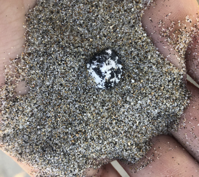
Gavin: Those light-colored feldspars and quartz make up most of the sand, but there are a few other darker minerals. Dark flaky sheets of biotite, black grains of other mafic minerals like amphibole or pyroxene, and some greenish looking minerals – these could be pieces of serpentinite (a Central Coast favorite!) or glauconite (fossilized ocean muck).
Graham: You know, the relative abundances of these minerals really tell you something about how certain rock and mineral types survive the weathering and erosion process. The feldspar and the quartz, especially, are relatively rugged minerals that resist being broken down by the chemical actions of water and the mechanical actions of tumbling around in rivers and waves. But the greenish and darker minerals, which are less resilient to weathering, are very rare. Most of them have been crushed or dissolved to far smaller sizes and have been swept out to sea.
Gavin: So a lot of this is geomorphology? This crushing and grinding of sediments down as they tumble through rivers and waves crash over them along the coast?
Graham: Without question, the erosive forces that shape beaches matter a great deal. If many of these rocks come from the Santa Cruz mountains, they have travelled a great distance and been worn down along the way. Their small size and rounded, almost smooth shapes speak to this long journey.
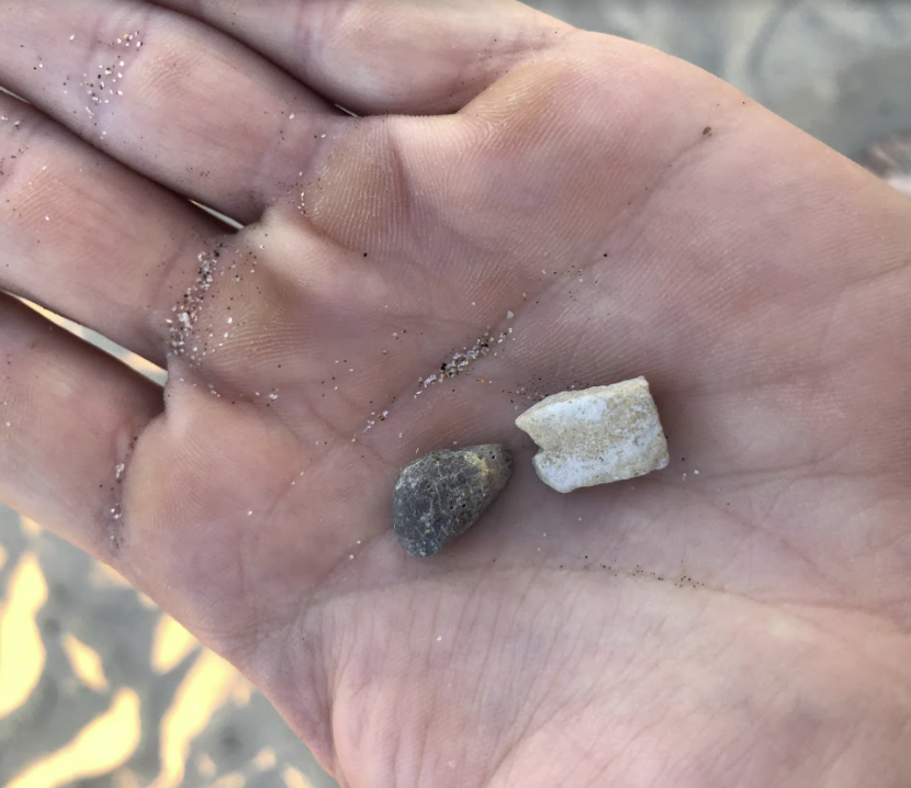
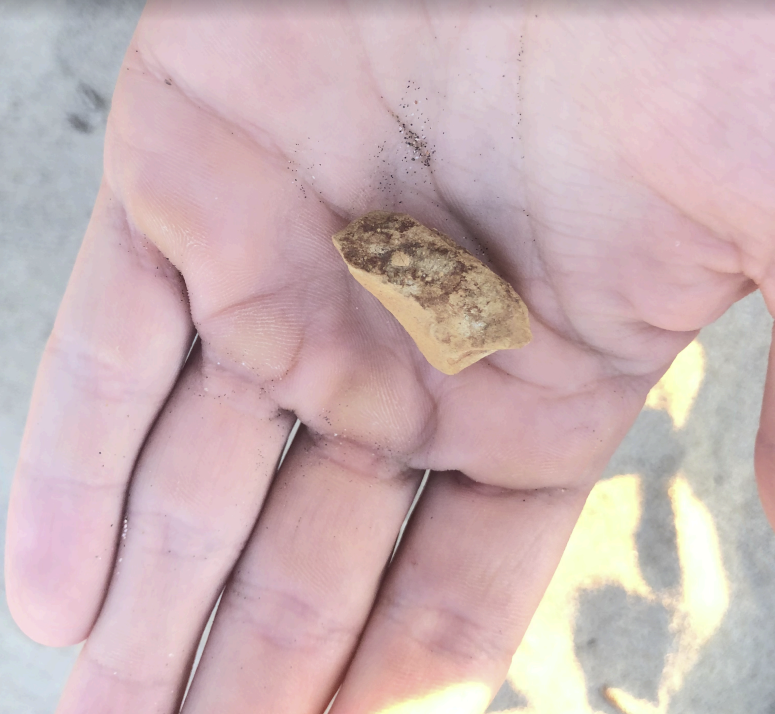
Gavin: And these pebbles? They are much larger and have sharper angles. There are pieces of mudstone, limestone, and fine and coarse sandstones. Common rocks found along the coast here. Likely these came from sea cliffs nearby that were worn by waves. Since these have not had to travel so far, they have not been weathered quite as much.
Mudstone and Limestone
Sandstone
Limestone
Conglomerate
Graham: Yes, only the closest rocks can survive in pebble form.
A Hint at the Tectonic History of California
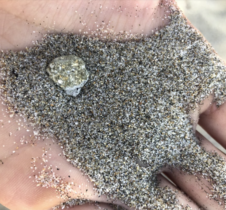
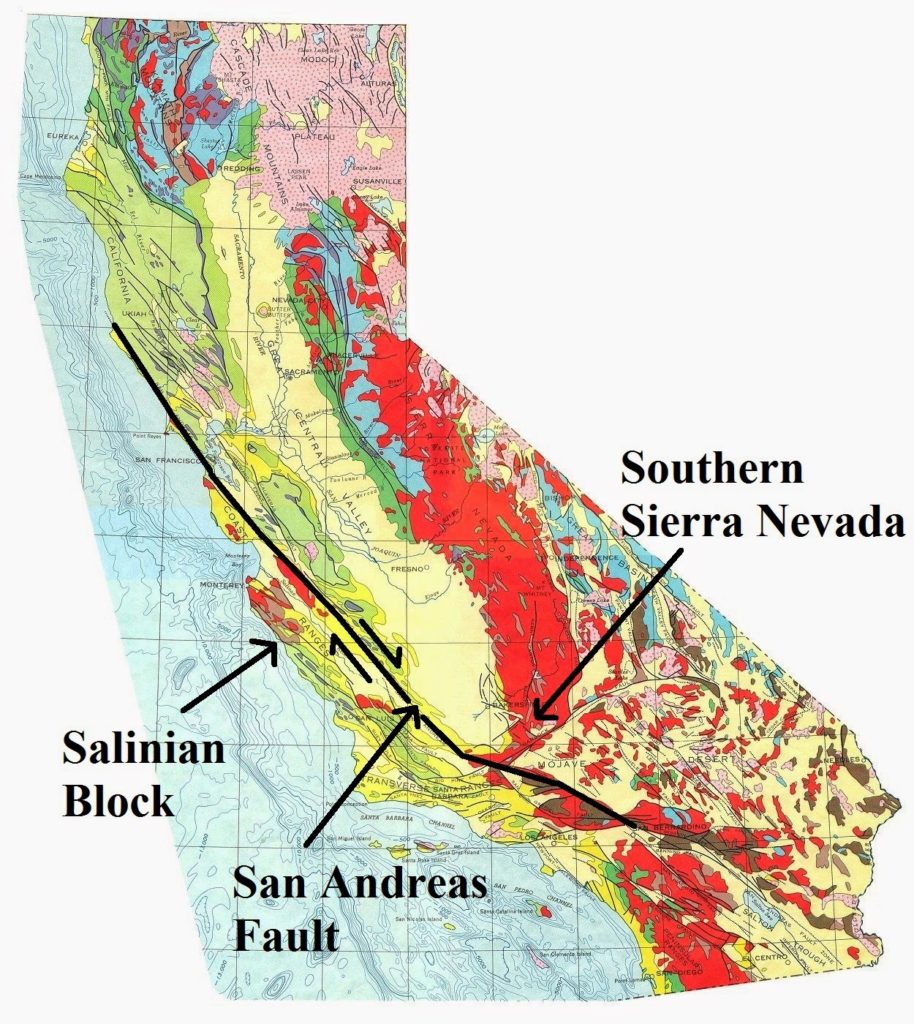
Gavin: And yet, there is one pebble type here that is not familiar from our coastal outcrops: these granite pebbles. Where could these come from?
Graham: Well, granite, made up mostly of quartz and feldspar with large interlocking mineral crystals, is particularly durable when it comes to weathering. Perhaps it has survived a longer journey than the other pebbles.
Gavin: But from where? These granites remind me of the granite of the Sierra Nevada.
Graham: That must be granite from the Salinian Block! Carried up from the region of today’s southern California by the San Andreas fault. These granites formed along with the rocks of today’s Sierra Nevada over 100 million years ago in huge magma chambers. Over the last 30 million years, the San Andreas fault has carried the Salinian block up to the northwest, pulling rocks from the southern extents of the Sierra Nevada along with it.
Gavin: Ahh, and so the Santa Cruz mountains are full of this granite! So that’s where all this quartz and feldspar are coming from?
Graham: That’s right! The “basement” rocks of the Santa Cruz mountains are these Salinian Block granites overlain by sedimentary rocks and metamorphic rocks of the last 30 million years or so. Quartz and feldspar sands come mostly from the granites, though some may be recycled from sandstones.
Gavin: How efficient, that sands from ancient beaches are weathered out of sandstones and returned to beaches today.
Graham: And bits of serpentinite and mafic minerals are also weathered out of other rock types and incorporated into the sands.
Gavin: So the sands at these beaches are not just the result of wind, rivers, and waves. They’re the whole of the Santa Cruz mountains and even nearby coastal cliffs, ground to fine grains and mixed well.
Graham: When we take a trip to the beach and sit in the sand, we really do find ourselves in the rocks of the Santa Cruz mountains. And while it’s a little bit harder to see and recognize each individual rock, when you look closely you can see each little bit of it.
Rock Record is a monthly blog featuring musings on the mineral world from Gavin Piccione and Graham Edwards.
Graham Edwards and Gavin Piccione are PhD candidates in geochronology with the Department of Earth and Planetary Sciences at UC Santa Cruz. They also host our monthly Rockin’ Pop-Ups as “The Geology Gents”.
Autumn is a season of transitions. Darkness noticeably overtakes light more rapidly everyday and months of drought along the Central Coast of California are dampened by the first rains of the season.
There is also a last minute abundance of activity in preparation for shorter, wetter days. Manzanita berries, tan oak acorns, and pine seeds are accompanied by a flurry of wildlife in active pursuit of additions to caches and fat reserves. Buffleheads and goldeneyes return to the river, while the terns and shearwaters leave the Bay. The bigleaf maple becomes a cloud of gold and the conifers remain ever green.
While spring reminds us of rejuvenation, fall recalls the dormancy of nature. Yet in the darkness, the promises of spring ruminate. Seeds that dropped days and months ago rest, wait, and are protected by the soil. As the sun retreats and the fruits fall and the collectors gather their winter rations, each minute of daylight is more precious than the last.
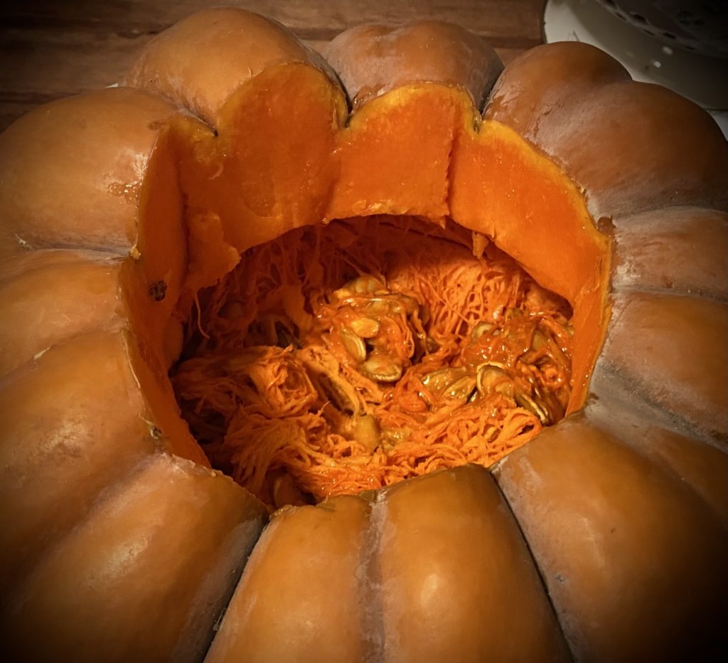
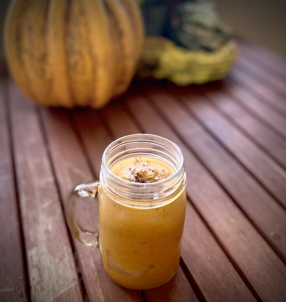
In a spirit of gratitude we offer the following recipe in celebration of abundance, even as the world around us grows darker. So gather up your fall gourds, your squash, your pumpkins. Stew the flesh, plant the seeds, and save a little for this tasty treat.
Gather your pumpkin seeds
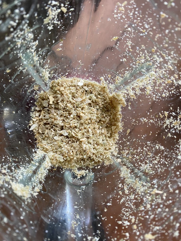
Blend your pumpkin seeds
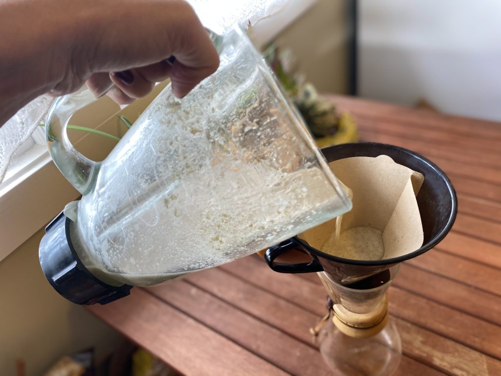
Strain your pumpkin seeds
Ingredients
Pumpkin Seed Simple Syrup:
½ cup of pumpkin seeds
1 cup of water
1 cup of sugar
Pumpkin Pie Tai:
¾ oz pumpkin seed simple syrup
2 oz dark rum
¼ oz allspice dram (or just add some ground allspice)
¾ oz lime
3 tbsp pumpkin puree
1 cup ice
Instructions
To make the Pumpkin Seed Simple Syrup:
Gather seeds from your chosen squash, gourd, or pumpkin (at least ½ cup)
Rinse and dry the seeds
Remove seeds from shells by trimming the edges of the shells with scissors and popping out the seed from within (optional, and interesting!)
Grind ½ cup of seeds in a blender until a powdery consistency
Add 1 cup of water and 1 cup of sugar to blender and mix until smooth
Strain through a coffee filter into a jar. Note: This can take awhile! Just let it sit and do it’s thing. You can also use cheesecloth.
California’s Coastal Prairies are a rare and incredibly biodiverse habitat found in Santa Cruz, and the most species-rich grassland type in North America. Despite its rarity and species-richness, this is a habitat-type at risk of continued range loss due to development, fire suppression, invasive plants, and other factors. During this interactive class we will explore these threats to this habitat type, as well as what makes coastal prairies unique, including the geology of coastal terraces, notable species, and ecological factors that have impacted the habitat type over millennia, including cultural burning by indigenous communities.
We are also excited to have a special guest join us this time! Justin Luong is a Ph.D. researcher in Environmental Studies at UC Santa Cruz, currently focused on grassland restoration in California, and will share his research regarding potential impacts on coastal prairies due to climate change and drought.
About the series: Join fellow nature enthusiasts for monthly explorations of the biodiversity of Santa Cruz County. Each month, our Public Programs Manager Marisa Gomez will share the stories of a specific Santa Cruz habitat as we develop our skills as naturalists.
This series will feature a presentation as well as an interactive session and is in partnership with Santa Cruz Public Libraries. Come prepared to share and to learn alongside naturalists deep in their journey and just starting out.
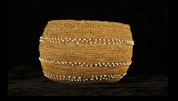
Spend an evening unraveling the complex ways in which consumer trends and museums influenced early 20th basketry collections and craft. Collections Manager Kathleen Aston will elaborate on these trends and how they relate to our collection. Joining us will be Julie Sidel, Interpreter 1 for Santa Cruz Mission State Historic Park, to share how the intersection of museum artifacts and interpretation illuminates daily life at the Santa Cruz Mission.
About the series: Zoom into the stories, secrets, and science of our collections during monthly webinars with Collections Manager Kathleen Aston. This live event is an extension of our monthly Collections Close-Up blog, with added insights and intrigue. Members are invited to participate in this program before it is made available to the general public as well as ask questions directly of Kathleen.
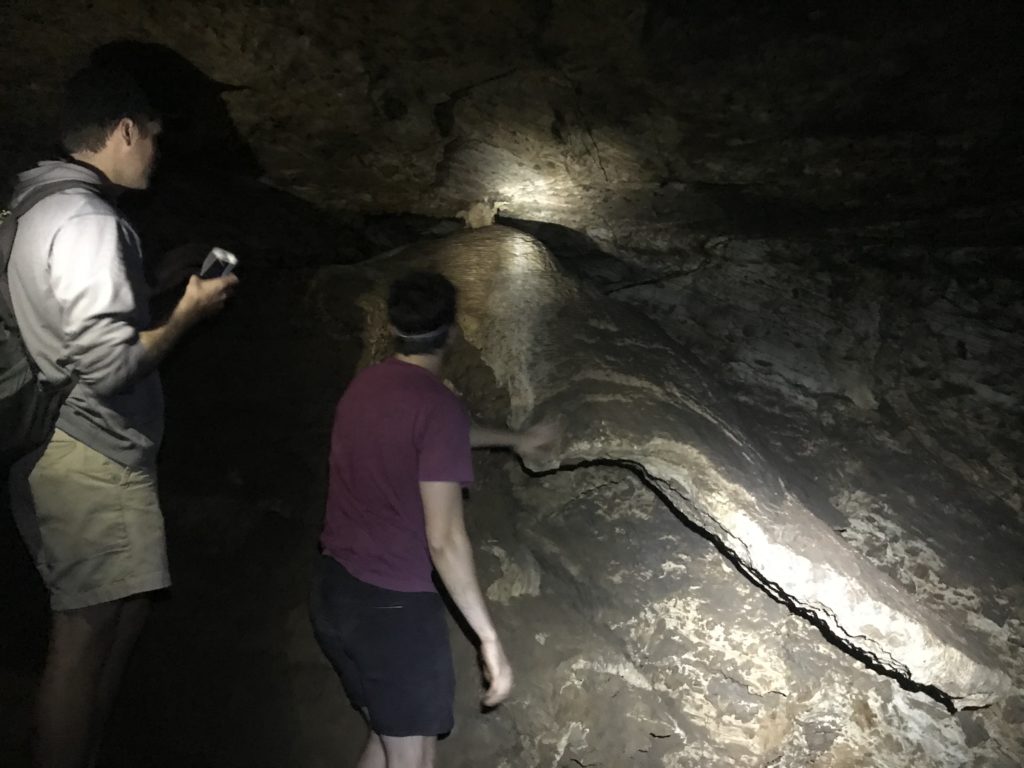
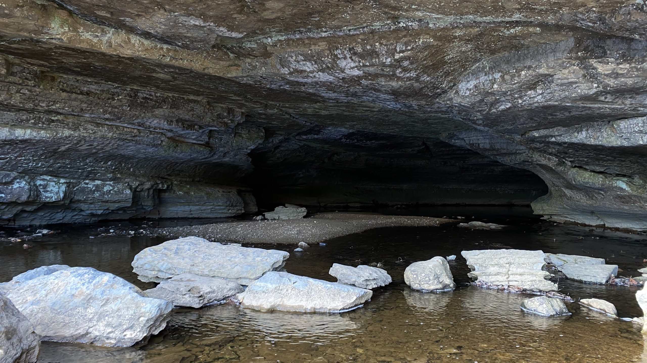
Caves are an intersection between natural destruction and creation, where existing rocks are eroded away, and new rocks are continuously formed. Descend into one of the many caves in Santa Cruz and you’ll get a unique viewpoint of the striped marble walls that were built offshore of the area’s ancient shorelines and thrust up onto the continent over the past million years.
This geologic flux also means that one can never enter the same cave twice, since the competing geologic processes of erosion and precipitation are constantly shaping the interior. When you visit a cave, you’ll be a first-hand witness to the geologic processes that shape the Earth.
Gavin and Graham explore speleological features in Empire Cave on the UCSC campus.
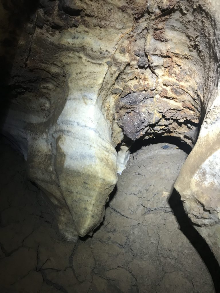
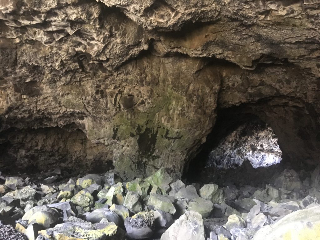
Evidence of dissolution in marble in Empire Cave.
Solutional Caves and Karst
The caves of Santa Cruz are called solutional caves because they form when groundwater dissolves pathways through rock, just as sugar or salt dissolve in warm water. However, to dissolve rock, it takes more than just plain old water. Rainwater and groundwater carry dissolved carbonic acid and organic acids that are pulled out of the soil as water percolates down from the surface. In Santa Cruz the bedrock (the solid rock beneath the soil) is mostly marble and made of the mineral calcite which is very susceptible to being dissolved by weak acids like these. Thus, the slightly acidic water can easily dissolve its way into the rock.
You can try this at home or in the field! Find a piece of marble or limestone, scratch at the surface a little bit with a paperclip, key, or coin to make a powder. Drip some vinegar (which is also a weak acid) on the powder and watch it fizz as the calcite dissolves!
As rainwater and groundwater slowly dissolve their way through the marble bedrock over thousands to millions of years little cracks turn into large caves, where the many dissolved minerals such as calcite precipitate, or become solid and separate out of the liquid, forming speleothems. These water-sculpted caves have a distinctive structure and shape: smoothed and rounded marble walls filled with holes and tunnels, covered with speleothems giving most surfaces a ropey, grooved, and nodular texture. In karst systems caves can develop as we’ve described, but if they grow close enough to the surface, the caves can’t support the weight of overlying rock and they collapse forming sinkholes, a familiar feature in the Santa Cruz area.
Since karst caves are formed by flowing water, water often continues to flow into them. Especially in the rainy wintertime, caves can partially or completely fill with water, so it’s important to be very careful whenever entering or exploring caves and postpone your spelunking if it’s rainy!
Sinks of Gandy, a karst cave in West Virginia.
Below the Surface
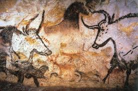
One of the most scientifically alluring aspects of caves are the preservation of rocks and artifacts that their sheltered interiors provide. Materials within caves are not subject to erosion or weathering to the extent that those exposed to the atmosphere are. Caves also stay the same temperature year-round because they are not affected by atmospheric temperature fluctuation, and instead have temperatures regulated by the ability of the surrounding rock to hold heat. These mild conditions help artifacts like the Dead Sea scrolls and cave paintings to survive for millennia. Similar to archeological preservation, rocks that would normally erode quickly at the surface of the Earth are remarkably well preserved in caves.
Ancient cave painting from Lascaux Cave, France (Wikipedia)
Caves are treasure troves of samples for geologists, biologists, hydrologists, and countless other kinds of scientists. Among the most exciting (at least for us geochronologists) are records of changing climate found in speleothems. As this calcite builds thicker and thicker speleothems, it captures the chemical signature of the climate at the time of its formation. By studying these speleothems, scientists can reconstruct the timeline of global climate change over the past 650,000 years.
Lava tube and lava stalactite at Craters of the Moon National Monument.
Other Types of Caves
Some caves form at the same moment the rock forms, usually from cooling lava. Some examples of these volcanic caves are lava tubes — an open tunnel left behind when a subterranean conduit of lava drains. Caves can also form in the deep chasms left behind by rifts, where volcanoes split the land apart as they swell. Since lava flows, volcanoes can leave all sorts of other cave-like voids behind from the flow, storage, or drainage of lava.
Sea caves, or littoral caves, form where waves carve out deep caverns into sea cliffs, usually into weaker parts of rock. We even see a few shallow sea caves along the Santa Cruz coastline!
Anchialine caves are caverns that connect inland pools, called anchialine pools, to the ocean where the cave ends underwater. The water levels in these pools often rise and fall with the tides, and these are popular sites for scuba-spelunking!
Caves can even form above ground! Talus caves form in the spaces between large boulders at the base of rocky cliffs, and if water flows into or under a glacier, it can melt out glacial caves!
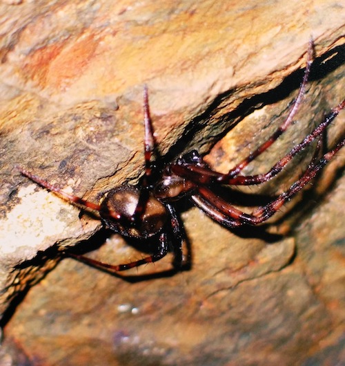
Critters in Caves
Meta dollof spider photo from our exhibit Crystals, Caves, and Kilns (2013).
While we most often associate caves with bats, caves are home to all sorts of organisms, including fungi, arthropods (insects, spiders, scorpions, and the like), salamanders, and fish. These creatures are usually adapted to live in these perennially dark, often flooded environments. Because caves are often isolated and disconnected habitats, many creatures that live in caves are endemic, meaning they are found in that cave network and nowhere else on Earth!
For example, the Cave Gulch cave network, just North of Santa Cruz, is home to two endemic species: the spider Meta dolloff and the pseudoscorpion Fissilicreagris imperialis.
Be very conscientious when you visit caves since these are the only homes for many of the creatures that live there. Never leave trash, burn fires, or damage the interiors of caves. If you do go into caves, be sure to pack trash out, or even better, enjoy the cave from the outside and leave its subterranean residents in peace.
Rock Record is a monthly blog featuring musings on the mineral world from Gavin Piccione and Graham Edwards.
Graham Edwards and Gavin Piccione are PhD candidates in geochronology with the Department of Earth and Planetary Sciences at UC Santa Cruz. They also host our monthly Rockin’ Pop-Ups as “The Geology Gents”.