Written by Gavin Piccione
The rocks on the surface of the Earth are shaped and transformed by the boundless forces of nature, creating a vast and ever-changing arrangement of formations for humans to observe and ponder. Even though the terrain of the U.S. comprises less than 2% of the Earth’s surface, the wide variety of environments found here gives rise to a diverse set of geologic wonders. In this installment of Rock Record, we will take a closer look at the mechanisms that formed some of the most distinctive and interesting of these geologic landmarks.
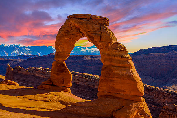
The Arches of Arches National Park
Unlike the natural bridges here in Santa Cruz, the arches of Arches National Park are not the result of localized erosion from waves. So how did these enigmatic features form?
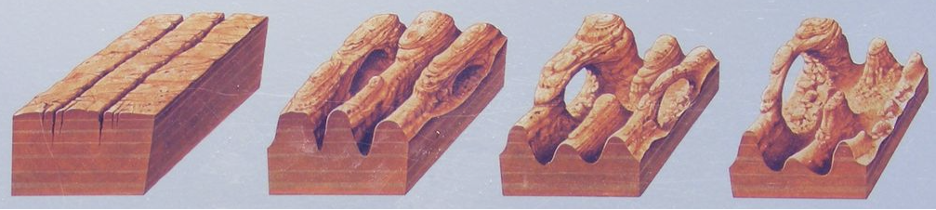
The famous arches are a marvelous geologic coincidence, stemming from three key processes that unfolded over the past 300 million years. The first factor leading to the arches was the deposition of massive salt layers by an inland sea 300 million years ago. In the ensuing time, denser, stronger sandstones were deposited on top of these salt layers and the weight of the overlying rocks, combined with tectonic forces in the region (the second arch forming factor), caused the salt layers to bulge and push to the surface. The combined effects of the tectonic forces and the underlying salt layers created a massive anticline, or convex rock fold, in the overlying sandstones (see the schematic below).
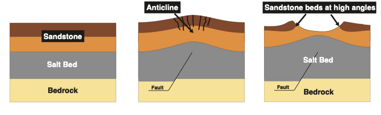
As this bulge in the Earth was eroded away, folded sandstone layers were then exposed at high angles at the surface. Because the sandstone layers were less erodible than some of the surrounding rocks they were left behind, jutting out of the earth surface in formations known as “fins” (see photos below). It was from these fins that the arches were eventually formed.
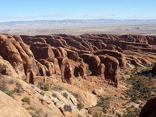
Aerial photo of sandstone “fins” near Arches National Park, Utah. Photo credit: hikingwalking.com. 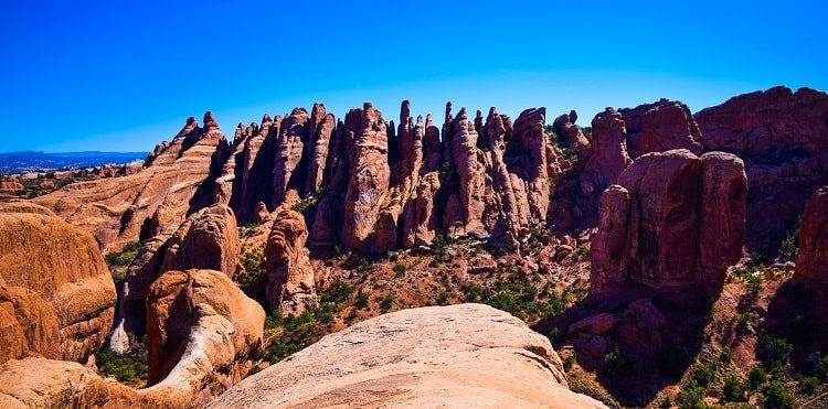
Side view of Sandstone “fins” near Arches National Park, Utah. Photo credit: ramblearoundtheworld.com.
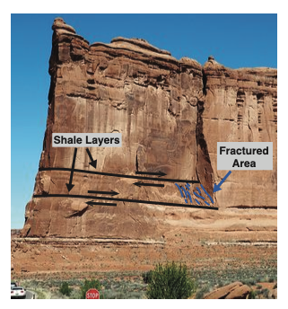
Fractured Area in “Tower of Babel” fin in Arches National Park, Utah. Image credit tripadvisor.com. 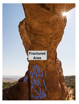
Fractured area inside “Broken Arch” in Arches National Park, Utah. Photo credit: QT Luong.
The final arch forming factor was localized fracturing from faulting within the fins. Tectonic processes caused faults along small, weak shale layers within the sandstone columns, leading to highly fractured zones. Over time, wind and rain plucked these fractured zones from the fins, leaving behind the arches we see today.
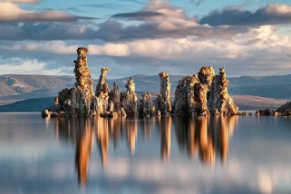
The Mono Lake Tufa Towers
Above the quiet waters of Mono Lake, the tufa towers stand like a peculiar shrine to the geologic processes operating in this area east of the Sierra Nevada. The conditions that created the otherworldly tufa were an intersection between the realms of chemistry, geology and hydrology, forming tufa towers throughout the ~760,000-year life of Mono Lake.
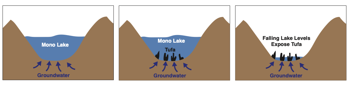
To understand the formation of the tufa, it is easiest to start by analyzing the setting of Mono Lake: Mono Lake lies in a basin that allows water to flow in, but not out. Meaning that all of the dissolved rock particles that flow into the lake stay there, causing the lake waters to become very salty and to have a very high pH (e.g. Acids like vinegar and lemon juice have low pH, while bases like baking soda and ammonia have high pH.) These lake conditions are conducive to high levels of the molecule carbonate (CO3), one of building blocks for “carbonate” minerals.
In addition to the surface lake waters, there are abundant groundwaters that flow into the basin from surrounding areas, which interact with the rocks as they flow towards the lake and become high in the element calcium. As these ground waters flow into the lake through underwater springs, the groundwater and lake water mix, causing the carbonate molecules and calcium from the two respective waters to bond, and form the tufa towers from the mineral calcite. This means that every tufa tower is a fossilized spring! Unfortunately, there is also a human induced component of the tufa towers we see today: when the city of Los Angeles diverted freshwater that once flowed into Mono Lake it caused lake levels to fall dramatically, leading to exposure of previously underwater tufa (see schematic of tufa formation below.)
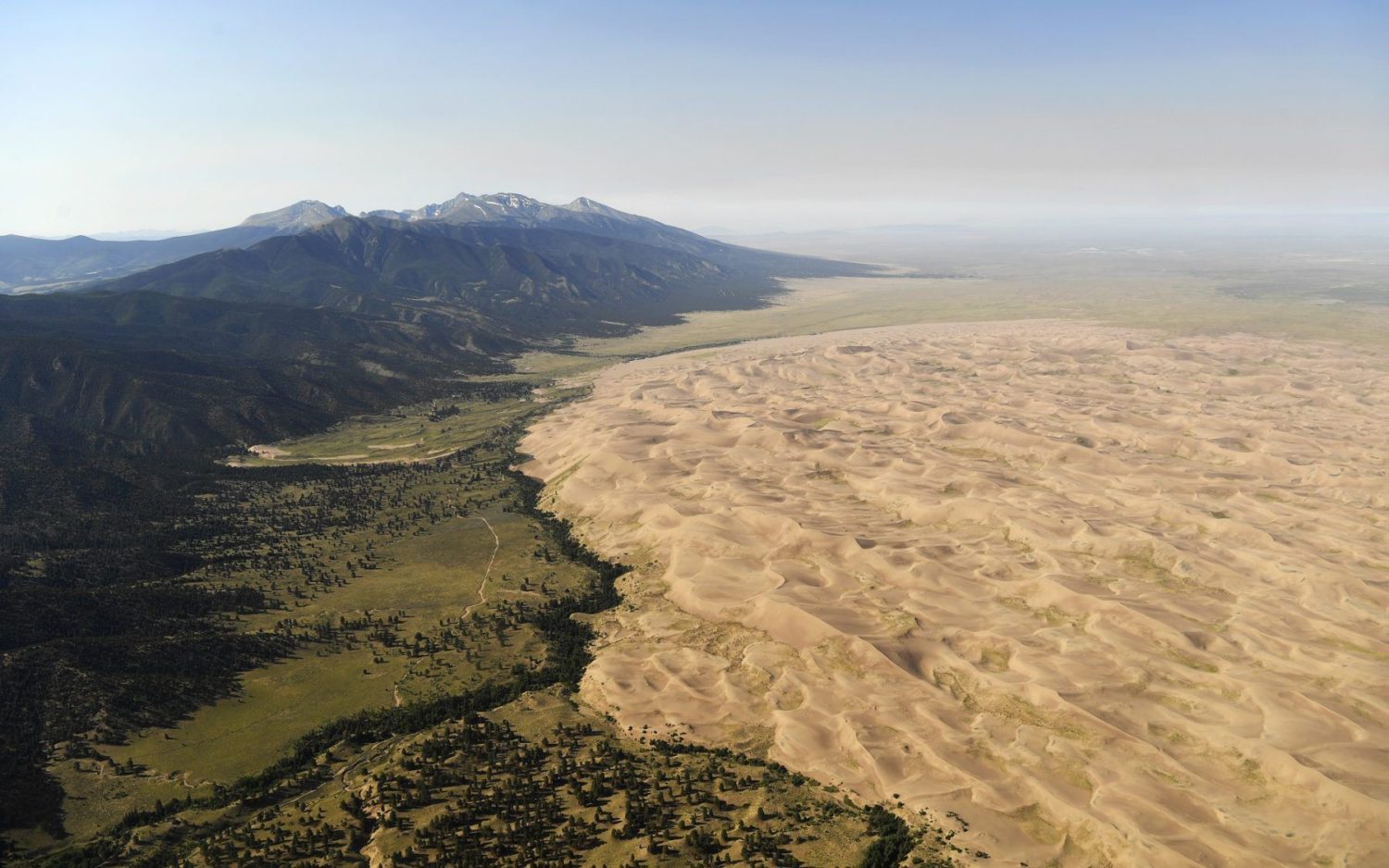
The Dunes at Great Sand Dunes National Park
Sand dunes probably seem mundane for folks living in Santa Cruz who’ve likely seen the coastal sand dunes on the drive from Santa Cruz to Monterey. However, it may come as a surprise that the tallest sand dunes in North America are far from the ocean and are not associated with grand deserts like the Mojave either, but instead are found right in the middle of Colorado!
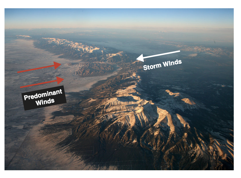
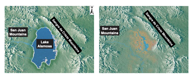
The dunes at Great Sand Dune National Park lie along the eastern edge of the San Luis basin between the San Juan Mountains to the west and the Sangre de Cristo Mountains to the east. This basin used to hold the massive Lake Alamosa, which drained around 440,000 years ago. Following the lake drainage, sediments from the lake bottom and the surrounding mountains began to build up in on the basin floor (see maps below).
The location of this basin in the greater Rocky Mountains funnels wind from the southwest, causing the sand dunes to grow in a natural pocket in the Sangre de Cristo Mountains. During storms events, opposing winds are driven from the east, causing the dunes to grow to their great heights (see image below).