New Perspectives on the Past Through Freshly Exposed Rocks

In this edition of Rock Record, the Geology Gents unearth a few key examples of how newly exposed outcrops have led to important geological insights, as well as some geologic exploration into freshly exposed rock and sediments exposed by the CZU Lightning Complex Fires. 

By Graham Edwards and Gavin Piccione (aka the Geology Gents)

To reconstruct Earth history, geologists rely on the rock record: the accumulated rocks that, through their accumulation and formation, are relics of ancient geologic processes spanning geologic history. Such rocks provide a spyglass with which to peer into geologic history. But our view through this spyglass is limited to rocks that are both exposed at the Earth’s surface and have survived the effects of erosion.

As geologists, we often rely on Earth processes to expose new rocks and provide us fresh glimpses into Earth’s history. Since exposing fresh rock requires a lot of energy, natural disasters or extreme natural events can expose clues to this history through fresh rock surfaces. Human activities, such as construction or mining, can also expose new geological wonders.

In this edition of Rock Record, we’ll go through a few key examples of how newly exposed outcrops have led to important geological insights, as well as some geologic exploration into some freshly exposed rock and sediments exposed by the CZU Complex Fire.

Roadcuts

Roadcut in Maryland exposing large folds. Image credit: Joel Duff, Naturalis Historia

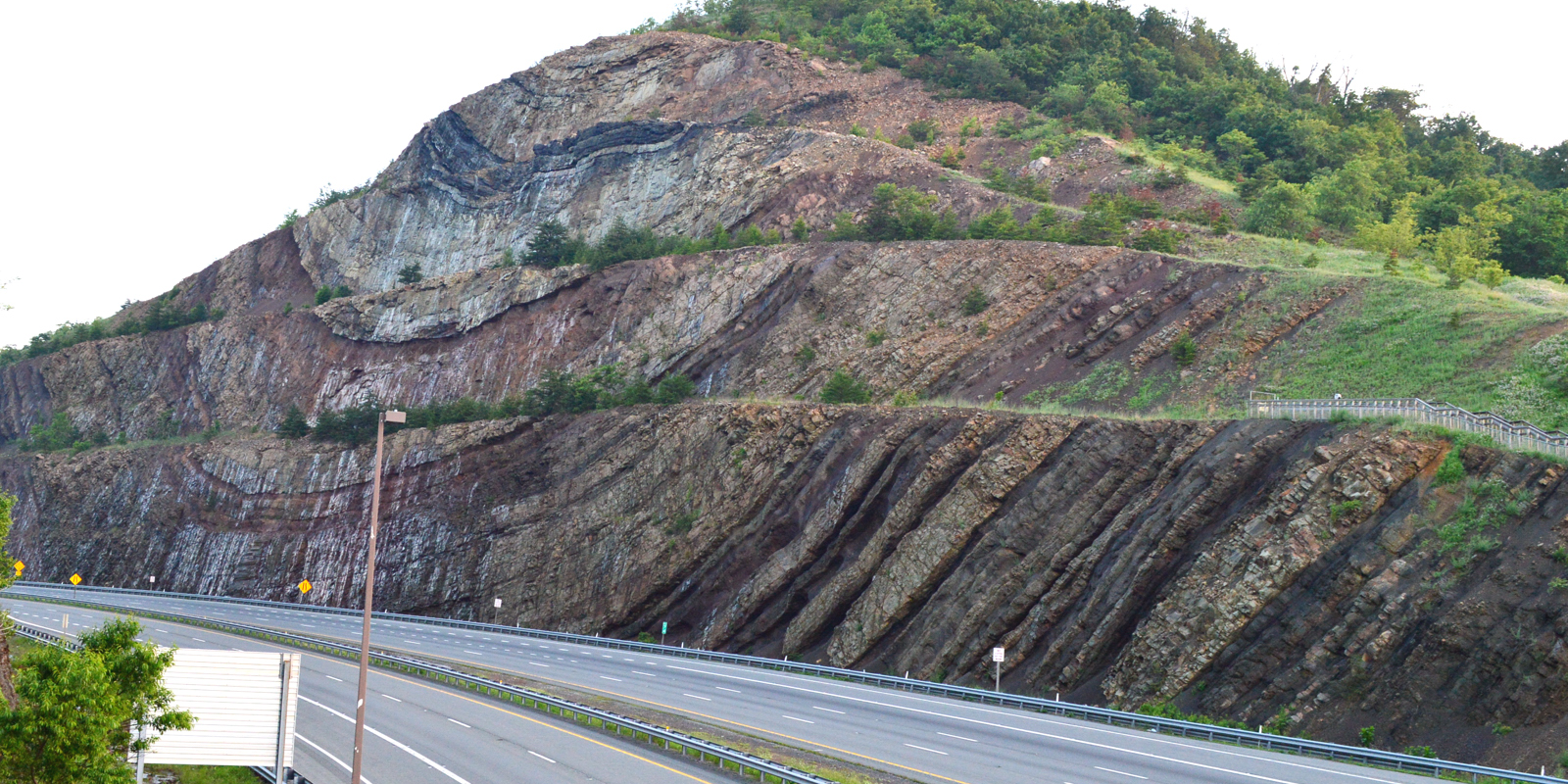
The construction of roads often requires the removal of large sections of rock, leaving sheer rock faces on the sides of the road. Some of the most famous rock outcrops are ones exposed in roadcuts and these unique locations are a frequent destination for college geology classes.

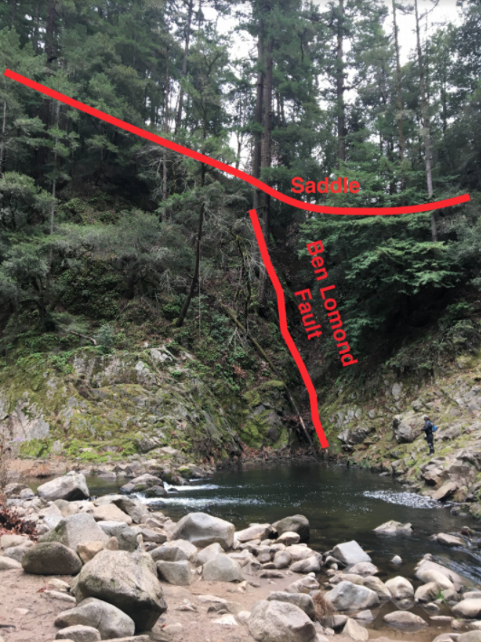
As undergraduates, the Gents (i.e. Gavin and Graham) explored roadcuts in the Northeastern US, and learned about tectonic motion through the faults and folds exposed in roadcuts (like the one in the image to the right), about metamorphic rocks via roadcuts in Maine, and about large deep-sea sediment avalanches (called turbidites) from roadcuts in upstate New York. Rocks exposed on the sides of roads can also be significant for geologist’s understanding of the sequence of events in an area.

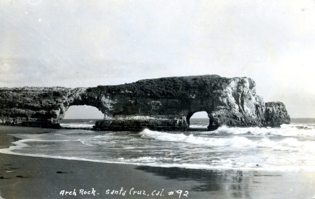
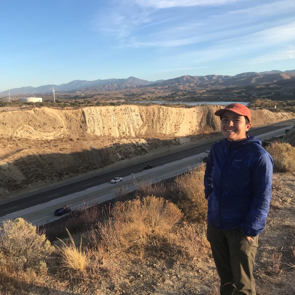
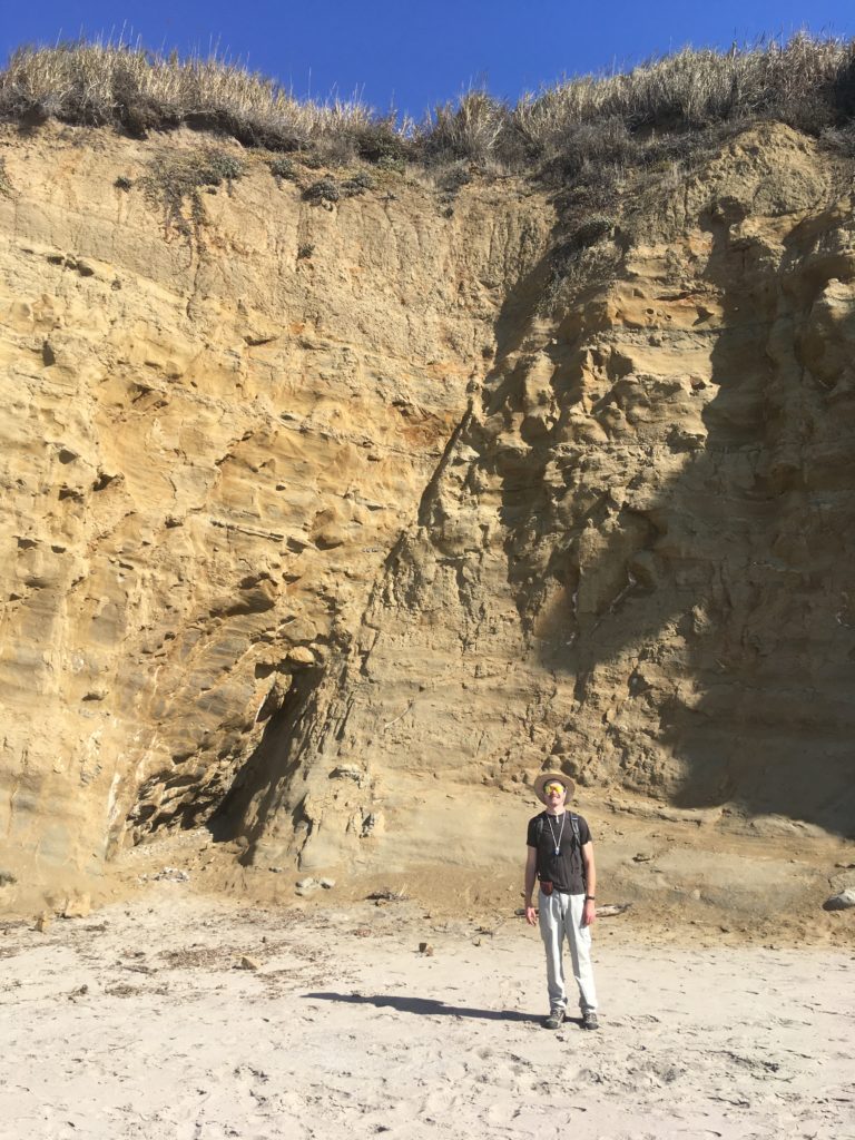
For instance, a roadcut in Owens valley (see image below), settled a longstanding debate amongst geologists about whether the Bishop Tuff was deposited before or after the first glaciations in the area. The exposed rock showed the Bishop Tuff sitting on top of the Sherwin Till glacial deposit, meaning that the tuff must have been deposited after the till.

Roadcut in Owens valley showing the Bishop Tuff overlying the Sherwin Till. Original image taken by James St. John

Fire

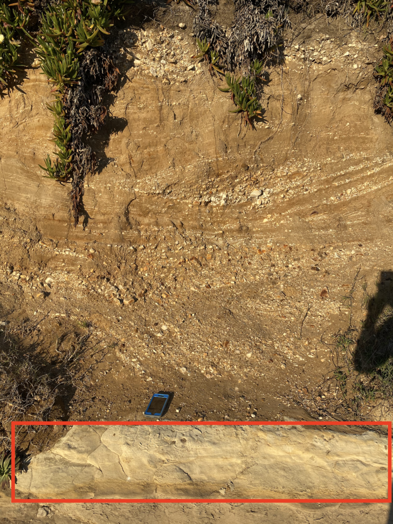
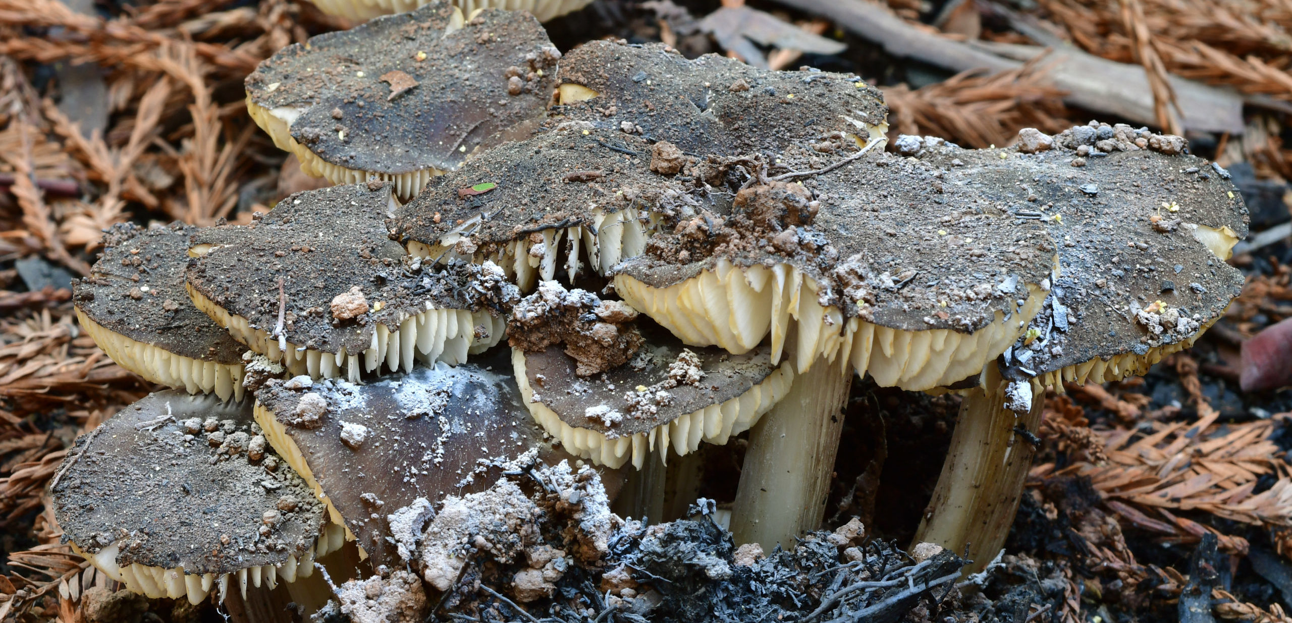
Forest fires are, in many cases, an important natural event for the health of a forest because they clear the forest floor of brush and dead vegetation. Through this process, fires also expose large portions of rock that would otherwise not be visible. For this addition of Rock Record, the Gents explored some areas of the Santa Cruz mountains that have been burned in the CZU Lightning Complex fires last August.

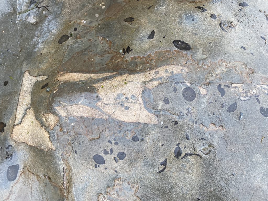
Taking Empire Grade North, areas of Cretaceous (145-66 million years before present) igneous and metamorphic rocks that were previously covered by vegetation are exposed in the burn zone of the recent fires.

Weather

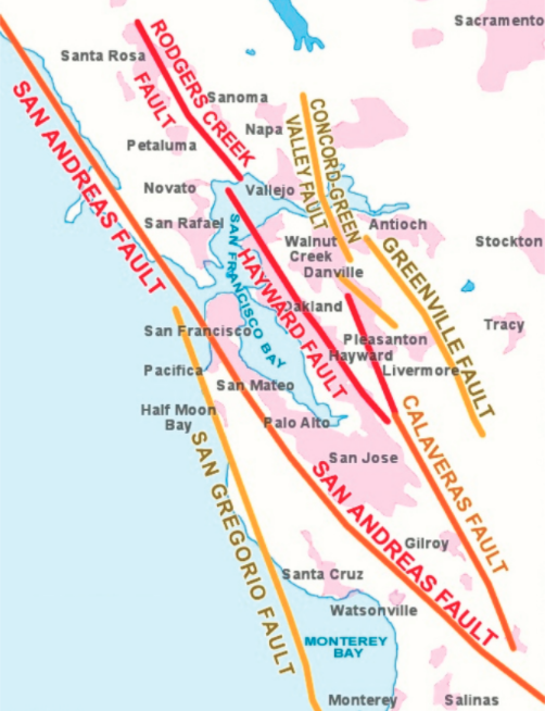
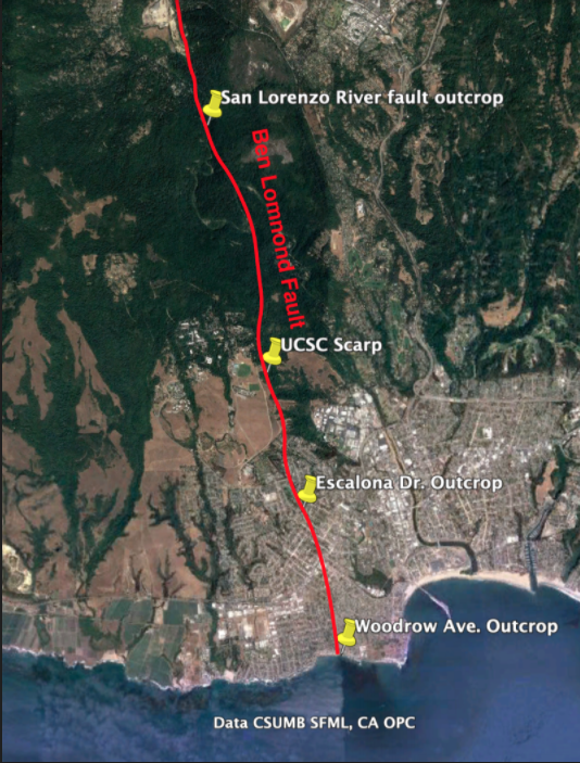
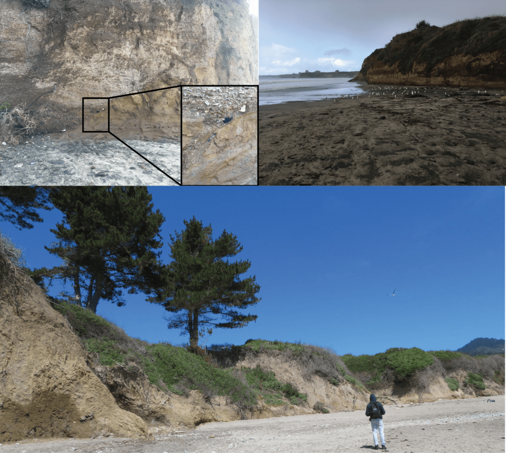
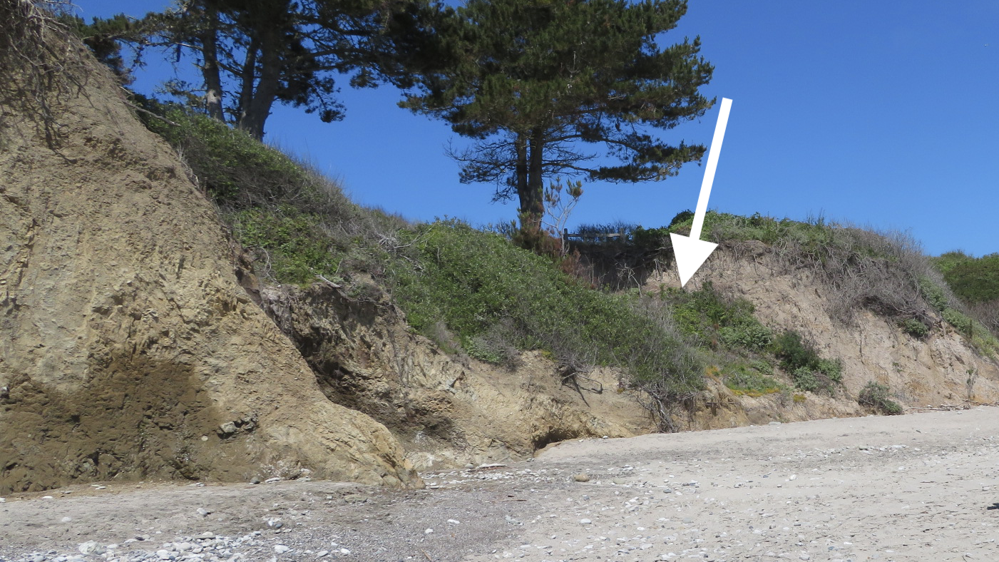
Sometimes extreme weather events can expose new outcrops or geologic features. For instance, the Frijoles Fault of a previous Rock Record post, The Faults that Shape Santa Cruz, was hidden behind trees and shrubs until a powerful storm event in the 1970s drove enough coastal erosion to expose the fault in the sea cliffs. Even more recently, heavy rains can cause landslides on the steep topography of the Santa Cruz Mountains and Santa Lucia Mountains of Big Sur. Each of these landslides exposes new surfaces that allow geologists and geomorphologists to study what causes landslides and the ways that massive amounts of Earth can be rapidly moved down hillslopes.

The exposed Frijoles fault contact, which was long hidden behind trees and shrubs before it was revealed by a storm in the 1970s.

Meteorites 

Some rocks are truly out of this world! Rocks that formed beyond Earth and arrive on Earth are called meteorites. Most meteorites come from the asteroid belt, a ring of rocky debris that dwells between the orbits of Mars and Jupiter, while some meteorites come from Mars and the Moon. As any Earth dweller knows, meteorites are incredibly rare, but they are important samples of other celestial bodies and leftovers from planet formation that we can study in close detail here on Earth. So, a meteorite fall is an incredibly exciting event for planetary scientists and geologists, alike!

One of the most important meteorites ever to land on Earth was the Allende meteorite, which landed in 1969 near the town of Pueblito de Allende in the state of Chihuahua in northern Mexico. The stone broke into pieces before it landed on Earth, but the collected chunks of this meteorite total >4,000 pounds with more pieces still found today! Because there was so much meteorite to go around, many scientists have studied it, and since the Allende meteorite is made of some of the most ancient material in our solar system it has provided an invaluable window into the earliest moments of our solar system just after the Sun formed!
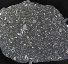
What mysteries do you suppose are hiding all around you, covered by trees, houses, or soil?


Rock Record is a monthly blog featuring musings on the mineral world from Gavin Piccione and Graham Edwards.

Graham Edwards and Gavin Piccione are PhD candidates in geochronology with the Department of Earth and Planetary Sciences at UC Santa Cruz. They also host our monthly Rockin’ Pop-Ups as “The Geology Gents”.

Collections Close-Up: Herbarium Highlights

Late rain and sporadic sunshine are lighting up the local landscape with green growth and bright blooms, raising spirits for the oncoming spring. This month’s Close-Up highlights a slightly less vivid but no less delightful collection of plants – a collection of preserved grasses, complete with identifications by their collector, beloved naturalist and conservationist Randy Morgan.

At first glance, the graceful blades and intricate flowers are captivating for their beauty alone, as in specimens like this California Canary grass (Phalaris californica). After all, another specimen in this collection represents a plant that so charmed Californias that it was designated the state grass. Not only are they beautiful, they’re informative – each specimen is carefully arranged to make visible important features such as the roots, blades, and flowers. The subtle distinctions between grass species in a field might blend together, but laid out on the herbarium sheet (or for that matter, conveyed via botanical illustration) the various parts of the plants can be easier to see.

This arrangement of significant features is a critical component of a quality herbarium specimen. The scientists who use herbaria (the plural of herbarium, or collections of plants preserved and labeled for reference, a practice which is more than 700 years old) such as these need to be able to see as many diagnostic features and as much of the plant as possible for use in understanding the identities of specimens, their classification, and their relationships to one another. This is harder with some plants than others – while grasses aren’t as difficult to capture on the herbarium sheet as, say, rattan palms, – at 103 cm, the above specimen didn’t quite fit on the herbarium sheet. Although this sheet is a petite 8.5 by 11 inches, at 103 cm this specimen still wouldn’t have been close to fitting on today’s standard herbarium sheets of 11 by 16 inches.

Thankfully, Morgan noted the height of the specimen on the label. The more than seventy specimens also have, at least, the general location name of where they were collected, their common name, scientific name, and collector listed. Quality herbarium specimens are fixed to archival paper and accompanied by labels that include this key information. It is preferable to have any other associated information like collection number or i.d., description of the plant and any collecting notes. Specimens in herbaria that meet these qualifications are called voucher specimens. 

Herbarium specimen of California canary grass

Not only is this information important for science, it’s important for collections management as well. As we strive to enhance the accessibility of our collections, the level of data a specimen or set of specimens has helps us make decisions about what to prioritize for the time-consuming process of digitization. The time spent is well worth it – the enormous increase in access to specimens brought on by digitization has not only accelerated the current possibilities of plant science but also created new opportunities for how we think about pressing issues like the future of botanical biodiversity.

Of course, digitization efforts connect us to more than just the scientific value of pressed plants. Who can be surprised, when herbarium specimens readily embody the intersection of science and art cherished by nature enthusiasts everywhere. One such fan was the poet Emily Dickson, whose enchanting collection of preserved flora, collected during a period when the formal study of science was inaccessible to many women, can now be accessed by anyone with an internet connection.

This collection of grasses is also dear to us for a different kind of connection – that of our institution’s relationship with Randall Morgan. Often known as Randy or R, Morgan was a pillar of the local natural history community. And though he passed away a few years ago, his influence on the natural world and those who celebrate it in Santa Cruz is evident from the the Sandhills that his activism helped to save, to the local chapter of the California Native Plant Society that he helped found, to this very Museum where he worked as a taxidermist to pay for studying linguistics at UC Santa Cruz. 

UCSC’s Norris Center for Natural History, the primary steward of Morgan’s collections, details in their vivid biographical rundown, Morgan’s love of nature began with birds and buoyed him through his life as a largely self taught naturalist. Even without formal training, his passionate observation of the world around led him to many achievements, including the discovery of new species, and his collection of plant voucher specimens that serves as the foundation of our understanding of plant biodiversity in the Santa Cruz Mountains. His story is inspiring in part because, like so many of those featured in the Norris Center-led exhibit Santa Cruz County Naturalists, it expands the notion of who can be a naturalist.

It’s inspiring to have this collection then, as a snapshot of the plant communities of California in the 1970s, but also as a window into Morgan’s dedicated observations of the natural world. As the Norris Center director Chris Lay mentions in the CNPS’s Randall Morgan memorial “When I look at plants I’ll be very satisfied if I can just tell you the species name. But Randy, he recognizes the diversity within the construct we call a species.”

For a deeper dive into the legacy of collector Randall Morgan, keep an eye on our April calendar for our next Collections Close-Up event.


A selection of native and non-native grasses collected by Randall Morgan in Soquel, CA.

Mini Museum Exhibit Project | 2nd Grade

A cardboard diorama of a nature exhibit

What kind of thinking goes into the design of a natural history exhibit? Over the course of three lessons, students deepen their observation-making abilities, learn about how to properly collect natural specimens, and create their own miniature museum exhibit. This project-based sequence will teach students how to interpret their findings and distinguish natural objects from one another based on their physical properties.

Lesson 1: Engage

Students view a presentation  of the Santa Cruz Museum of Natural History’s exhibits, and think about how different specimens are interpreted.

Lesson 1 Student Guide
Lesson 1 Slides

Lesson 2: Explore

Students collect different specimens from around their home or favorite outdoor place to explore.

Lesson 2 Student Guide
Lesson 2 Slides

Lesson 3: Explain

Students create an exhibit that displays and interprets collected specimens, grouping them by shared characteristics.

Lesson 3 Student Guide
Mini Museum Video

A Guide to the Fossils of Santa Cruz County

Santa Cruz County is home to marvelous wonders, from the shoreline to the summit — and every inch of this landscape was under the ocean mere millions of years ago. In an afternoon you can watch whales breach in the ocean and look at the fossilized remains of their ancestors on the beach (or high up in the mountains for that matter).

From mastodons to megalodons, this guide provides an overview of our local rock formations that feature fossils and how to dig deeper with the resources we’ve compiled.

Jump to: Fossiliferous Formations | FAQ | Additional Resources

Fossiliferous Formations

Before you can understand the fossils of Santa Cruz County, you need to dig a little deeper into the rocks of Santa Cruz County.

Purisima Formation (3-7 Ma)

This sandstone formation was deposited at shallow, near-shore conditions, which is why it has a coarser composition than the Santa Cruz Mudstone it followed. The blue-gray sandstone primarily consists of sediment deposited from rivers dumping into estuaries and bays.

A large fossil in grey rock on the beach.

FOSSILS
If you find a fossil on a beach in Santa Cruz County, it is most likely from this formation. The Purisima Formation features dozens of species of invertebrate fossils, especially mollusks, as well as cetaceans and pinnipeds (i.e. whales and seals).

WHERE
Though there are outcrops of this formation north of Santa Cruz, within the County this formation can be found from where Merced Avenue intersects West Cliff Drive in Santa Cruz down to the cliffs of Seacliff State Beach. The best way to find fossils from this formation is at low tide on the beaches below Depot Hill in Capitola, between Capitola Beach and New Brighton Beach. Look to the cliff walls and through boulders and smaller rocks littering the sandy shore.

Santa Cruz Mudstone (7-9 Ma)

While the Purisima Formation formed from shallow-water sediment, the Santa Cruz Mudstone formed farther out at sea where the sediment consists of finer silt and clay. This formation has a more yellow tone and is often patterned with rusty red cracks, caused by methane seeping through the rock while it was still under water.

FOSSILS
Finding a fossil in the Santa Cruz Mudstone formation is a much trickier task than the Purisima Formation that overlays it (in parts), but there are fossils to be found. While most are small bivalves (i.e. clams) and echinoids (i.e. sand dollars), O. megalodon teeth have been found in this Formation.

WHERE
The arch at Natural Bridges State Beach is Santa Cruz Mudstone, as are all of the cliffs up the coast from there until just before Año Nuevo. Read our Guide to the Swift Street Outcrop to learn how to distinguish this mudstone from the Purisima Foundation sandstone.

The arch(es) at Natural Bridges State Beach have eroded over time so that now just one remains.

Santa Margarita Formation (10-12 Ma)

The Santa Margarita Formation is a marine deposit of Miocene sandstone and conglomerate. It is visible in areas of the southern Santa Cruz Mountains and you can spot it by its rough, chunky, and sparkling white appearance.

FOSSILS
Some of Santa Cruz County’s most magnificent fossil finds have been unearthed from the Santa Margarita Formation. According to Frank Perry, “Fossils of at least 20 species of sharks and rays are present, as are remains of bony fishes, marine mammals such as sea cows and sea lions, and invertebrates including mollusks and sand dollars.”

ON EXHIBIT
Features from this formation on display in our exhibits are a cast of a fossil sea cow, an O. megalodon tooth, a jaw bone from a baleen whale, and a dig-box of sand dollars. We also have many more examples in our collections storage, such as the ones seen here.

WHERE
There are outcrops of this formation in the lower parts of the Santa Cruz Mountains all the way up to Año Nuevo, but in Santa Cruz County we find it mostly north of Santa Cruz, through Scotts Valley and up to Boulder Creek. The rare Santa Cruz Sandhills habitat consists of sediment from this formation.

Monterey Formation (17.5-6 Ma)

The Monterey Formation is a Miocene deposit rich in organic material. While it might not reveal fossils of charismatic megafauna like the Santa Margarita formation that followed, the Monterey formation has other interesting biotic features. Monterey Chert, used for tools by Indigenous peoples along the coast for thousands of years, is a feature of the Monterey formation. Chert is extremely diatomaceous (contains high quantities of organic material from plankton), and under other conditions could have become oil. Regularly occurring controversies regarding drilling for oil in the Monterey Bay are due to the presence of the diatom-rich Monterey Formation.

FOSSILS
All of the above notwithstanding, there are micro-fossils to be found. Fossils of diatoms are only visible under a microscope, but fossils of some fish fragments and mollusks are (a little) easier to find. The example from our collections on the left is a fossil pea crab.

WHERE
There are outcrops of this formation throughout the Santa Cruz Mountains — and throughout California. Oil drilling operations off the coast of Southern California and even inland are removing oil from the Monterey Formation. In Santa Cruz County, you can explore this type of rock on parts of Ben Lomond Mountain, along Lompico Creek, and at Majors Creek Canyon.

A variety of Awaswas stone points from present day Santa Cruz County, featuring chert.

FAQ

I think I found a dinosaur bone — did I?

That cool thing you found in Santa Cruz is undoubtedly cool, but we gotta tell you — it’s not a dinosaur. Our landscape in Santa Cruz was still millions of years away from forming when the dinosaurs were alive in the Mesozoic era, 248 to 65 million years ago.

So what did I find?

It could be a fossil bone or shell, or it could be a uniquely weathered stone. Explore the resources listed here or email a photo and detailed description to us at info@santacruzmuseum.org. You can help us identify your object if you:

  • Include a scale in your images, ideally not something that is relative in size like a hand or a banana, etc.
  • Take pictures or videos from multiple angles. For skulls, seeing the teeth is important.
  • Provide some general information on where you found it.

May I collect fossils?

Read our extensive guide on collecting ethics. When collecting anything from nature, always practice the “Know Before You Go” philosophy. Determine who manages the land you are on and their laws. For instance, State Parks do not allow collecting of any kind (plants, fossils, etc.), while National Forests do to an extent. Never collect without permission.

Is it a bone or a stone?

There are a few things to consider when determining if the object you have found is a (fossilized) bone or a stone.

  • Where was it found? If it was in your lawn, it’s probably a rock. Consider what rock formations are around you and how old they are.
  • Look at the texture. A rock will either be made up of packed sediment or crystalized minerals, whereas a fossilized bone will likely show evidence of the canals and webbing featured in actual bone.

Is it a modern bone or is it a fossilized bone?

Discarded bones have canals and webbing within them that are hollow. If the bone has fossilized, this texture will likely still be in evidence, but it will have been “filled” by mineralization. This also means that fossilized bones will likely feel heavier. Depending on how the bone fossilized, it may also have an altered color. BUT dark coloration does no necessarily mean it is a fossil — recent bones can also turn dark just by being under deep sand where the environment is anoxic.

Dig Deeper

Fossils at the Museum

On exhibit at the Museum

  • Cast of a fossil sea cow (Dusisiren jordani) excavated from the Santa Margarita Formation at a Zayante sand quarry in 1963.
  • Fossil skull of a Pacific Mastodon (Mammut pacificus) discovered in March 1980 by Aptos resident Jim Stanton. He spotted the giant molars protruding from a gravel bank along Aptos Creek.
  • Fossil jaw bone of a baleen whale from the Santa Margarita Formation in Scotts Valley.
  • An array of shark teeth (including Megalodon), bivalves, plants, and the skulls of a fossil dolphin, walrus, and sea lion, as well as microfossils.
  • Garden fossils: Take a stroll around the Museum’s Garden Learning Center and see if you can spot our large whale fossils.
  • Activities for kids: Multiple dig boxes features Santa Margarita Formation fossils of sand dollars and casts of a fossil sea cow.

Bring fossils home

Explore our other online fossil resources

Local Paleontologists: Then & Now

Books and Papers

Online Resources

Other Resources

Have a question? Email us at info@santacruzmuseum.org.

How to Make a Spore Print

Sure, you can make beautiful pieces of art from the spores of a mushroom, but you can also learn more about the mushroom in the process, too!

Watch this video to learn how to make a spore print and explore more resources below.

Do you know what a spore is?

A spore is a reproductive cell. Some plants make them but bacteria, algae, and fungi make them too. Spores are to mushrooms as seeds are to plants. Spores are how mushrooms reproduce and make more mushrooms. 

The first step to making a spore print is collecting a mushroom.

You can collect from:

  • Your yard
  • Your friend’s yard (with permission)
  • Local city park. 

You cannot collect from:

  • Someone else’s property without permission
  • State parks

Please follow the rules of where you collect and make sure it is okay to collect from the area you are visiting. 

Bring something to carry your mushroom with, like a basket or paper bag. You don’t want them to get squished in your pocket! Only pick the mushroom if there are a lot around because they are important for the environment

Do you know why mushrooms are important? 

Mushrooms are decomposers which means that they break down dead materials such as fallen leaves and logs to make soil and nutrients that help other living things survive. Remember to wash your hands after handling mushrooms!

Once back home:

  1. Gather jars or containers big enough to place over the mushrooms. Gather white and black paper. It is okay if you only have white paper, but some mushroom spores are white and therefore they won’t show up on white paper that well. 
  2. Take the stems off the mushrooms using your hands or scissors. 
  3. Place the mushrooms with the gills or pores facing down onto the paper. Then place the container over the mushroom to create an airtight seal.
  4. Leave the mushrooms covered anywhere from a couple hours to overnight based on how fresh the mushrooms are.
  5. After you let the mushrooms sit for a while, carefully pick up the containers and the mushrooms to reveal the spore print. Spore prints are fragile, so try to avoid touching it. 

Resources for identifying mushrooms

Ten Years Since the Tsunami with the UCSC Seismology Lab

Santa Cruz Harbor after the tsunami (Karen T. Borchers/Mercury News)

The March 11, 2011 magnitude 9.1 Tohoku-oki earthquake and accompanying tsunami was devastating to Japan and affected regions all around the Pacific Ocean, including here in Santa Cruz.

On the tenth anniversary of the earthquake and tsunami, Heather Savage and Kristina Okamoto of the UC Santa Cruz Seismology Lab discussed how and why the earthquake occurred and the lessons learned by earthquake scientists from this event. We also discussed how Japan has recovered since the earthquake.

About the speakers

Heather Savage | Associate Professor, Department of Earth & Planetary Sciences, UC Santa Cruz

Professor Heather Savage’s research focuses on earthquakes and faults. Using both laboratory experiments and field studies, she works on questions regarding the strength and stability of faults in order to improve our understanding of when and where larger earthquakes occur. She uses rock deformation and friction experiments at pressures and temperatures relevant to the seismogenic zone to study in situ fault conditions where earthquakes start. Heather uses field observations of fault structure, particularly mapping earthquake slip and fault damage zones, to provide windows into the processes that occur during earthquakes, such as heat production and chemical reaction, that affect fault zone mechanics. She has worked in a variety of geologic settings, studying faults in California, Nevada, Oklahoma, Alaska, Wyoming, Japan and New Zealand.

Kristina Okamoto | Graduate Student, Department of Earth & Planetary Sciences, UC Santa Cruz

Kristina Okamoto is a graduate student in the seismology lab at UCSC. Currently, she’s studying an induced earthquake sequence in Prague, Oklahoma in order to analyze the mechanics of earthquakes. She also uses laboratory experiments to explore the physics of friction at conditions relevant to earthquake depths.

Rockin’ Pop-Up: Biogenic Geology

When we think of geology and rocks, living things rarely jump to mind unless we’re talking about fossils. And when we think of fossils, we usually think of mineralized bones and shells or tell-tale impressions within sedimentary rocks. Some rocks, however, are made up entirely of the fossilized remains of once living creatures. These “biogenic” sedimentary rocks are an important part of the solid Earth and more common than you might think! The Geology Gents are no biologists, but they nonetheless explore biogenic sedimentary rocks and the incredible geologic histories they record.

About the Series: Join the Geology Gents, Gavin and Graham, for monthly conversations about rocks live on Facebook. Each month we’ll explore a different geologic topic, from Santa Cruz formations to tips for being a more effective rockhound. Graham Edwards and Gavin Piccione are PhD candidates in geochronology with the Department of Earth and Planetary Sciences at UC Santa Cruz.

Submit your questions ahead of time by emailing events@santacruzmuseum.org and feel free to include pictures of rocks you’d like identified! Note: you do not need to have a Facebook account to be able to watch the program live.

Watch Past Pop-Ups
Read our blog Rock Record

Coyote Skull Activity | K-3 Grade

Coyotes are widely known as clever animals. Commonly heard, less commonly seen, and rarely surprised, coyotes are able to survive in all kinds of habitats thanks to their ability to eat lots of different foods.

Explore a coyote skull and learn about how these tricky creatures are able to adapt to eating different foods, and how teeth and skeletons can tell us a lot about how an animal survives!

Materials Provided:

Use this activity with our rentable coyote specimen! Learn more about kit and specimen rentals HERE.

Long-term lessons: Perspectives on three years of mushroom monitoring in the Santa Cruz Mountains with Christian Schwarz

As mushroom hunters, we enjoy traveling far and wide, bouncing from place to place and following the rains to stay with the season. But what happens when we focus on revisiting the same small areas whether there has been rain or not? And what if we take it a step further, and rather than just harvesting chanterelles or photographing the flashiest species, we take the time to pay attention to everything, counting individual fruitbodies and keeping track of changes from year to to year?

Christian Schwarz has been undertaking just such an effort for the past three years, supported by a grant from the Save the Redwoods League, and this year, some of his survey transects were burned in the CZU Lightning Complex fires. Join the Kenneth S. Norris Center for Natural History, the San Lorenzo Valley Museum, and the Santa Cruz Museum of Natural History to hear what discoveries, lessons, and patterns have emerged from this ambitious project.

Resources

Watch past presentations from Christian:
Data is Not the Destination
Macabre Mushrooms: Ghouls of the Woods

Other resources:

About the speaker

Christian Schwarz is a naturalist currently living in Santa Cruz, the land of milk (caps) and honey (mushrooms). He studied Ecology and Evolution at UCSC, and now spends his time photographing, teaching about, collecting, and researching macrofungi. He is coauthor of Mushrooms of the Redwood Coast. Fungi satisfy his curiosity with their seemingly endless forms – from the grotesque to the bizarre to the sublimely beautiful. Besides dabbling in mushroom taxonomy, he loves fish, plants, nudibranchs, moths, and dragonflies. He is passionate about citizen science, especially iNaturalist.

This program is part of a series in support of the exhibit Look. Act. Inspire. and is presented in partnership between

Image result for san lorenzo valley museum

Rock Record: The Faults that Shape Santa Cruz

In this installation of Rock Record, we explore how faults shape Santa Cruz. First, a little about faults.

By Graham Edwards and Gavin Piccione (aka the Geology Gents)

Image: San Andreas Fault. Credit: Kate Borton, David Howell, and Joe Vigil.

Faults are flat fracture surfaces within rock where portions of the rock move past each other. These features are some of the most prominent ways geologic processes shape the surface of the Earth. Motion along faults is responsible for the creation of most of the Earth’s mountains and valleys; faults significantly impact how and where rocks are eroded; and motion across faults causes earthquakes. In California, the most iconic fault is the continent-scale San Andreas Fault, but faults in this area occur at a wide range of sizes and often create familiar landscape features.

The Creation of the Santa Cruz Mountains

Faults of the Bay Area. Credit: UC Berkeley Seismology Lab.

Plate tectonics drive fault motion, creating large fracture surfaces in the Earth’s crust as the plates move apart, alongside, or crash into each other. Along the San Andreas, this plate motion is primarily horizontal (side-to-side), as the Pacific plate moves North and the North American plate moves South.

Major faults like the San Andreas are not actually one single fault, and instead make up fault zones, or networks of parallel faults that take up portions of the overall motion. Regional scale plate motion, like that responsible for the San Andreas, is often taken up by branching fault networks, instead of by one single fault zone. In the San Francisco Bay Area, the North-South motion of the Pacific and North American plate is taken up by four major faults: San Andreas, San Gregorio, Hayward, and Calaveras (right).

A careful look at the trace of the main San Andreas Fault reveals that this fault is not perfectly straight, but rather curves and wiggles a little bit. This complicates the motion of the fault. It is easy to slide two flat blocks past one another, but if you add bumps to these blocks, they are much harder to move. This is because when these bumps run into each other, they catch on one another. When these bumps are small (like sandpaper) it makes the fault hard to move. When these bumps are large, like the bend of the San Andreas Fault just north of Santa Cruz, the landscape in that bend can get squeezed together or pulled apart. Given the left-to-right motion of the San Andreas, the bend North of Santa Cruz squeezes the landscape together, thickening the crust and pushing the Earth upward to form the Santa Cruz Mountains.

The Faults in our Backyard

The Ben Lomond fault is the largest fault running through Santa Cruz, starting offshore in the Monterey Bay and weaving its way up into the Santa Cruz Mountains. Geologists know this fault was last active over 85,000 years ago, since it cuts through the older Purisima Sandstone and Santa Margarita Sandstone but does not disrupt the younger marine terrace deposits. The Ben Lomond fault is responsible for the path of the San Lorenzo river, which took advantage of rock that was fractured and weakened by motion along the fault.

Geologists from UCSC mapped the fault through Santa Cruz in the 1980’s, and for this installation of Rock Record we tracked the areas where this fault is visible from West Cliff drive up through Felton.

West Cliff Outcrop

The Ben Lomond fault first outcrops (geologist jargon for becomes visible in rock) on West Cliff Dr. in Santa Cruz, at the end of Woodrow Avenue, just west of Mitchell’s Cove Beach. This outcrop is a subtle, tight notch in the cliff. When compared to other rocks along the sea cliff, the rocks in the Woodrow Ave. outcrop are much more fractured, which is a result of more intense rock deformation caused by motion along the fault. Note, the large, dark boulders along this section of the cliff were placed there to prevent erosion.


Escalona Dr. Outcrop

Because the Ben Lomond fault is younger than the marine rocks that make up most of Santa Cruz, evidence of its existence does not appear in many areas South of Felton. One exception is along Escalona Dr., where the fault creates a small notch in the north side of street on private property.


Fault Scarp on UCSC campus

While an outcrop of the Ben Lomond fault is not visible between Escalona Dr. and Felton, evidence of motion along the fault can be seen along Coolidge Dr. on the UCSC campus. On the west side of the road, there is a steep drop down into Pogonip park. This ledge, termed a fault scarp, was made by motion along the Ben Lomond fault, where the east side of the fault was push upwards and the west side downwards. 


Outcrop Along the San Lorenzo in Henry Cowell State Park

North of UCSC, the Ben Lomond fault runs parallel (and sometimes through) the San Lorenzo River. In Henry Cowell State park, just north of the “Garden of Eden” swimming hole, the Ben Lomond fault can be seen along the west bank of the river. While subtle, this outcrop has some of the tell-tale signs of fault activity. Similar to the West cliff outcrop, there is pronounced fracturing of the rock in this area. Additionally, topography on the west side of the river reaches a low-point, which geologists term a saddle, where the rocks are more eroded.

A Detour North: Año Nuevo Faults

While the faults around Santa Cruz can be subtle or hard to get to, you don’t need to travel far to see faults and evidence of their activity. Año Nuevo State Park lies on the land where the trace of the San Gregorio Fault strikes dry land again (south of here it follows the coast just offshore). The San Gregorio Fault continues on its right-ward progress, dragging the westward/seaward portions of Año Nuevo to the northwest. Looking down at Año Nuevo State Park from the air, you can see the work of the San Gregorio Fault plainly. Año Nuevo Creek, which drains out of the steep mountains here, passes right by the visitor center and creates a pleasant, sheltered beach where it meets the ocean. However, over geologic history, the last leg of Año Nuevo Creek kept getting pushed to the northwest. Eventually it got pushed so far out of the way of upper Año Nuevo Creek, that the creek abandoned the distant creek bed and found a new, more convenient route. Geologists call this streambed hopping avulsion. But the abandoned creek beds to the northwest of today’s creek show us that the San Gregorio Fault has been shifting everything to the right of their neighbors across the fault. 

With the benefit of this birds’ eye view, let’s look a little bit closer and see what’s going on at human-scale. If you go from the visitor center (Marine Education Center) down along the Steele and New Years Creek Trails, you will arrive at the southern edge of Cove Beach, where Año Nuevo Creek reaches the ocean. If you continue southeast a short distance you come across a beautiful fault slicing across the sea cliff (below). This small little fault is not the San Gregorio Fault, but actually related to the nearby Año Nuevo Creek Fault which slices up the valley the creek flows down. As faults damage the rocks they cut through, they weaken the rock there, making it easy prey for an erosive mountain stream to chew into.

First creek fault.

We can even do a little geologic sleuthing. The fault clearly slices through the ancient sandy beach deposits on the top of the cliff, so we know the fault must be younger than those. Those sandy deposits are less than 100,000 years old, so we know this fault has moved in the last 100,000 years.

Let’s return to the creek, and look southeast toward Santa Cruz. Here you can see two different rocks pressed together There are light-colored pebbly rocks that meet with the familiar brown sandstone of the Purisima Formation along a jagged, sloping line of contact. The zig-zags of the contact are old stream banks where the ancient creek chewed into the rocky bank. Those pebbly rocks above the old stream banks are ancient deposits of Año Nuevo Creek. This means that today the Creek is now eroding back into them! If we get up close to the rocks, we can even find a variety of rocks including some charcoal that came from ancient fires and was washed away with rainwater before getting caught up in these streambank deposits. 

Some of these chunks of charcoal have been dated using radiocarbon and give an age of around 10 thousand years old (unpublished data from this report). Since these deposits have 10,000 year old charcoal in them, they cannot be any older than 10,000 years. That is super young in geologic terms.

If we travel to the northwest toward Pescadero on Cove Beach we can follow these young creek deposits on the cliff and even see a few faults that cut through the rocks of the cliffs. As you come level with the “Pond” a few trees tower at the edge of the cliff. If you look closely here, you can see that the light pebbles fade into a messy zone of jumbled rock and eventually back into familiar Purisima sandstones. That messy zone of jumbled rock is none other than the Frijoles Fault. Since this fault slices through those 10,000 year old stream deposits, the fault must be younger than 10,000 years. Once again, in geologic terms, this is a young and active fault.

The sea cliffs along Cove Beach are a great place to do geologic detective work. Just remember that these sea cliffs are zones of active erosion and rockfalls may happen unexpectedly. When looking at rocky cliffs, always be careful, aware, and safe!


Rock Record is a monthly blog featuring musings on the mineral world from Gavin Piccione and Graham Edwards.

Graham Edwards and Gavin Piccione are PhD candidates in geochronology with the Department of Earth and Planetary Sciences at UC Santa Cruz. They also host our monthly Rockin’ Pop-Ups as “The Geology Gents”.