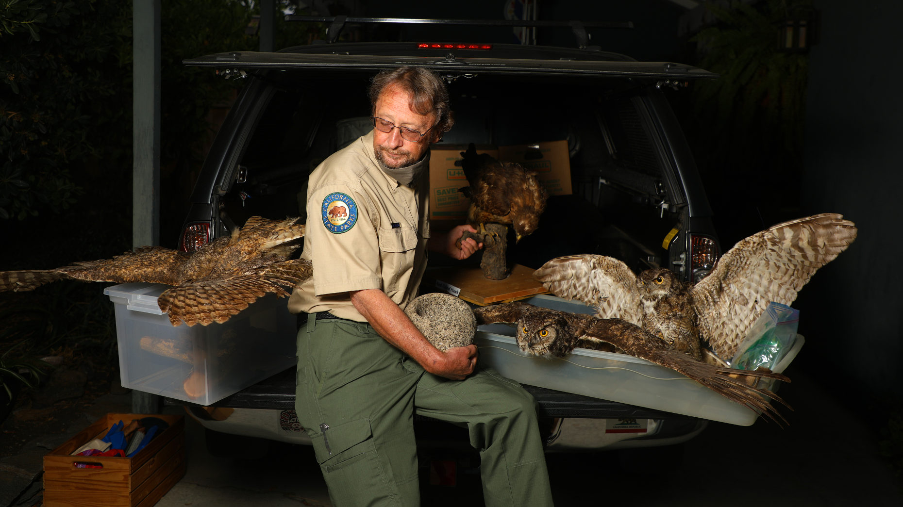
Many had to evacuate the Santa Cruz Mountains during the CZU Lightning Complex fires of August, 2020, including museums, visitor centers, and cultural heritage sites managed by California State Parks. Jenny Daly, museum curator for the Santa Cruz District of California State Parks, was part of a team that worked quickly to save artifacts from threatened State Parks, including Big Basin, Año Nuevo, and Wilder Ranch.
During this online event, learn about the immediate steps taken by State Parks to save our cultural history and the ongoing process of caring for objects impacted by the fires. Kathleen Aston, Collections Manager at the Santa Cruz Museum of Natural History, will also share how the Museum approaches natural disasters and collections, from Loma Prieta to ongoing efforts with the CZU Lightning Complex.
Photo of Mark Hylkema by Aric Crabb/Bay Area News Group.
About the Speaker
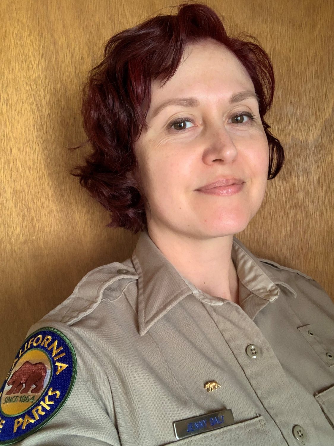
Jenny Daly, Museum Curator I for the California State Parks in the Santa Cruz District, grew up in Santa Cruz and is fortunate to live and work in her hometown. After transferring to UC Berkeley from Cabrillo College, Jenny received a double BA in Near Eastern Studies and Theater, Performance, and Dance Studies. The most valuable part of her time at Berkeley was the internship she had working with the Registrar at the Phoebe Hearst Museum of Anthropology where she became hooked on the idea of a career working in museums. Jenny then received a Master’s in Museum Studies from John F. Kennedy University and has worked in collections management at various institutions since then, including at the California Academy of Sciences, the Cantor Arts Center, and the Getty Center. Jenny was very excited to start working for the State Parks as a curator because it meant she could combine her love of Parks with her expertise in museum collections management.
Fire is many things to the Amah Mutsun and other California Indian Tribes — it is sacred, it is a tool gifted by Creator, and it is a way to restore balance to Mother Earth. This presentation will share more about how the Amah Mutsun are using fire to restore landscapes and relationships in the Santa Cruz mountains and beyond.
About the Speakers
Lawrence Atencio is the Native Stewardship Corps Field Manager for the Amah Mutsun Land Trust.
Marcella Luna is an Amah Mutsun Tribal Member, Native Stewardship Corps member, and sits on the Amah Mutsun Tribal Council.
The Amah Mutsun Land Trust is an initiative of the Amah Mutsun Tribal Band, which is the vehicle by which the Amah Mutsun access, protect, and steward lands that are integral to their identity and culture. The AMLT returns the tribe to their ancestral lands and restores their role as environmental stewards.
The Santa Cruz Museum of Natural History is located in the unceded territory of the Awaswas-speaking Uypi Tribe. The Amah Mutsun Tribal Band, comprised of the descendants of Indigenous people taken to missions Santa Cruz and San Juan Bautista during Spanish colonization of the Central Coast, is today working hard to restore traditional stewardship practices on these lands and heal from historical trauma.
For this month’s curated cocktail, we’re celebrating how culinary traditions represent one of our most fundamental relationships with the natural world.
The Sorrel Spritz is inspired by Juneteenth, the commemoration of the end of slavery in the United States, a holiday that is receiving more attention as an increasing number of institutions strive to acknowledge the contributions of Black American history and culture.
The holiday hails from June 19, 1865 — the day that Union troops announced to slaves in the remote Confederate state of Texas that the Emancipation Proclamation had technically freed them two years prior. While formerly enslaved folks still faced violence, forced labor, and other challenges, celebrations persisted and “June” and “19th” ultimately merged to become today’s Juneteenth.
Juneteenth celebrations take many forms, but commonly feature readings of the Emancipation Proclamation, parades, and lots of delicious food and drink. Crimson colored treats like red velvet and red colored punch are a staple. In her exploration of the origins of this tradition, Christina Ayele Djossa points to the longstanding use of the hibiscus plant for making tea in West Africa as a forerunner of these beverages.
Hibiscus sabdariffa, also called Roselle, is a flowering plant in Malvacaea, nicknamed the mallow or hibiscus family. Usually yellow flowering, it is the fleshy red calyx, a protective structure at the base of the flower, that is boiled for making hibiscus tea. Indigenous to Africa but now found throughout the world, its bright tangy flavor and rich red color make it a favorite in food traditions in the African Diaspora and beyond (for example, Jamaica aguas frescas).
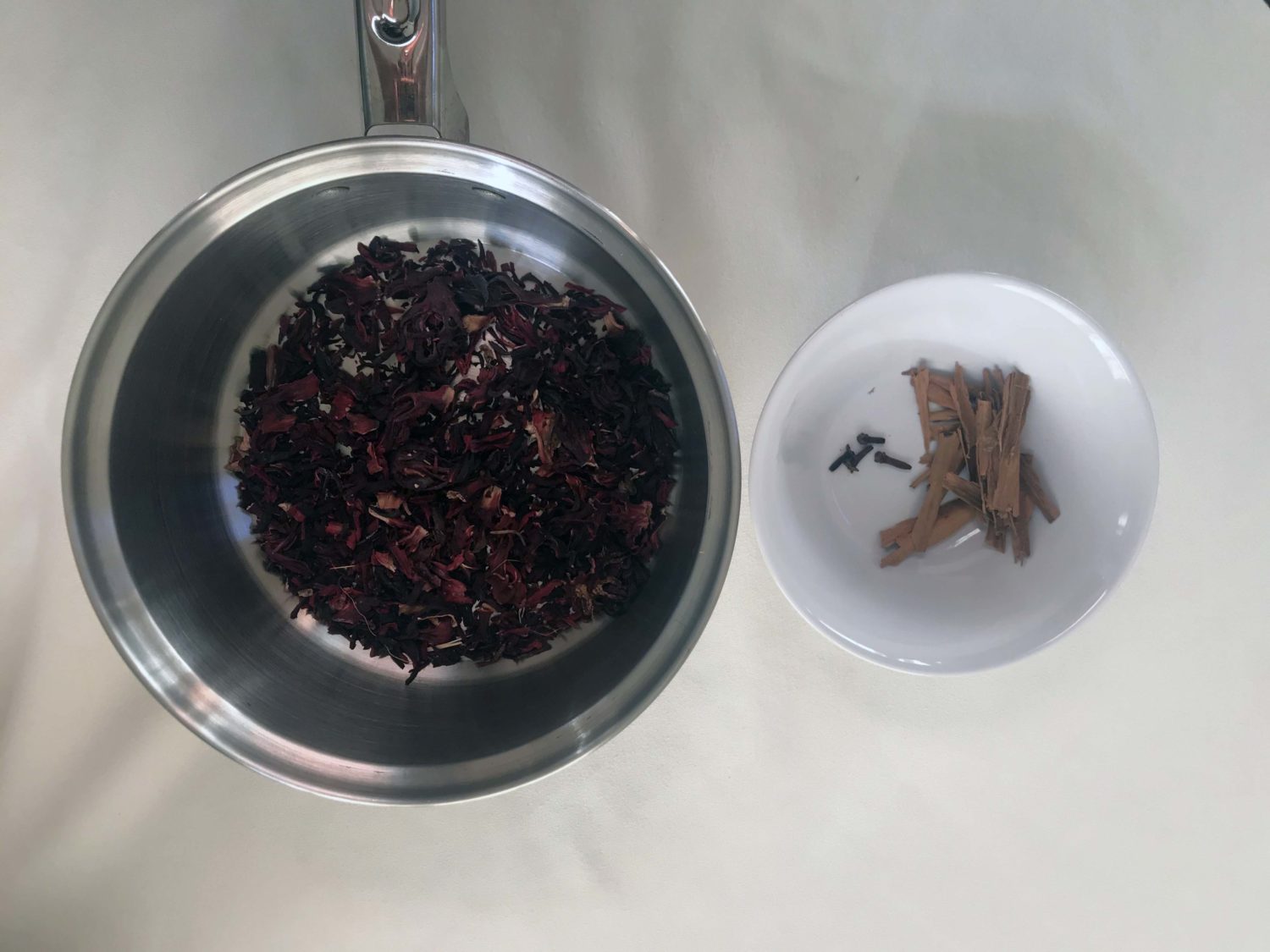
The Sorrel Spritz is based on a Jamaican Christmas punch that combines the delightful tartness of the hibiscus with the warming tones of cinnamon and cloves, and is then brightened up with some blood orange soda. The name “sorrel” comes from the Jamaican word for this plant, not to be confused with the leafy green herb.
Recipe
Boil one ounce hibiscus, four cloves, and one cinnamon stick in 1 ⅓ c water
Let sit for at least one hour
At this point you can drink this non-alcoholic version by itself, adding simple syrup and citrus to taste
For an alcoholic version, combine ¼ c hibiscus base, ¼ c rum, tablespoon of simple syrup, and teaspoon of lime juice with ice
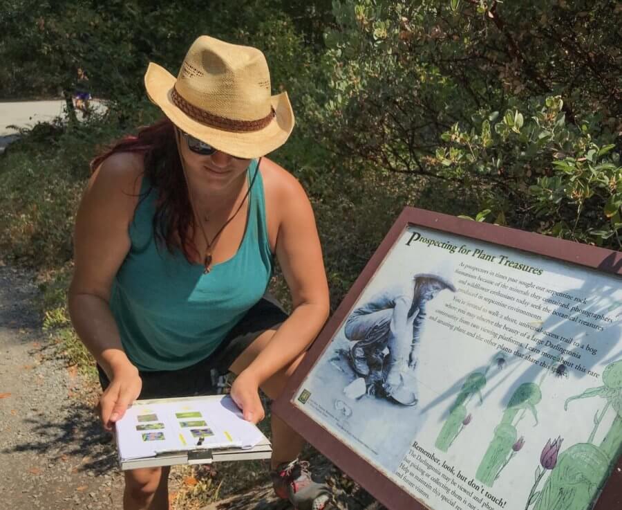
California has more native plants than any other state, most of which are endemic to California (only found here). What’s more, over 1/3 of our native plants are also considered rare due to human development, climate change, habitat fragmentation, rare habitats, and other factors.
During this collaborative program where science meets art, we’ll learn about human relationships with nature from two rare plant lovers who engage with California’s unique flora in their own unique ways.
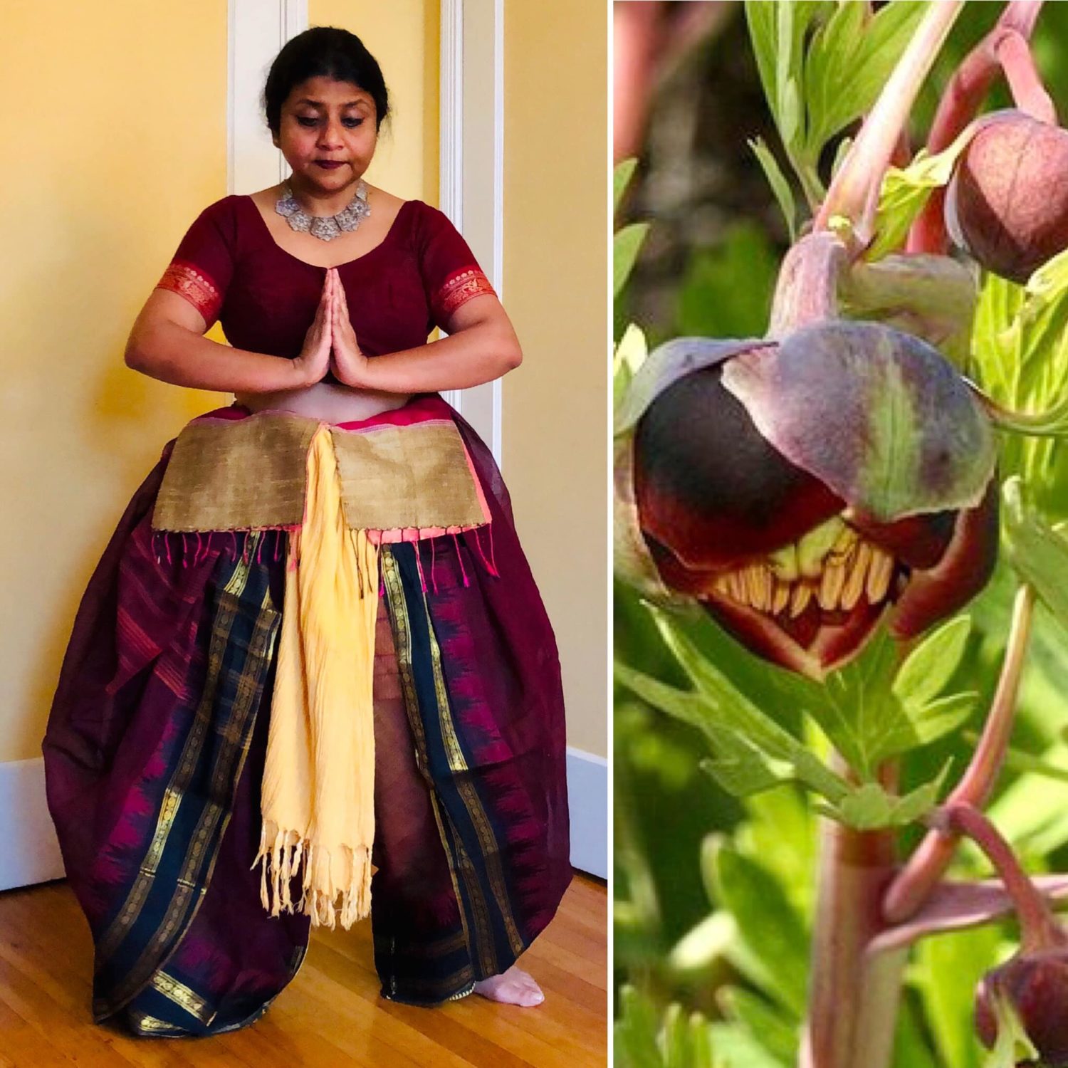
Barnali Ghosh, an immigrant storyteller and California landscape architect, has taken the native plant world by storm with a series of fashion self-portraits bridging home and homeland — re-creations of California native flowers, using fabrics and dance forms from India.
Amy Patten works with community scientists to document rare plant populations throughout California through her role as Rare Plant Treasure Hunt Manager with the California Native Plant Society. She also captures the flora and fauna around her through the art of photography.
Barnali Ghosh has featured several of Amy Patten’s photographs of native plants in her self-portraits.
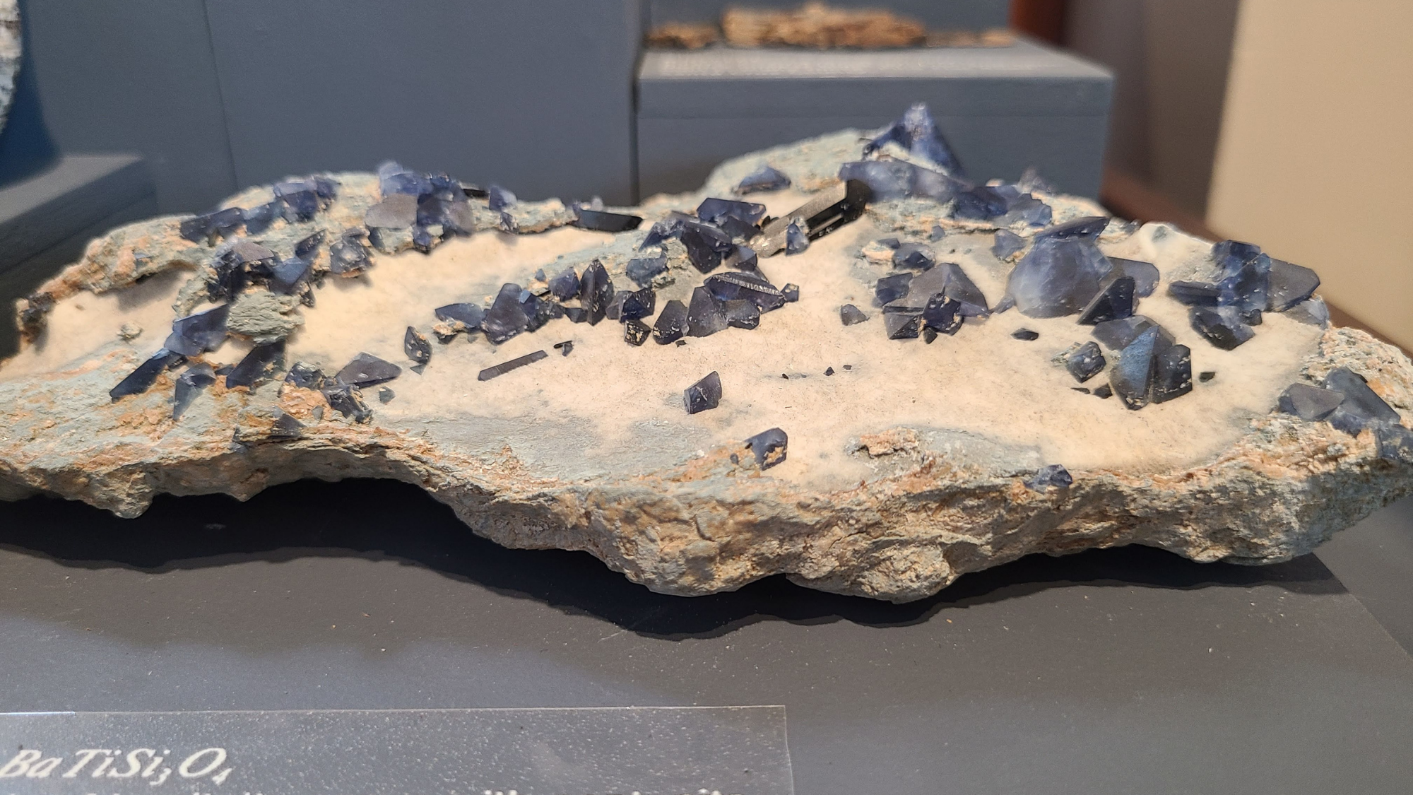
Not all that glitters is gold — sometimes it’s benitoite! So discovered prospector James Couch, when in 1907 he encountered some sparkling specimens of what would one day become the California state gem. While gold looms large in the story of our state, the unique geology of California has gifted us many other magnificent rocks and minerals. From cinnabar to serpentinite, we are delighted to share these with the public once more in our classic California minerals exhibit. We are fortunate enough to have one specimen of rare benitoite on display, and for this month’s close-up, we’ll zoom in on our only other specimen, safely secured in storage.
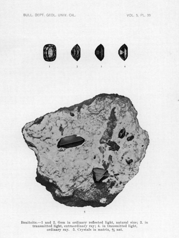
Benitoite specimen from the Museum’s collections.
Our second benoite specimen is hosted by a chunk of blueschist that amounts to the size of a large hamburger. Brilliant blue sparkles alert us to the presence of benitoite, or barium titanium silicate (BaTiSi₃O₉). These are nestled alongside black sprinkles of neptunite in a white, almost fuzzy looking layer of natrolite. Blue, black, and white, each of these substances is its own mineral, a naturally occurring inorganic element or compound with a characteristic structure.
These minerals and their blueschist host rock come from the guts of the southern end of the Diablo Range. Millions of years ago, unusual combinations of hydrothermal fluids seeped into the cracks of the blueschist found within metamorphosed serpentinite, forming a variety of rare minerals including benitoite, neptunite, natrolite, joaquinite and others. And while benitoite is found in a few places around the world, this section of the California Coast Range geologic province in southeastern San Benito County is the only place in the world where gem quality benitoite crystals are found.
It’s also the first place where benitoite was found. There are some complex claims to the initial discovery, but the most widely accepted story begins with failed melon farmer James Couch prospecting outside Coalinga on behalf of investor R. W. Dallas. In December of 1907, Couch noticed some blue sparkling stones he thought to be sapphire. In the subsequent months, Dallas looped in a few dealers and gem cutters, who offered different identifications, including an expert in Los Angeles who thought it was volcanic glass (perhaps because of it’s conchoidal fractures). By the time a sample made its way to San Francisco, a lapidary who thought the stone was spinel showed it to a friend, who sent it to UC Berkeley mineralogist Dr. George Louderback.
Dr. Louderback investigated the sample, finding it too soft to be either spinel or sapphire. Upon examination, Louderback identified the specimen for what it was – a new substance to science, and named it Benitoite, after the San Benito river which ran through the area of the mining claim. He soon journeyed to the Dallas Mine, where operations had already started, to study benitoite’s geological context. The paper he published describing benitoite’s mode of occurrence also includes the first published photos of benitoite and early photos of the mine.
Benitoite Mineral Specimen and Gems (Louderback, 1909)
The paper describes a lot of the properties that make benitoite exciting – including the high refractive indices and strong dispersion that make it especially sparkly (although you have to go elsewhere to learn about benitoite’s stunning fluorescence). It is still described by many sources as one of the “finest” descriptions of a new mineral species to be written. It’s worth noting that benitoite, while new to science, was nonetheless the embodiment of a scientific prediction that had been made decades prior. It exhibits a ditrigonal-dipyramidal crystal habit, a shape that looks sort of like someone glued the bottoms of two triangular pyramids together, within the hexagonal crystal class. This was the first time such a form was found naturally occurring, one of only thirty-two possible classes of crystal shapes mathematically predicted by Leipzig crystallographer J.F.C. Hessel in 1830.
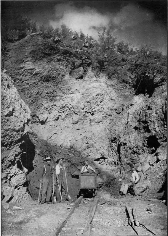
Open Cut Benioite Mine 1908 (Louderback, 1909)
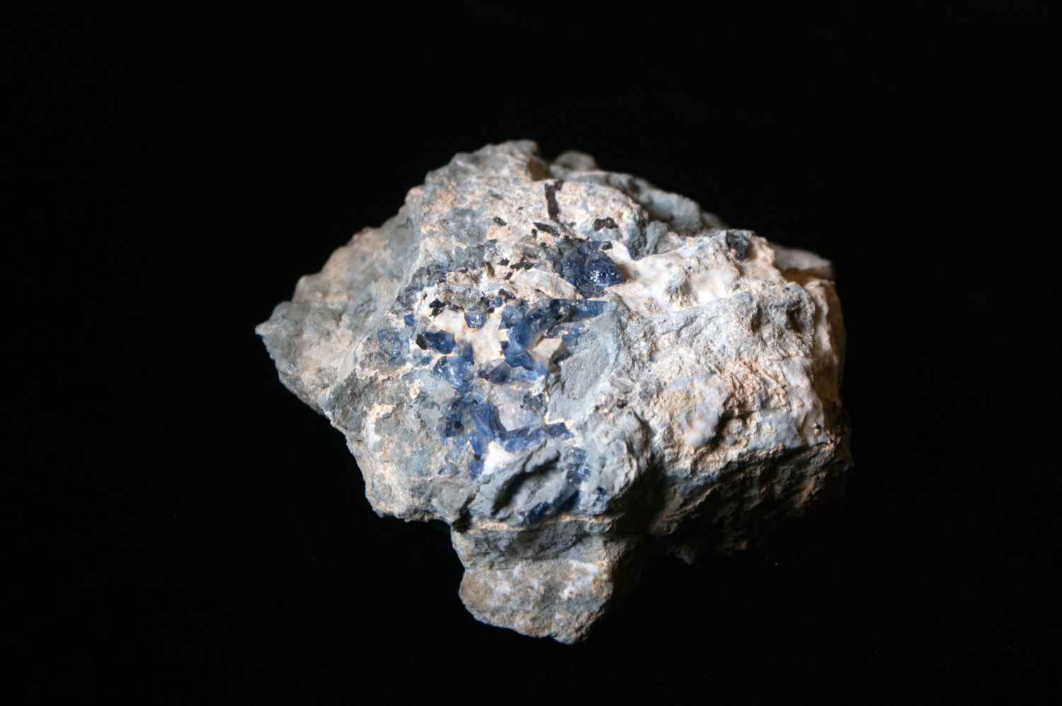
Even as the true nature of benitoite was unfolding, commercial operations quickly emerged at what was first called the Dallas Mine. Over the decades the mine has seen varying techniques and levels of productivity. In the earliest years, folks were after the largest possible gems and they wanted them fast. This meant hacking off a lot of big knobs of crystal that were initially covered, due to the way the mineral veins had formed within the blueschist, in a fine layer of natrolite. Waiting to dissolve the natrolite in acid, which could happen with no harm to the benitoite, took too long. This meant that a lot of well crystalized mineral specimens within their original rock matrix were broken up and made into gems. Fortunately, some whole specimens remain, and the museum purchased the specimen featured in our Collections Close-Up from San Francisco based J. Gissler in the late 1930s.
Our display specimen was also purchased in the 1930s. This specimen has been exhibited since 1985, the very year that Californian’s made benitoite their state gem to celebrate its beauty and uniquely California story. And though the history of this mineral is part of it’s charm, mineral discovery is not a thing of the past. Scientists continue to discover new minerals as the result of current field work, or even through fresh understandings of preserved museum specimens.
For more on benitoite and it’s geological and cultural history, join our Collections Close-Up conversation with Professor Hilde Schwartz on June 10.
Conservation and recovery of threatened and endangered species requires more than bringing individual organisms back from the brink. It also requires the restoration and recovery of ecological relationships that allow all organisms in an ecosystem to survive and thrive.
During this lecture with artist Megan Gnekow, we will explore how understanding and communicating food webs and other ecological relationships can help put some favorite (and famous!) creatures into context. We’ll also learn how creative use of science illustration can help tell these stories.
This program is in support of our science illustration exhibit, The Art of Nature, on view online and in-person.
Megan Gnekow
With formal training in a wide variety of media, Megan’s current work focuses primarily on honoring the fine details of the world and depicting the relationships between organisms in a wide variety of ecosystems. Her great passion is bringing people back to connection with the natural world through artistic experiences. She also volunteers for Resource Management at Pinnacles National Park, where she continues her training as an amateur naturalist. Megan spends most of her free time exploring the vast collection of ecosystems we call California.
There are few things more Californian than benitoite, a mineral formed within the low temperature, high pressure environment of subduction zones and sparsely sprinkled throughout serpentinite landscapes. While the mineral exists in isolated locations globally, gemstone quality material has only been found in California — one of the reason’s it was named our State Gemstone in 1985.
Learn about the geologic and cultural history of this mineral with Museum Collections Manager Kathleen Aston and Dr. Hilde Schwartz, lecturer in the Earth and Planetary Sciences Department at UC Santa Cruz, during this installment of our member-exclusive Collections Close-Up series.
Benitoite Mineral Specimen and Gems (Louderback, 1909)
Benitoite sample (Wikipedia)
Open Cut Benioite Mine 1908 (Louderback, 1909)
About the series
Zoom into the stories, secrets, and science of our collections during monthly webinars with Collections Manager Kathleen Aston. This live event is an extension of our monthly Collections Close-Up blog, with added insights and intrigue. Members are invited to participate in this program before it is made available to the general public as well as ask questions directly of Kathleen.
Your support helps us steward our collections and offer educational programs that connect people with nature and science. Memberships start at just $15/year.
The rocks on the surface of the Earth are shaped and transformed by the boundless forces of nature, creating a vast and ever-changing arrangement of formations for humans to observe and ponder. Even though the terrain of the U.S. comprises less than 2% of the Earth’s surface, the wide variety of environments found here gives rise to a diverse set of geologic wonders. In this installment of Rock Record, we will take a closer look at the mechanisms that formed some of the most distinctive and interesting of these geologic landmarks.
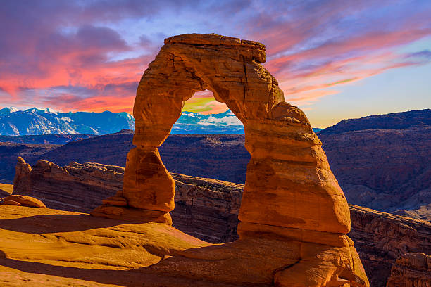
Delicate Arch in Arches National Park, Utah. Photo credit: Wikipedia user Palacemusic.
The Arches of Arches National Park
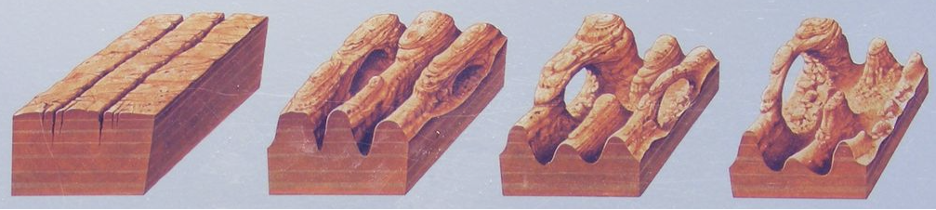
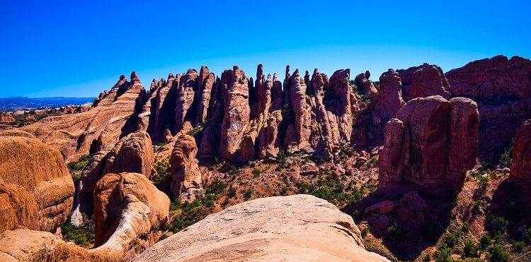
Unlike the natural bridges here in Santa Cruz, the arches of Arches National Park are not the result of localized erosion from waves. So how did these enigmatic features form?
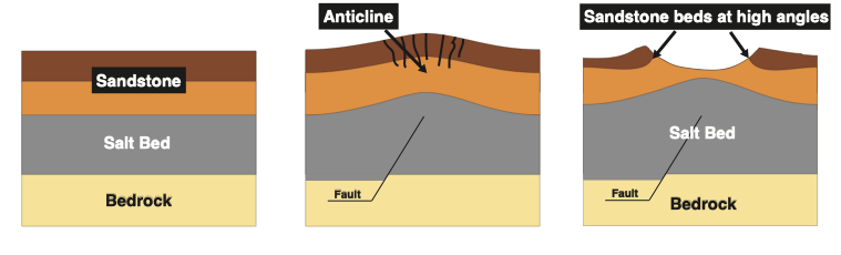
The famous arches are a marvelous geologic coincidence, stemming from three key processes that unfolded over the past 300 million years. The first factor leading to the arches was the deposition of massive salt layers by an inland sea 300 million years ago. In the ensuing time, denser, stronger sandstones were deposited on top of these salt layers and the weight of the overlying rocks, combined with tectonic forces in the region (the second arch forming factor), caused the salt layers to bulge and push to the surface. The combined effects of the tectonic forces and the underlying salt layers created a massive anticline, or convex rock fold, in the overlying sandstones (see the schematic below).
Schematic of the geologic processes leading to arch formation.
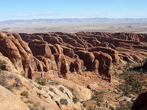
As this bulge in the Earth was eroded away, folded sandstone layers were then exposed at high angles at the surface. Because the sandstone layers were less erodible than some of the surrounding rocks they were left behind, jutting out of the earth surface in formations known as “fins” (see photos below). It was from these fins that the arches were eventually formed.
Aerial photo of sandstone “fins” near Arches National Park, Utah. Photo credit: hikingwalking.com.
Side view of Sandstone “fins” near Arches National Park, Utah. Photo credit: ramblearoundtheworld.com.
Schematic of Arch formation from Sandstone “fins”. Image courtesy of the National Park service.
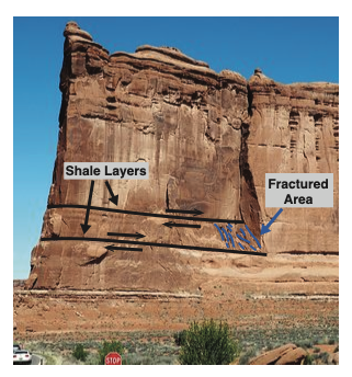
Fractured Area in “Tower of Babel” fin in Arches National Park, Utah. Image credit tripadvisor.com.
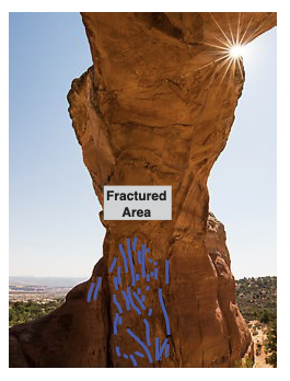
Fractured area inside “Broken Arch” in Arches National Park, Utah. Photo credit: QT Luong.
The final arch forming factor was localized fracturing from faulting within the fins. Tectonic processes caused faults along small, weak shale layers within the sandstone columns, leading to highly fractured zones. Over time, wind and rain plucked these fractured zones from the fins, leaving behind the arches we see today.
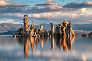
Photo of Mono Lake tufa towers. Photo credit: oakdaleleader.com.
The Mono Lake Tufa Towers
Above the quiet waters of Mono Lake, the tufa towers stand like a peculiar shrine to the geologic processes operating in this area east of the Sierra Nevada. The conditions that created the otherworldly tufa were an intersection between the realms of chemistry, geology and hydrology, forming tufa towers throughout the ~760,000-year life of Mono Lake.
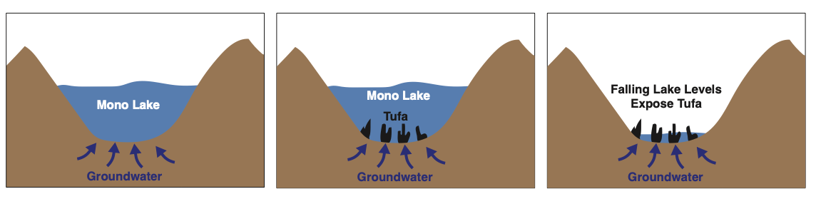
To understand the formation of the tufa, it is easiest to start by analyzing the setting of Mono Lake: Mono Lake lies in a basin that allows water to flow in, but not out. Meaning that all of the dissolved rock particles that flow into the lake stay there, causing the lake waters to become very salty and to have a very high pH (e.g. Acids like vinegar and lemon juice have low pH, while bases like baking soda and ammonia have high pH.) These lake conditions are conducive to high levels of the molecule carbonate (CO3), one of building blocks for “carbonate” minerals.
In addition to the surface lake waters, there are abundant groundwaters that flow into the basin from surrounding areas, which interact with the rocks as they flow towards the lake and become high in the element calcium. As these ground waters flow into the lake through underwater springs, the groundwater and lake water mix, causing the carbonate molecules and calcium from the two respective waters to bond, and form the tufa towers from the mineral calcite. This means that every tufa tower is a fossilized spring! Unfortunately, there is also a human induced component of the tufa towers we see today: when the city of Los Angeles diverted freshwater that once flowed into Mono Lake it caused lake levels to fall dramatically, leading to exposure of previously underwater tufa (see schematic of tufa formation below.)
Schematic of tufa formation from mixing of lake and ground waters (left and middle) and exposure through falling lake levels (right).
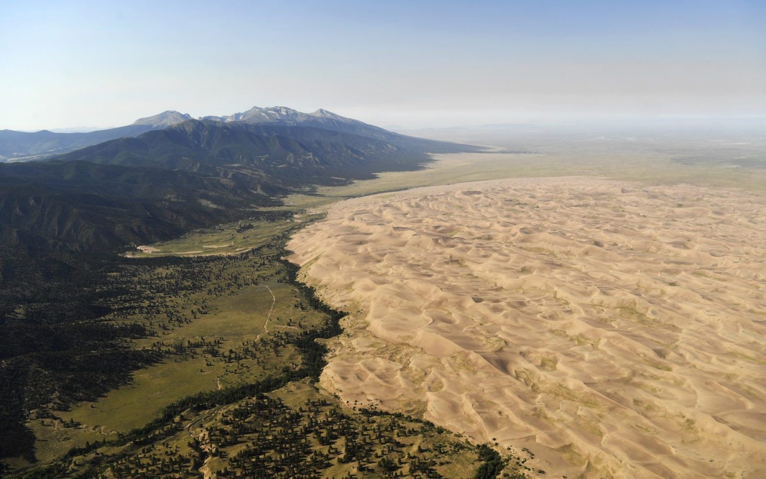
Aerial photo of Great Sand Dune National Park. Photo credit: The Denver Post.
The Dunes at Great Sand Dunes National Park
Sand dunes probably seem mundane for folks living in Santa Cruz who’ve likely seen the coastal sand dunes on the drive from Santa Cruz to Monterey. However, it may come as a surprise that the tallest sand dunes in North America are far from the ocean and are not associated with grand deserts like the Mojave either, but instead are found right in the middle of Colorado!
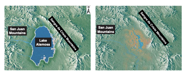
The dunes at Great Sand Dune National Park lie along the eastern edge of the San Luis basin between the San Juan Mountains to the west and the Sangre de Cristo Mountains to the east. This basin used to hold the massive Lake Alamosa, which drained around 440,000 years ago. Following the lake drainage, sediments from the lake bottom and the surrounding mountains began to build up in on the basin floor (see maps below).
Idealized maps of the San Luis Basin before (left) and after (right) Lake Alamosa drained. Map credit: National Park Service.
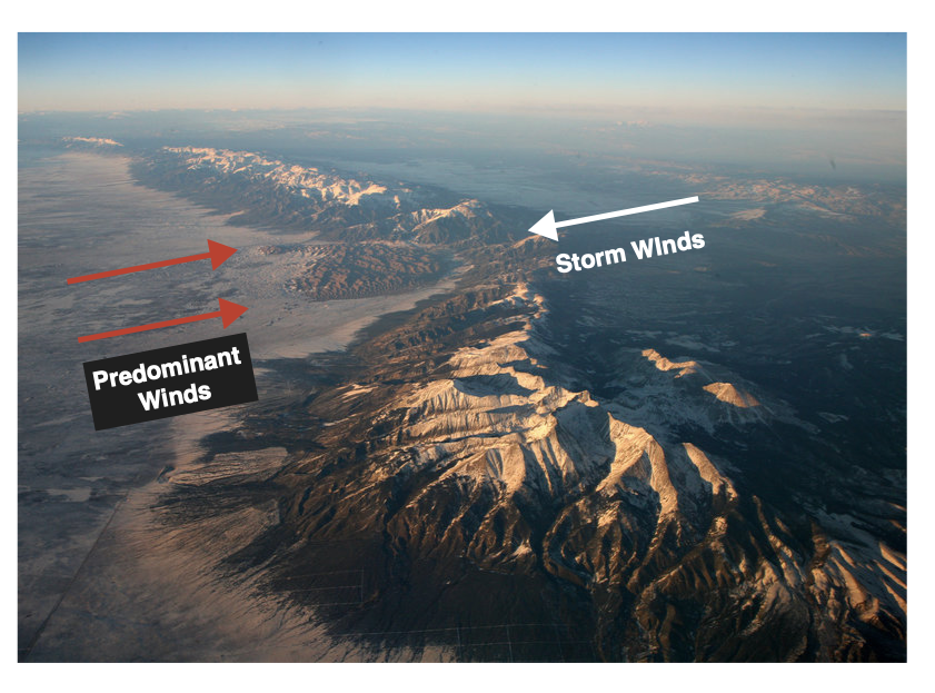
The location of this basin in the greater Rocky Mountains funnels wind from the southwest, causing the sand dunes to grow in a natural pocket in the Sangre de Cristo Mountains. During storms events, opposing winds are driven from the east, causing the dunes to grow to their great heights (see image below).
Aerial photo of the great sand dunes in their natural pocket in the Sangre de Cristo Mountains.
Learn more about our nation’s geologic landmark, including some closer to home, during May’s Rockin’ Pop-Up.
Rock Record is a monthly blog featuring musings on the mineral world from Gavin Piccione and Graham Edwards, PhD candidates in geochronology with the Department of Earth and Planetary Sciences at UC Santa Cruz. They also host our monthly Rockin’ Pop-Ups as “The Geology Gents”.
The CZU Lightning Complex fires burned roughly 80% of the old growth redwood forests in the Santa Cruz Mountains, notably including Big Basin, the largest contiguous stand of old growth redwoods south of Humboldt County. While it’s still unclear what the outcome of this fire complex will be, we can look to prior fires to see how the redwood trees might respond.
Join us as we discuss what is known about redwoods and fire, from historic fire intervals, to fire adaptations, to tree-level physiological and anatomical responses. We’ll also explore how severely trees were burned using ground and satellite measurements and what we may expect forest recovery to look like.
About the Speaker
Zane Moore is a doctoral student at UC Davis studying redwood development and genomics. He has studied redwood forests in the Santa Cruz Mountains since 2010 with a focus on albino redwoods, large redwood clones, dendrochronology (tree ring science), and tall trees. Zane has also been a docent at Big Basin since 2012, engaging in science communication with the public about these fascinating trees.
This program is part of the CZU Lightning Complex and Community Science Project in partnership between the California Native Plant Society, the Kenneth S. Norris Center for Natural History, the San Lorenzo Valley Museum, and the Santa Cruz Museum of Natural History.
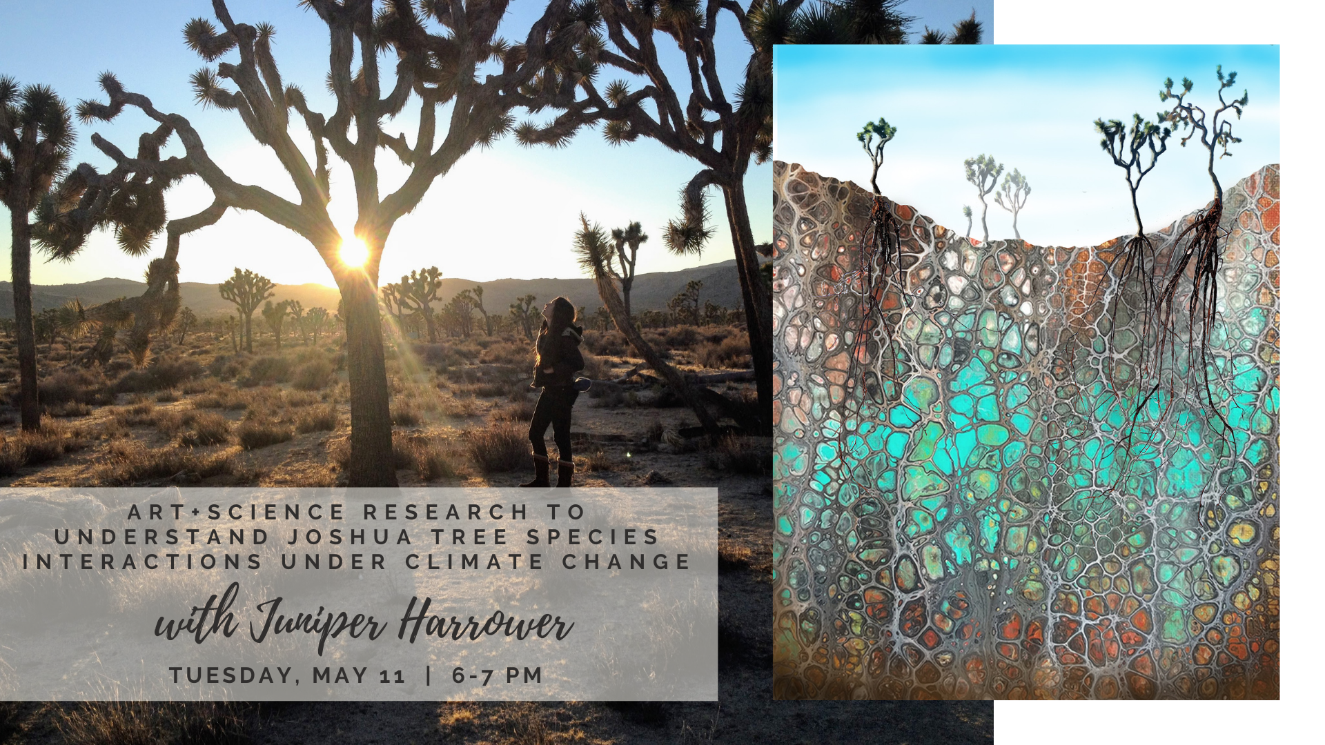
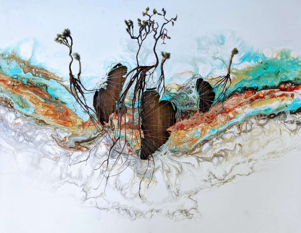
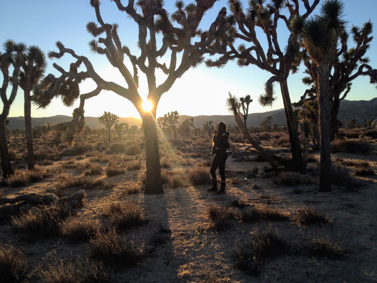
Joshua trees are threatened by the changing climate and may be extinct from their namesake park within a century. In this talk, Dr. Juniper Harrower will share her multimedia art and ecological research practice that investigates the impacts of climate change on Joshua trees and their critical symbiotic partners — a clever moth pollinator and an underground community of mycorrhizal fungi.
Join us to learn about how she brings together years of species monitoring in Joshua Tree National Park, DNA sequencing, experimental painting, animation, and an online dating site to meet Joshua trees!
Specializing in species interactions under climate change, Dr. Juniper Harrower works across disciplines as both an ecologist and an artist. She uses rigorous science methods and a multimedia art practice to investigate human influence on ecological systems while seeking solutions that protect at-risk species and promote environmental justice.