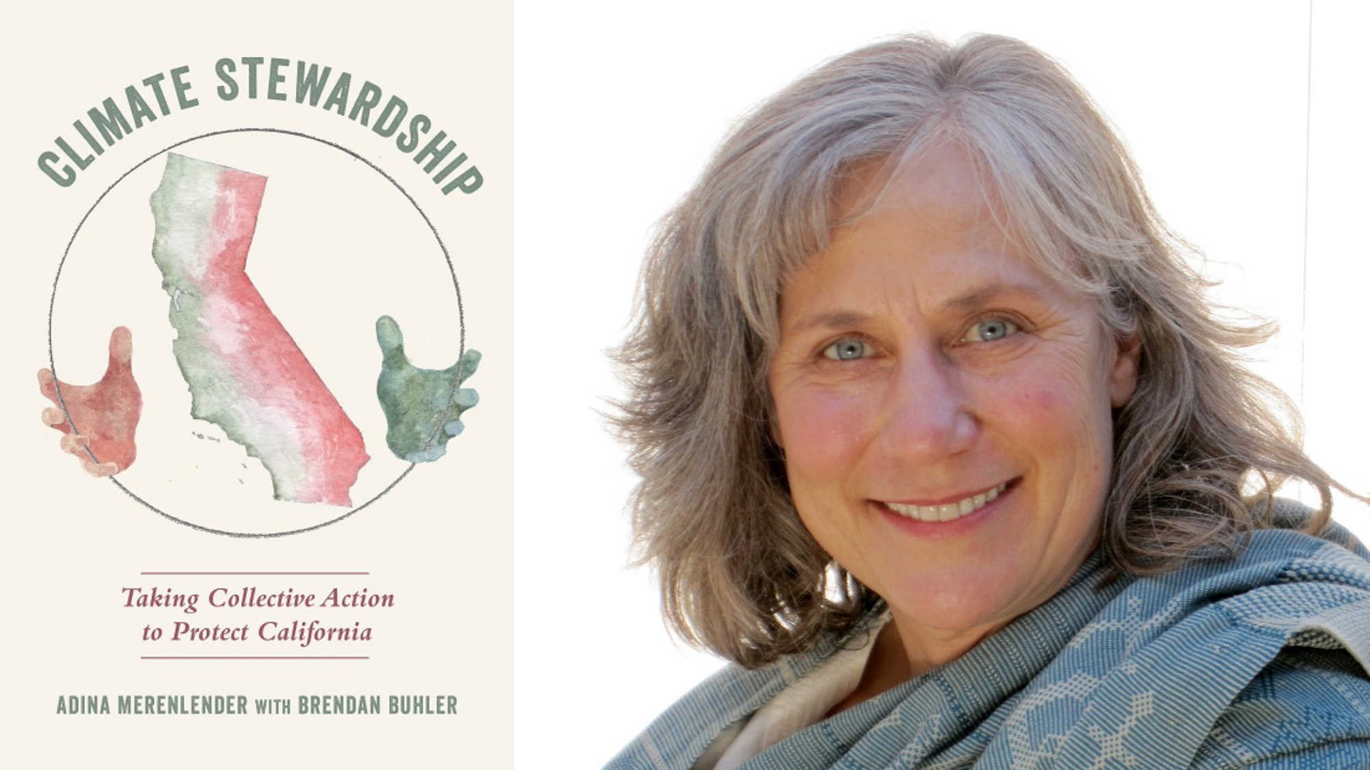
Across California, communities are addressing wildfires, climate justice, urban heat islands, ocean temperature rise, and other climate issues in an effort to make natural, working, and urban landscapes more resilient. During this talk, author Adina Merenlender will share stories from her recently published book, Climate Stewardship: Taking Collective Action to Protect California, which highlights the real work being done by everyday citizens throughout the state to address climate change.
Adina Merenlender is a Cooperative Extension Specialist at University of California, Berkeley, and is an internationally recognized conservation biologist known for land-use planning, watershed science, landscape connectivity, and naturalist and stewardship training. She has authored more than 100 published works in the field of conservation science.
Merenlender started the California Naturalist Program and served as its founding director, which to date has graduated over 4,000 certified California Naturalists. Building on the success of this program, Merenlender helped start the first public education and service program on climate stewardship, including writing Climate Stewardship: Taking Collective Action to Protect California with Brendan Buhler. The two programs provide collective impact on ecological health through community and citizen science.
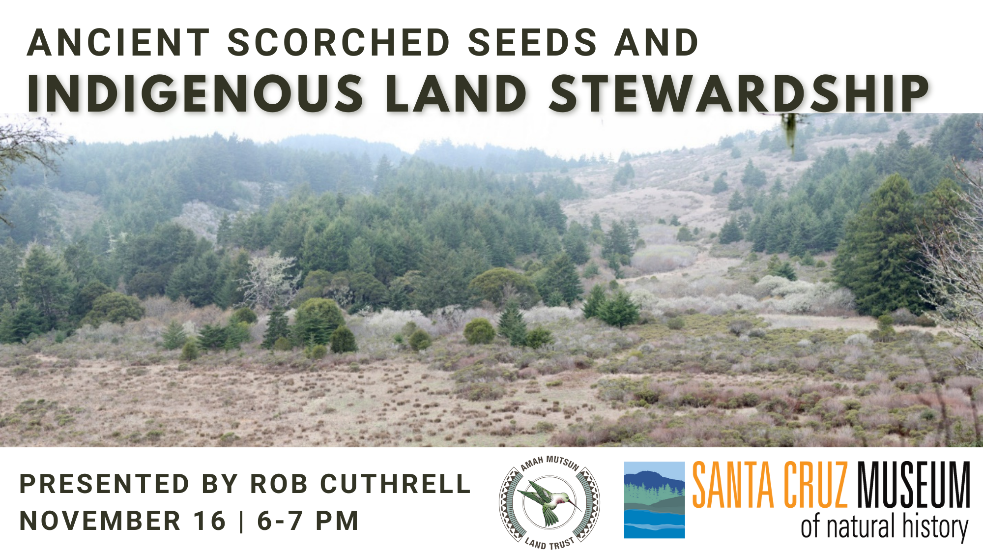
Archaeologists can analyze charred seeds and other plant remains to learn about relationships between people and the natural world deep into the past. This talk will describe how a collaborative research project between Amah Mutsun Tribal Band, State Parks, and academic researchers utilized this type of information to explore how Indigenous peoples on the coast of San Mateo and Santa Cruz Counties used prescribed burning to steward local landscapes. Guided by these findings, Amah Mutsun Land Trust is working to revitalize Indigenous-based stewardship of open spaces today.
Rob Cuthrell is a researcher in archaeology and historical ecology who has studied relationships between Indigenous people and landscapes west of the Santa Cruz Mountains for over a decade. Currently, Rob works as a consultant for Amah Mutsun Land Trust managing a native plant propagation and restoration project on Año Nuevo Point.
This program is in support of the exhibit Seeds: Nature’s Artful Engineering, on view at the Santa Cruz Museum of Natural History through November 28.
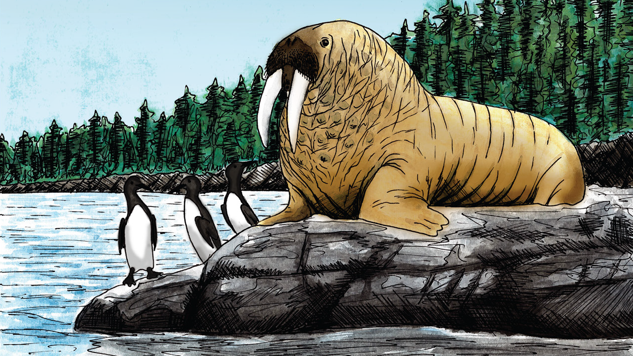
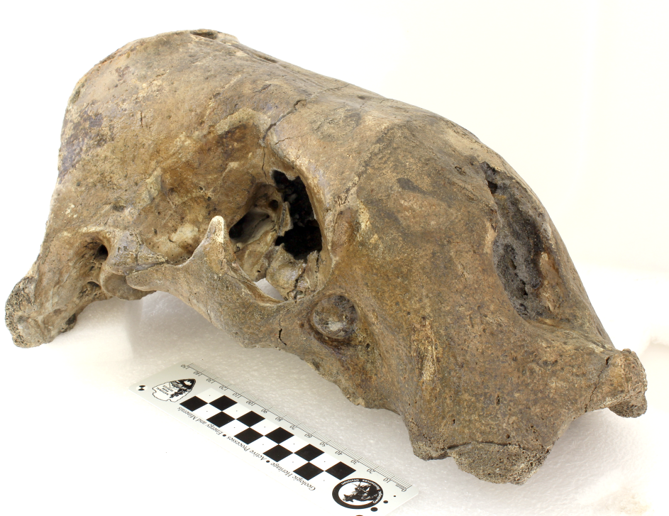
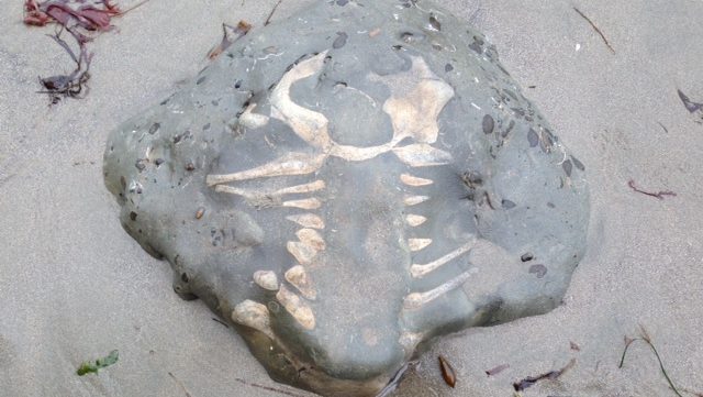
Though our coast today is inhabited by sea lions, harbor seals, and elephant seals, none of these species existed in California 3-5 million years ago. Instead, fossils from the Purisima Formation tell a very different story of strange walruses and early fur seals that inhabited our coast. These include the ancestor of the modern northern fur seal (today a rare visitor to Monterey Bay), the bizarre “double tusked” walrus Gomphotaria, and the toothless walrus Valenictus. Several discoveries made by local collectors and paleontologists represent new species — and you’re going to hear new data and findings never reported before during this presentation.
Join us on National Fossil Day for this member-exclusive presentation with longtime friend of the Museum, Dr. Robert Boessenecker.
Dr. Robert Boessenecker
“I grew up in Foster City on the peninsula, disappointed as a dinosaur nerd kid that there weren’t much in the way of dino fossils from California – which I mistook for “no interesting fossils at all”. Once in high school I visited some shark tooth sites in Scott’s Valley and became obsessed with marine mammal fossils none of the fossil collectors could identify. As an undergraduate student at Montana State University, I started collecting and researching a marine mammal fauna I discovered in Half Moon Bay; I continued with my master’s thesis at MSU on the preservation and stratigraphic context of Purisima Formation fossils, and then went to University of Otago in New Zealand to do my Ph.D. on early baleen whales from much older rocks down under. I have been at the College of Charleston in South Carolina, studying early baleen whales and dolphins, and once again researching Purisima Formation sharks, fish, birds, turtles, and marine mammals.”
-Dr. Robert Boessenecker
About the series
Zoom into the stories, secrets, and science of our collections during monthly webinars with Collections Manager Kathleen Aston. This live event is an extension of our monthly Collections Close-Up blog, with added insights and intrigue. Members are invited to participate in this program before it is made available to the general public as well as ask questions directly of Kathleen.
Your support helps us steward our collections and offer educational programs that connect people with nature and science. Memberships start at just $15/year.
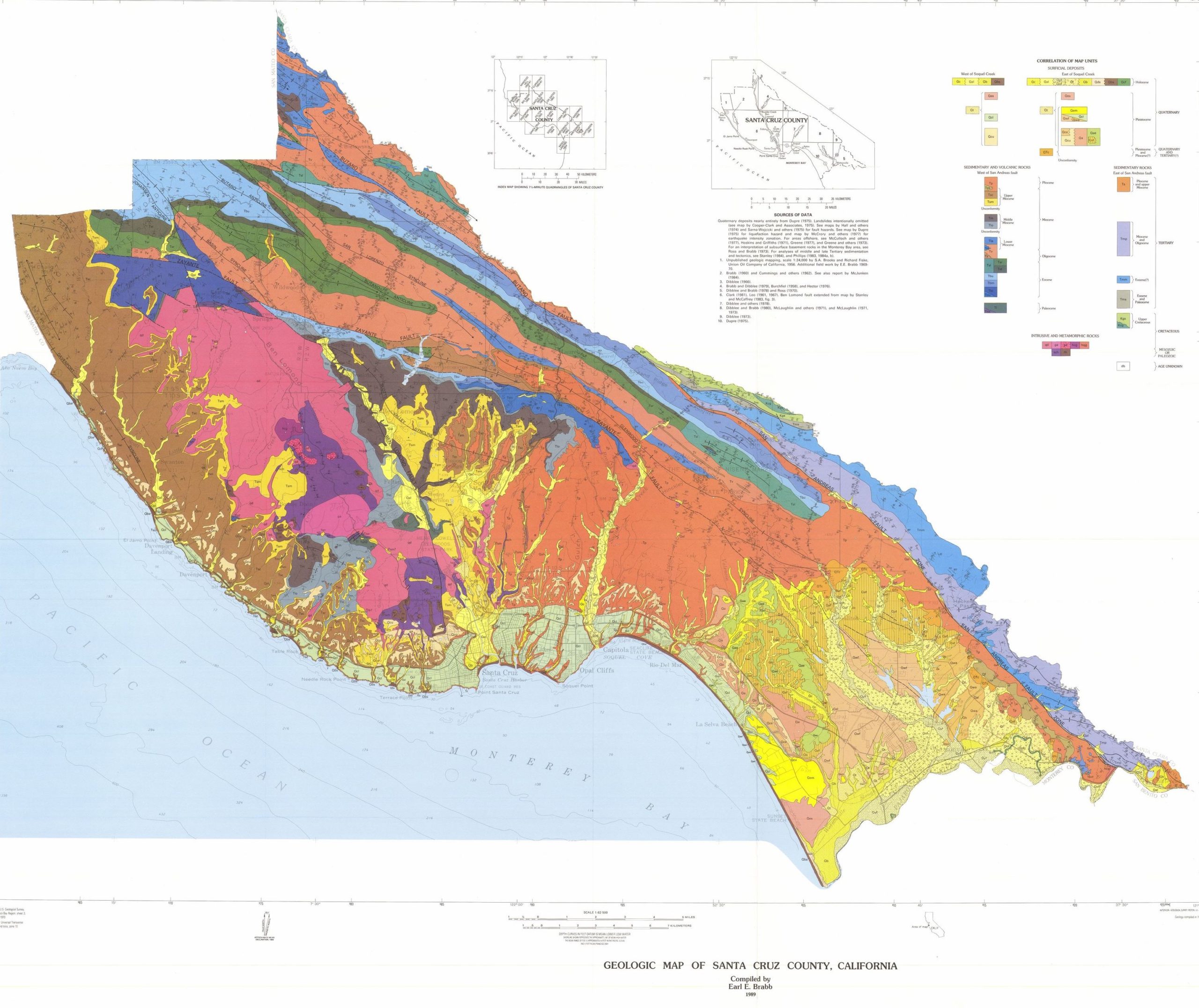
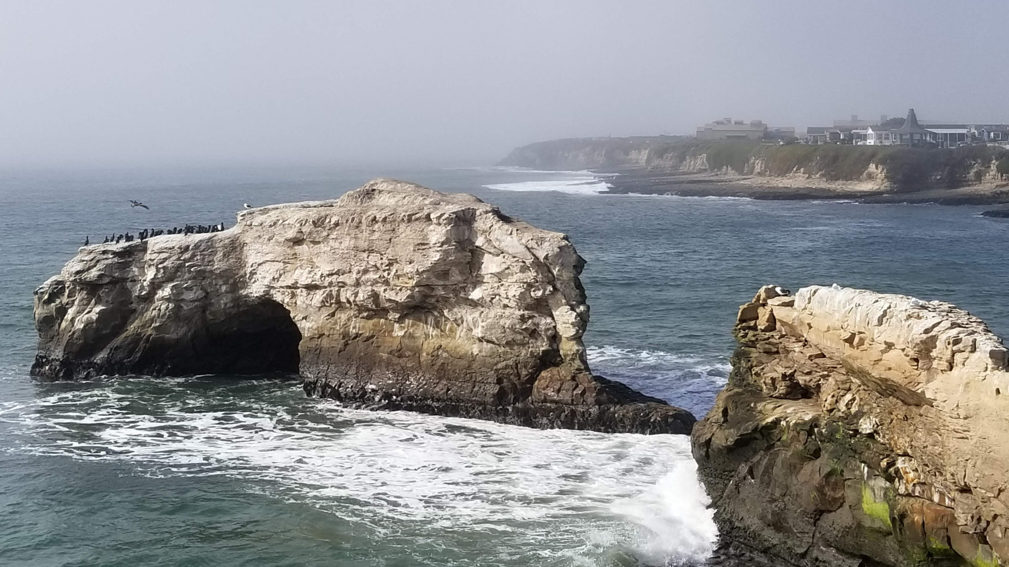
Santa Cruz is an area of geologic interest with a complex history of processes that shaped the coastline, bluffs, terraces, and mountains we see today! Wind, waves, earthquakes, fires, and other natural forces have changed and shaped the landscape for millions of years, though humans have only been able to document those changes in the recent past.
The above map shows the distribution of different rocks in Santa Cruz County. Each color represents a different kind of rock and, in turn, a particular age. Many of these rocks represent formations.
A geological formation is a basic rock unit that geologists use to group rock layers. Each formation must be distinct enough for geologists to tell it apart from surrounding layers and identify it on a map. A formation can consist of a variety of related or layered rocks, rather than a single rock type. There are over 14 geologic formations in Santa Cruz County. Most of these formations were created through movement of the crust because of tectonic uplift at the subduction zone off the California coast.
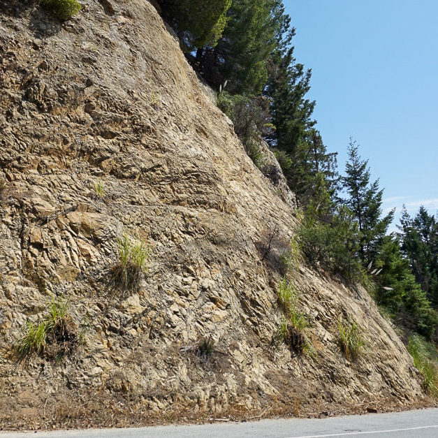
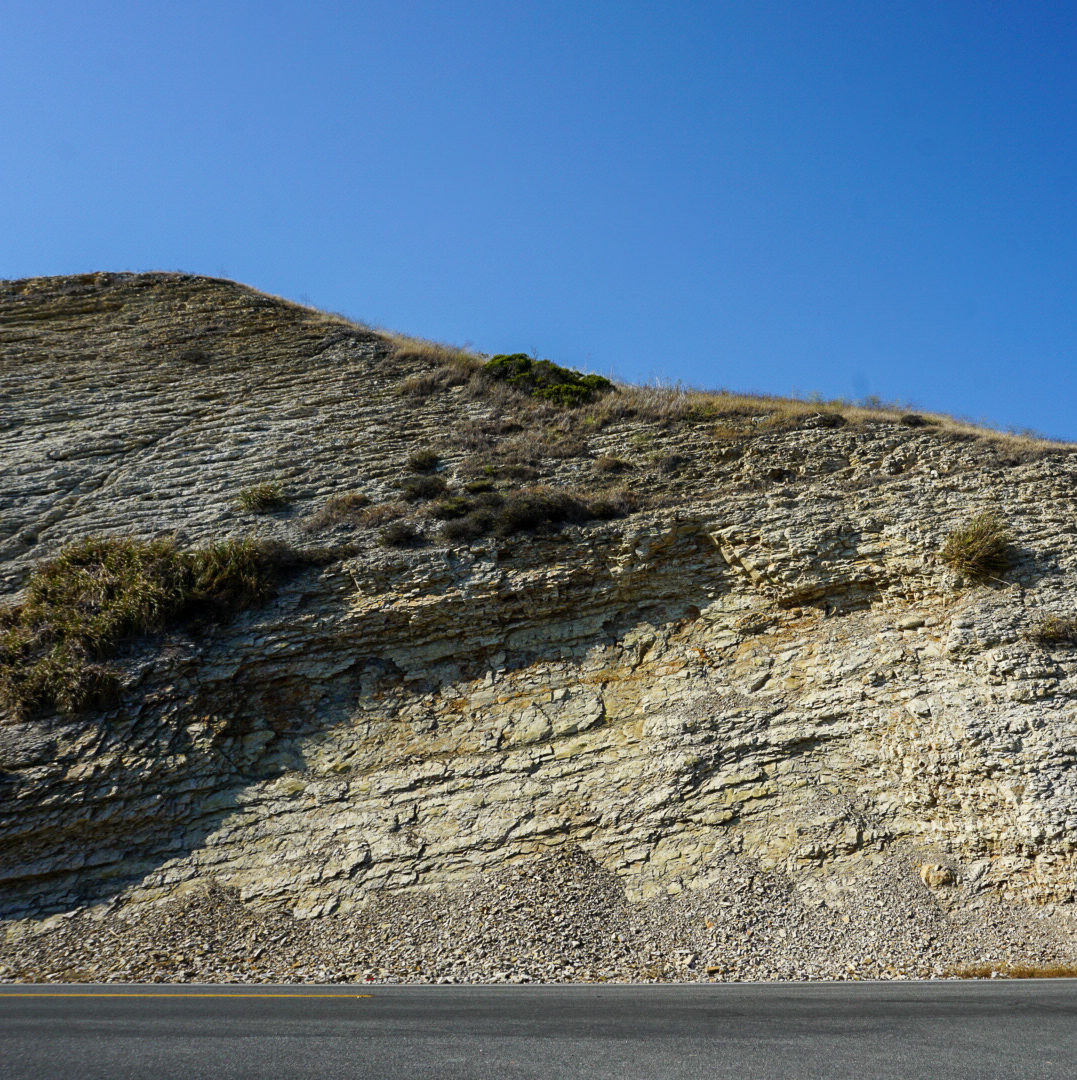
Most of the county is underlain by granitic rock. It formed about 100 million years ago from molten rock which cooled very slowly at a depth several miles below the earth’s surface. Since then, this area has been covered by the sea much of the time. Sand, mud and other sediment was deposited on the seafloor and was eventually compressed and hardened into sedimentary rock which was uplifted to form the Santa Cruz Mountains. Many of the sedimentary beds, which were originally horizontal, have been tilted, folded or partly eroded away. In some areas major faults have offset the rocks.
3 formations are known for fossils in this region: Purisima Formation (3-7 Ma) Santa Cruz Mudstone (7-9 Ma) Santa Margarita Formation (10-12 Ma)
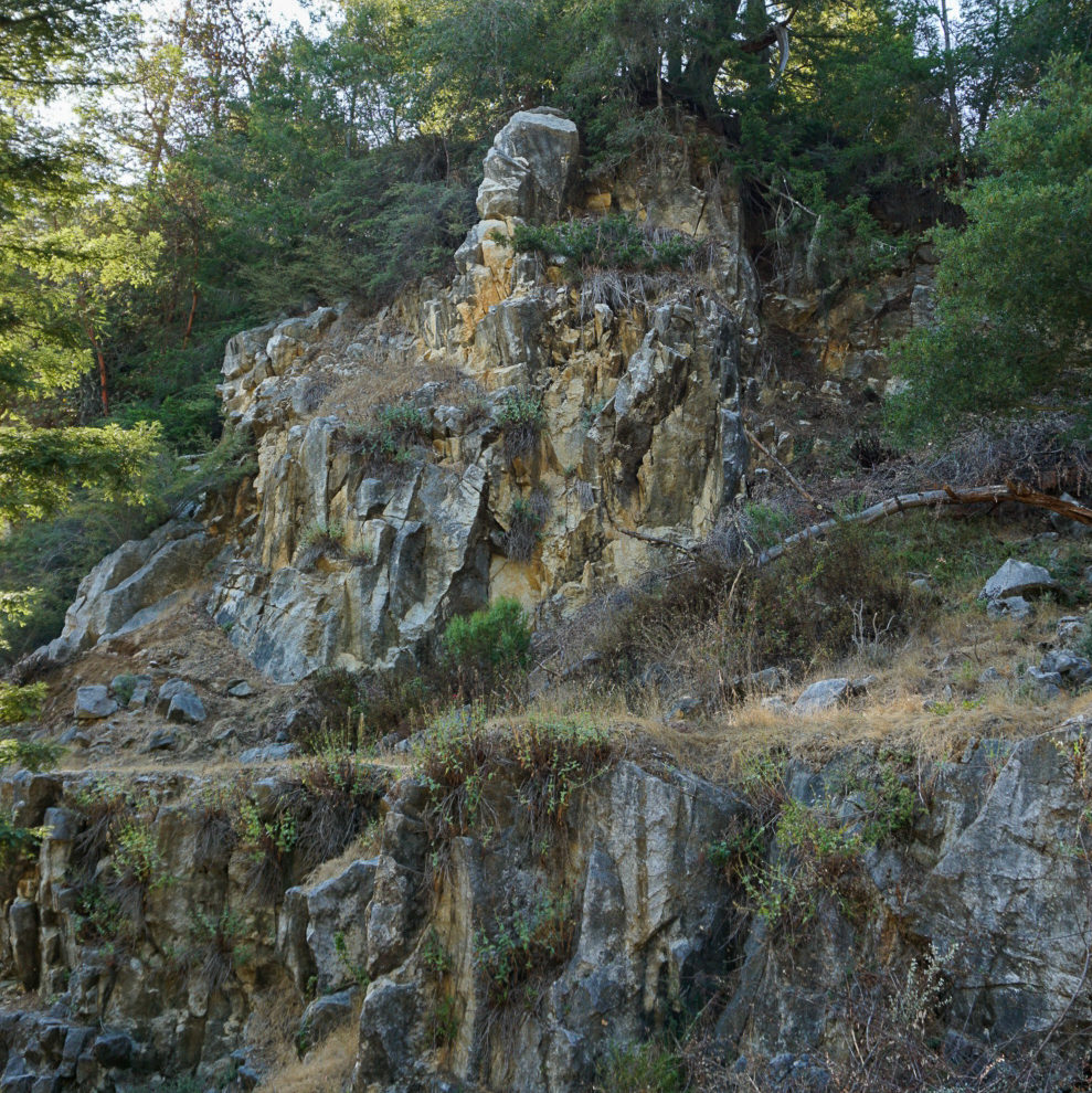
The three basic types of rocks — igneous, metamorphic and sedimentary — occur in Santa Cruz County. All are composed of minerals. Some consist of primarily one mineral, as in the case of marble, while others are an aggregate of many different minerals, as in the case of granite and conglomerate.
Each rock type in the Santa Cruz area represents a different chapter in this region’s geologic past, and each has its own unique story to tell. The rocks of this area are mostly covered by soil and vegetation, so geologists must rely on scattered outcrops in creek beds, quarries, road cuts and sea cliffs in order to piece together the geologic history.
Granite, Empire Grade Road
Igneous rocks formed from molten rock called magma. Plutonic rocks, such as granite, gabbro and alaskite, cooled very slowly, solidifying deep below the earth’s surface. This provided time for larger crystals of quartz, feldspar, mica and other minerals to form, giving the rocks a coarse texture. Volcanic rocks, such as basalt, cooled quickly at the earth’s surface and are very fine grained.
Marble, UCSC Quarry
Themetamorphic rocksof this area are a geological enigma. They predate the granite rocks and were originally sedimentary rocks such as limestone, shale and sandstone. These were respectively metamorphosed into marble, schist and quartzite by the intrusion of magma about 100 million years ago. How much earlier these rocks were laid down as sediment, however, remains a mystery.
Mudstone, HWY 1 North of Santa Cruz
Sedimentary rocks in the Santa Cruz area originated for the most part from sediment such as mud, sand and gravel that was deposited on the sea floor. Over millions of years chemical alteration and pressure from burial hardened the sediment into rock. These rocks overlie the igneous and metamorphic rocks of this region and are of a younger age.
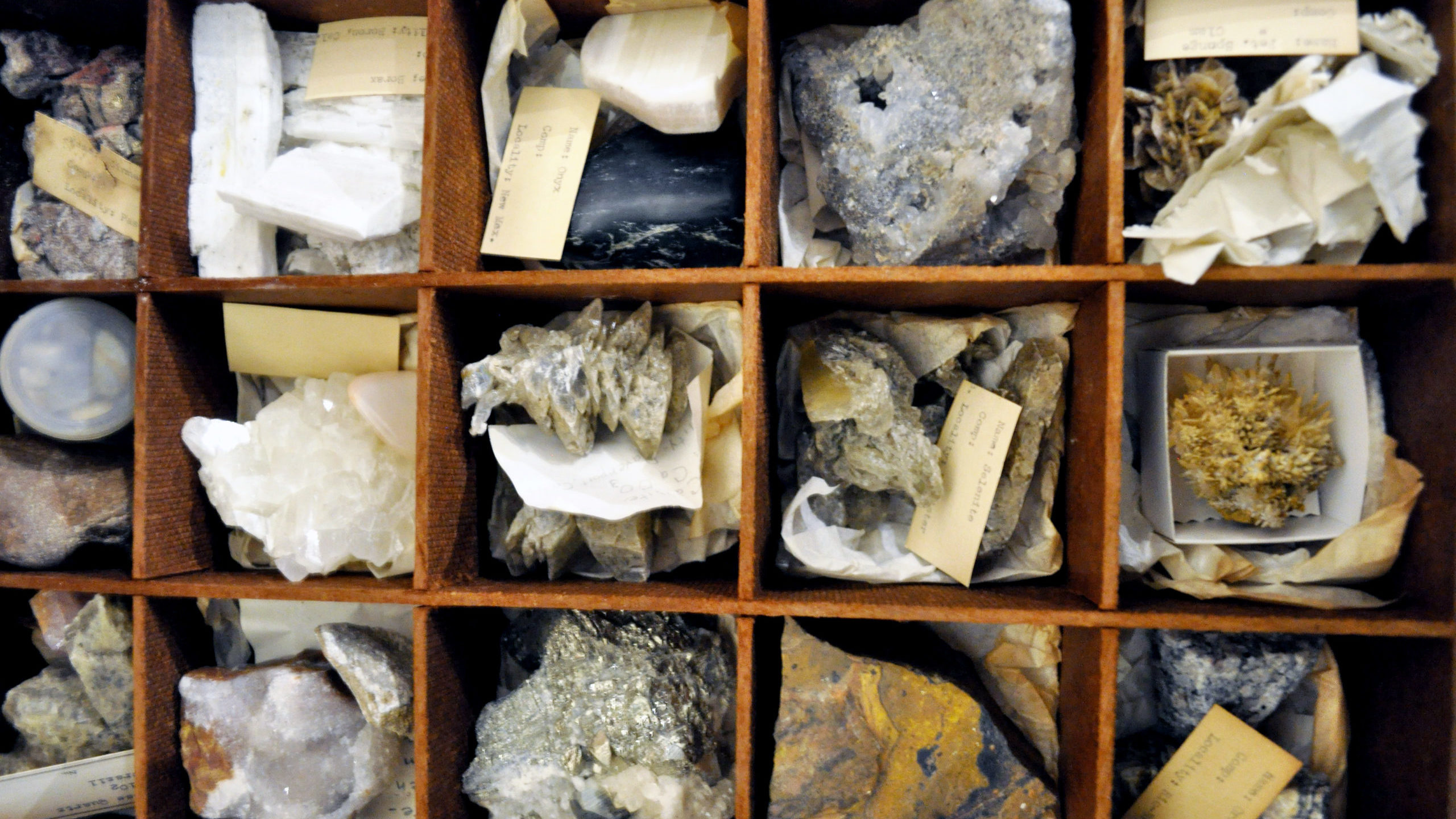
Minerals
Minerals are the naturally occurring crystalline substances that make up the rocks around us. Minerals such as quartz, feldspar, and calcite are the most common constituents of rocks in this area. Dozens of other mineral species occur here, but in small amounts. Large, well-formed crystals- the kind most sought after by collectors- are scarce.
Several minerals in this region have proven to be of great economic importance. Cinnabar (the chief ore of mercury) has been mined extensively at the New Almaden on the east slope of the Santa Cruz Mountains. Calcite (in the form of marble) has long been quarried near Santa Cruz for the manufacturing of lime and cement.
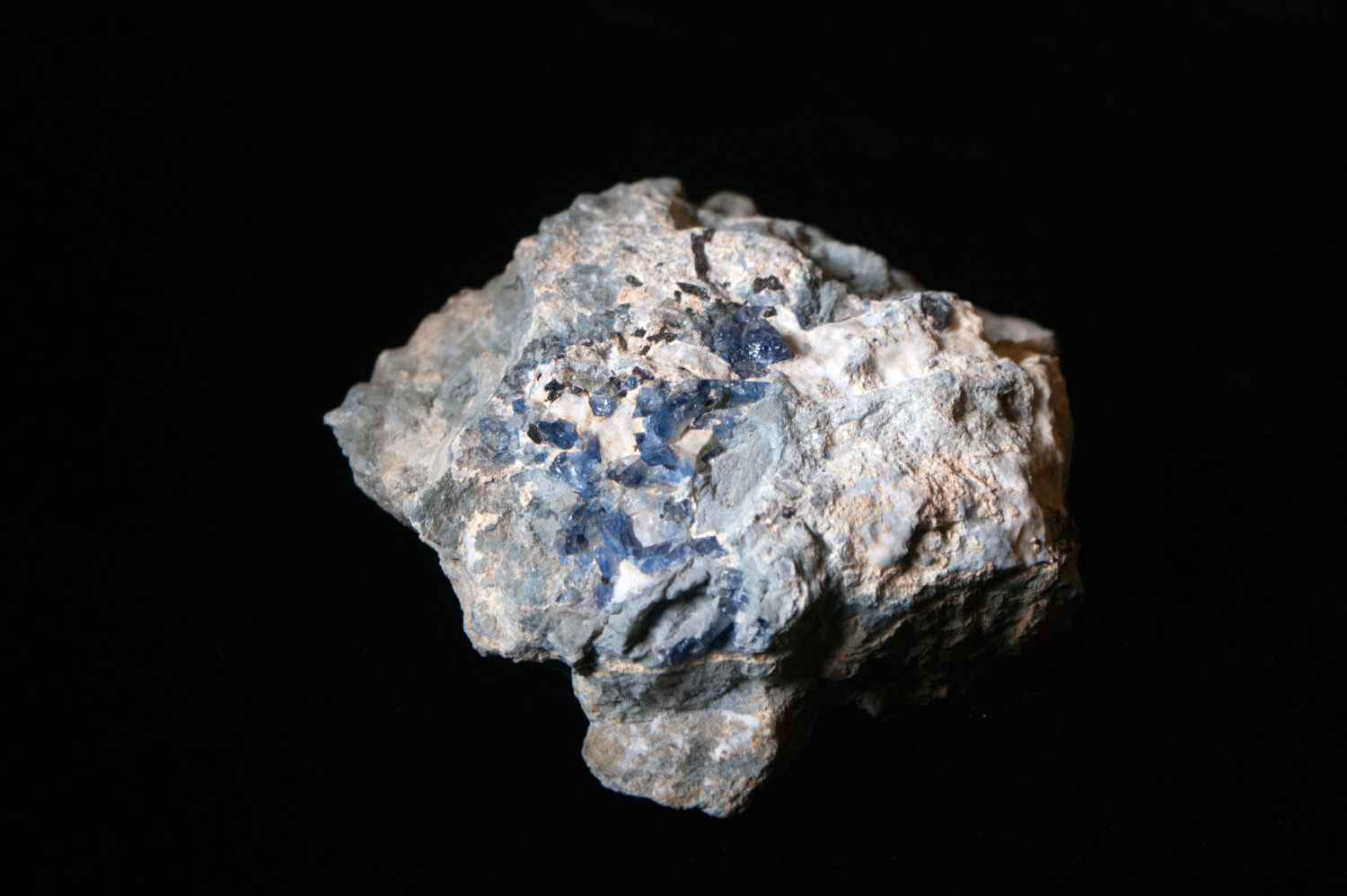
Benitoite is the California state mineral. This unusual blue crystal was first discovered in 1907 in San Benito County. While benitoite is found in a few places around the world, San Benito County is the only place in the world where gem quality benitoite crystals are found.
Garden: Take a stroll around the Museum’s Garden Learning Center and see if you can spot fossils and other large rock samples.
Activities for kids: Multiple dig boxes features Santa Margarita Formation fossils of sand dollars and casts of a fossil sea cow.
Bring rocks home
Rent a kit to explore local rocks at home. Kit rentals are $10 per week and can be requested here (you do not need to be a teacher to request a rental).
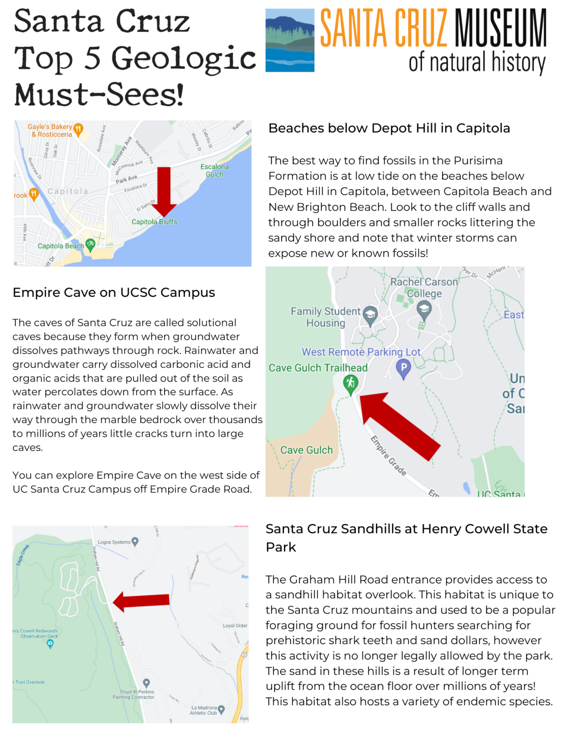
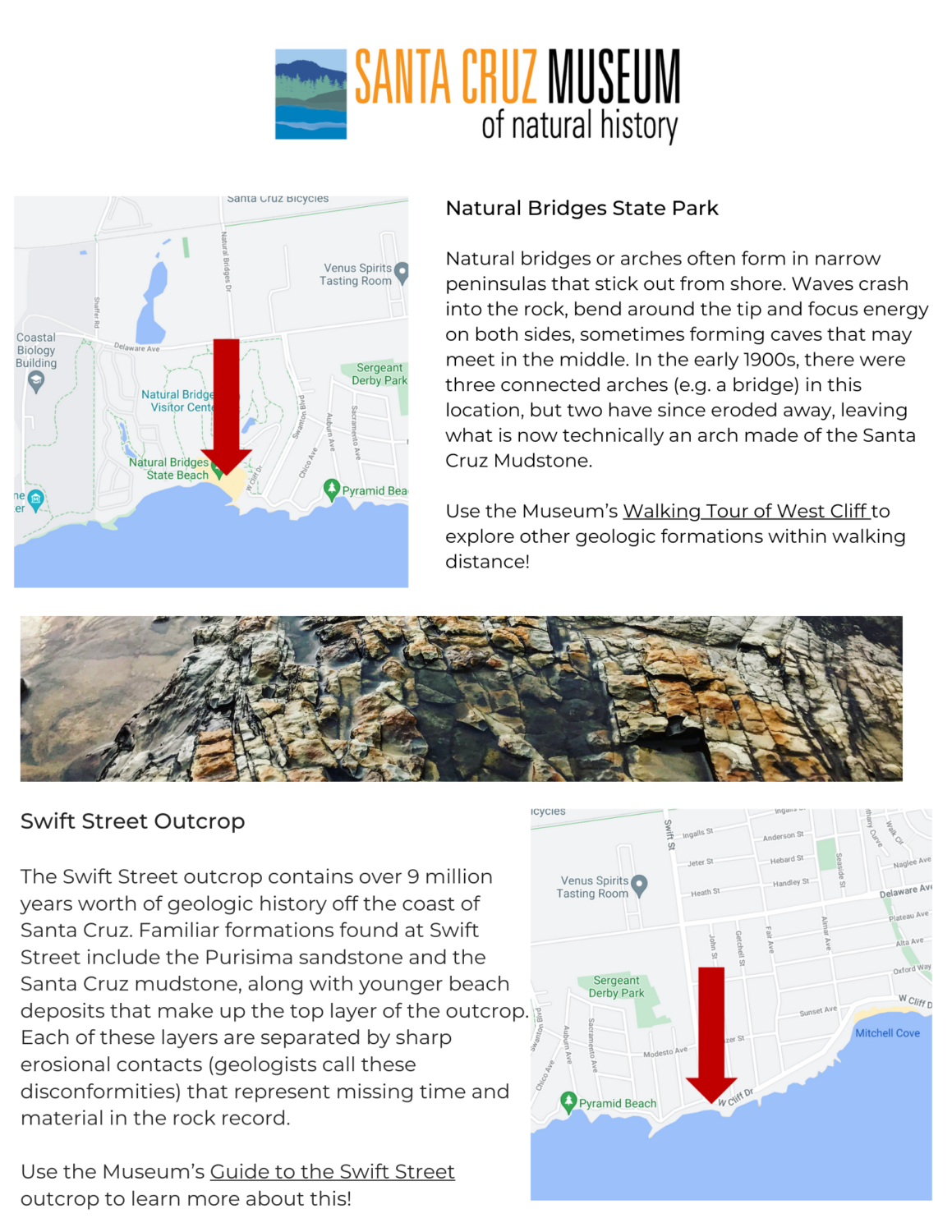
Santa Cruz is an area of geologic interest with a complex history of processes that shaped the coastline, bluffs, terraces, and mountains we see today! Use this map as you walk, bike or ride your way across the county and explore some of the geologic must-sees our area has to offer. Visit our online Guide to the Rocks of Santa Cruz County to dig even deeper into the geology of the region.
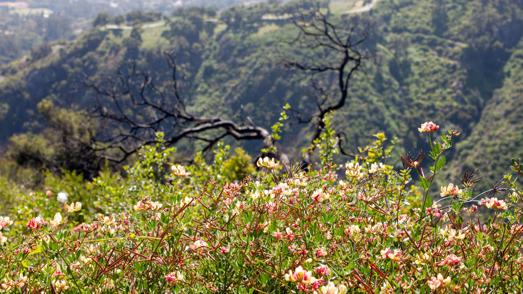
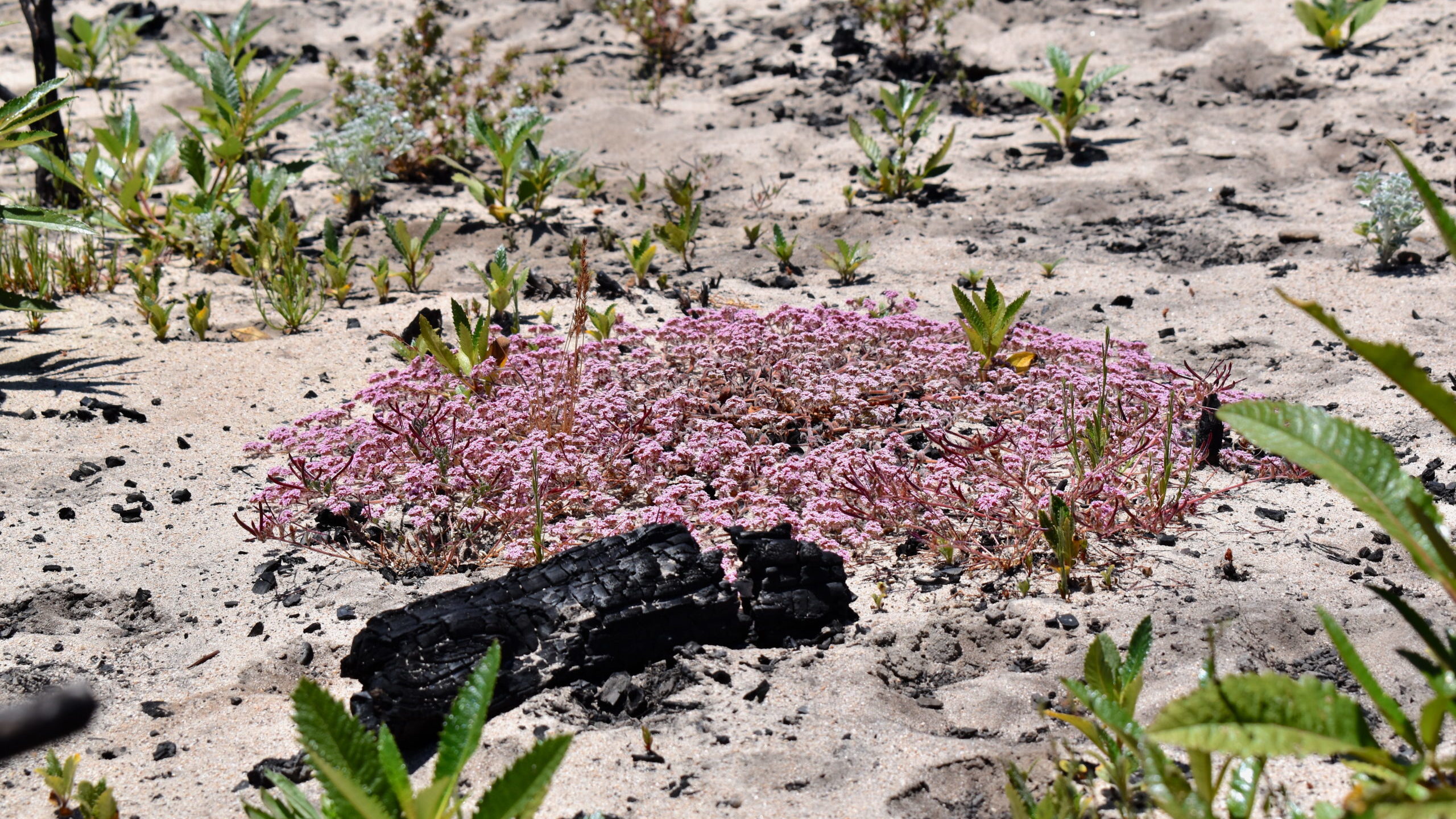
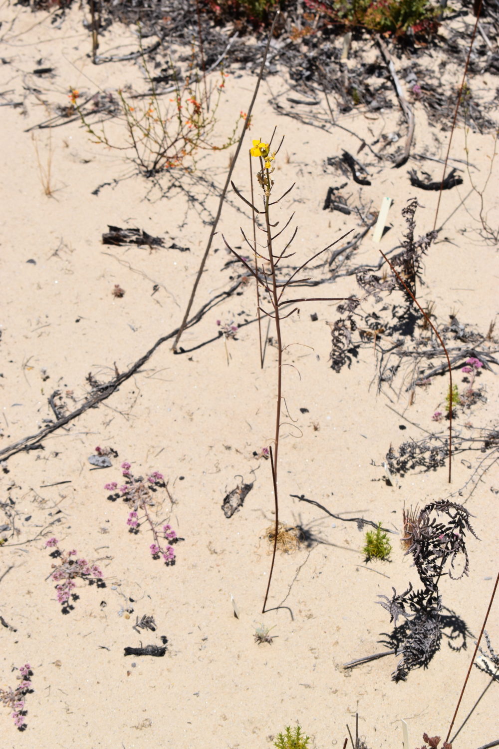
After fire, ecosystems can experience many changes. There can be increased risk of erosion and novel species can invade new areas, but fire can also reveal plants that have been waiting years for this natural disturbance to stimulate their seed banks — and there is still much to learn.
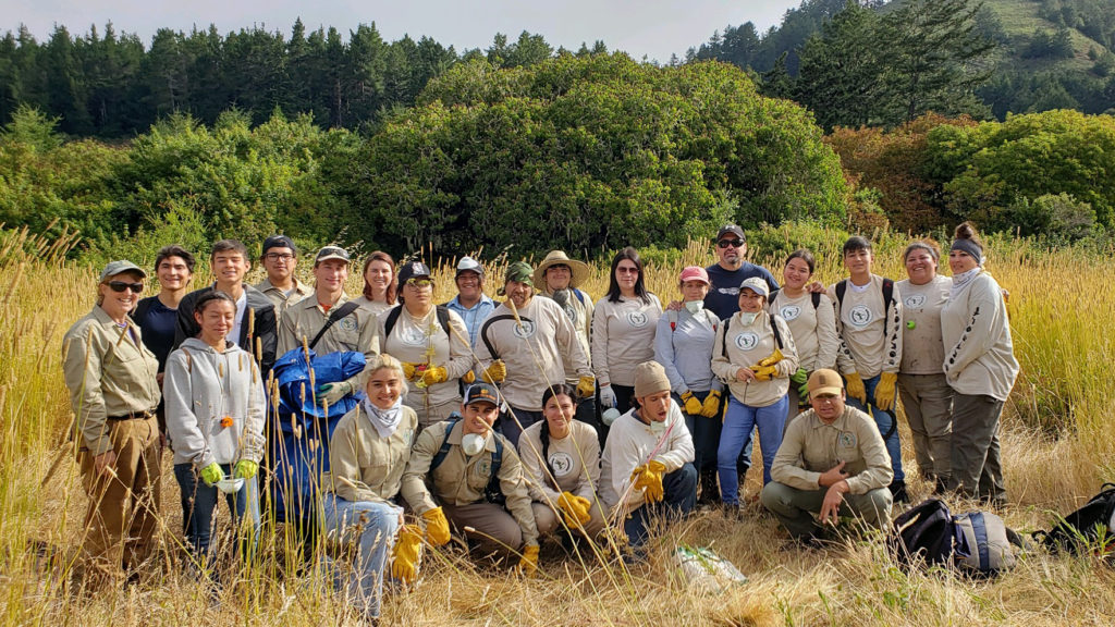
As the Santa Cruz community recovers from the impacts of the CZU Lightning Complex fires, we can look to other communities for guidance on where to go from here and how community scientists can help.
Join us for an online presentation from Josie Lesage of the Santa Barbara Botanic Garden and learn about their response to the Thomas Fire that burned through Santa Barbara and Ventura Counties in 2017-2018.
About the Mapping Recovery Project
The Mapping Recovery project leveraged the enthusiasm of over 100 volunteers who surveyed plants and erosion in the Thomas and Whittier fire scars. The project gathered over 5000 data points on the locations of plants in these fire scars, significantly expanding the known locations of many common invasive species, while also identifying populations of some rare or new invasive species. This data is being used to develop a map of priority intervention areas where restoration of native habitat is most needed and will be most beneficial to the ecosystem in the future.
About the Speaker
Josie Lesage works to understand, protect, and restore California habitats using ecological theory as a guide. She has a Ph.D. in Environmental Studies from the University of California, Santa Cruz, where she studied long-term management and community change in California’s coastal prairies. As the Santa Barbara Botanic Garden’s Applied Ecologist, she is interested in understanding how local ecosystems respond to disturbance and restoration intervention, and in building a community of volunteer scientists to steward our local habitats. She is currently involved in several projects related to invasive plant management and ecosystem recovery following fire. Her favorite plants are in the genus Castilleja.
Interested in becoming a community scientist? Join us for an iNaturalist training in the Museum’s Garden Learning Center on September 11.
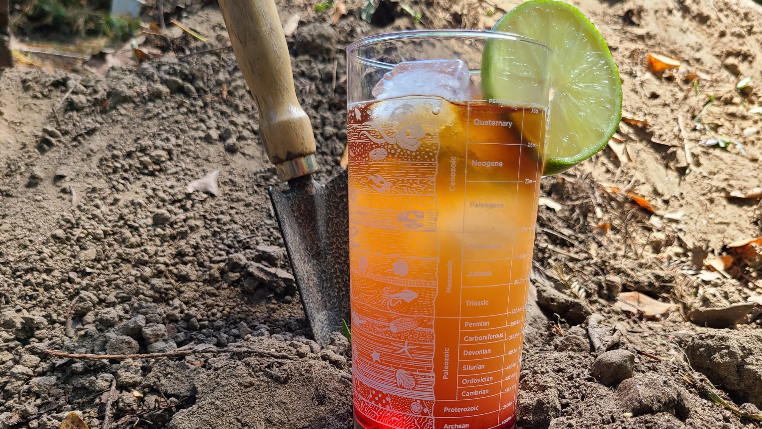
This month join us in raising a glass to the field of paleontology (the study of fossils) as we explore geologic time through a layered drink in one of our favorite glasses.
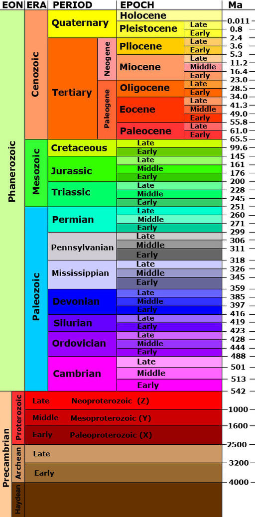
The history of life on earth is measured in millions of years, and humans are only a tiny blip in that long history. While geologic time can be a hard concept to wrap your mind around, people like Aristotle (384–322 BCE) first noticed the presence of fossil shells on land and concluded that the shape of the earth’s surface must have changed over time. Early scholars from across the world also made observations about the layering of rocks, and in 1669 the Danish scholar Steno proposed the Law of Superposition, a key concept to the earth sciences which generally states that stratigraphic layers on the bottom of a sequence will be older than those layered on top of them.
These concepts were the building blocks for the geologic time scale as we know it today. The geologic time scale is broken down into four large eons and each eon is then further broken down into eras, which are in turn divided into periods, epochs and ages. Today, we are living in the Holocene Epoch, going back 11,700 years ago it generally marks the end of the last ice age. The Holocene is also referred to as the Anthropogene, the “Age of Man” as of all recorded human history falls in this time period and it acknowledges the huge impact we have had on the earth.
Explore more about geologic time with videos from our Geology Gents and peruse our Guide to Local Fossil if you want to dig even deeper.
Layered drinks such as this one are both eye-catching and a fun way to experiment with the density of liquids. The force of buoyancy keeps the various layers from mixing as long as you are using liquids with different densities and build your drink with the heavier liquids at the bottom. Explore this resource for the relative densities of various liqueurs for your future cocktail creations.
Ingredients
0.5 oz. Grenadine or other syrup of your choice 1.5 oz. Coconut rum 1 oz. Dark rum 0.5 c. Juice (pineapple or other tropical flavor) Ice
Recipe
Pour the grenadine into the bottom of your glass.
Fill the glass to the top with ice, trying not to splash the grenadine.
Mix your juice with the coconut rum. Slowly pour over the ice so that the force doesn’t cause it to mix with the grenadine.
Top with carefully poured dark rum.
Garnish with the citrus of your choice.
Alternatives
Substitute the dark rum for blue curacao for a more eye-catching color combination.
For a non-alcoholic option, leave out the rum and experiment with the density of other additives like soda water or coconut cream.
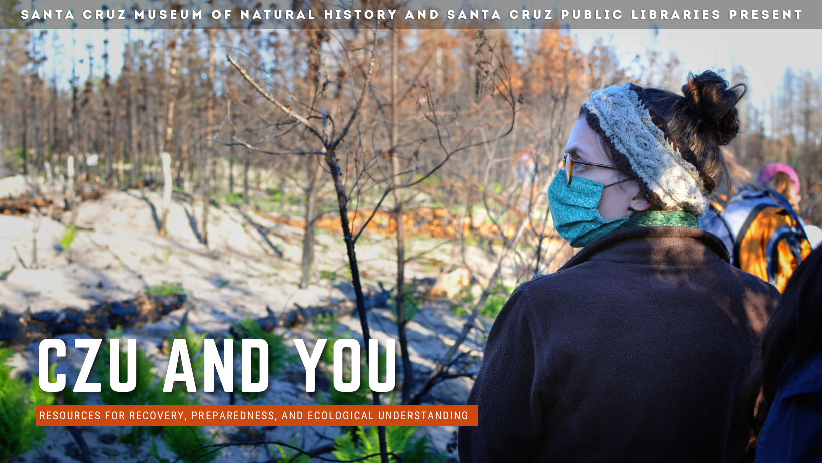
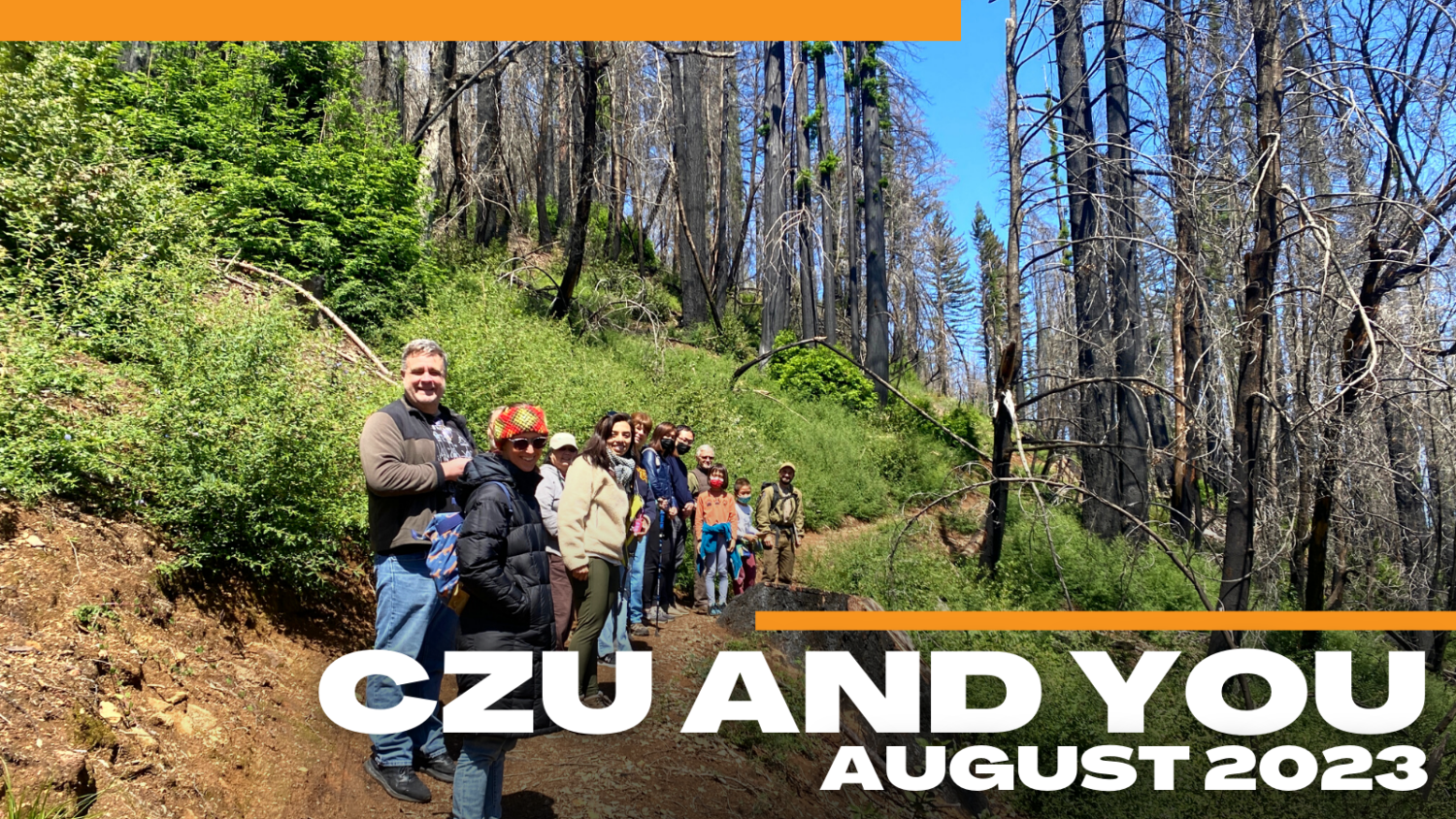
CZU AND YOU Resources for Recovery, Preparedness, and Ecological Understanding from the Santa Cruz Museum of Natural History and Santa Cruz Public Libraries
Fire is many things to the Amah Mutsun and other California Indian Tribes — it is sacred, it is a tool gifted by Creator, and it is a way to restore balance to … Read more
Many had to evacuate the Santa Cruz Mountains during the CZU Lightning Complex fires of August, 2020, including museums, visitor centers, and cultural heritage sites managed by California State Parks. Jenny Daly, museum curator for … Read more
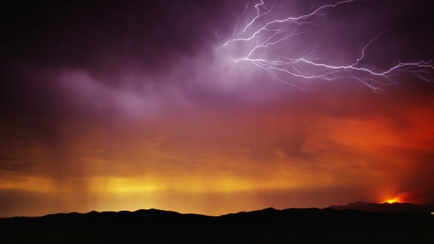
In August 2020, Northern California was ignited by a series of 650 wildfires spurred by dry lightning from rare, massive summer thunderstorms. Today, all of California is experiencing drought conditions and fire season … Read more
Many of our native plants in the Santa Cruz Mountains are fire adapted, from the familiar coast redwood (Sequoia sempervirens) to the extremely rare Santa Cruz cypress (Hesperocyparis abramsiana) and Santa Cruz wallflower … Read more
Explore the role of fire on our landscape through a series of programs that invite our community to reflect on the CZU Lightning Complex fires of August 2020, while learning about proactive steps … Read more
Many of our native plants in the Santa Cruz Mountains are fire adapted, from the familiar coast redwood (Sequoia sempervirens) to the extremely rare Santa Cruz cypress (Hesperocyparis abramsiana) and Santa Cruz wallflower (Erysimum teretifolium). However, decades of fire suppression have greatly reduced the frequency of fires in our region. The Bonny Doon Ecological Reserve is a rare example of a location that has burned multiple times in just over a decade: in 2008 during the Martin Fire and again in 2020 during the CZU Lightning Complex fires.
Join Dr. Jodi McGraw for an exploration of this unique Santa Cruz sandhills habitat, which is home to the Santa Cruz cypress and Santa Cruz wallflower, and what we’ve learned since the 2008 Martin Fire.
Resources
THE SANDHILLS CONSERVATION AND MANAGEMENT PLAN A: Strategy for Preserving Native Biodiversity in the Santa Cruz Sandhills. Prepared by Jodi M. McGraw with Contributions from Matt Freeman, Richard Arnold, and Caitlin Bean. Prepared for The Land Trust of Santa Cruz County June 2004.
Dr. Jodi McGraw is an ecologist who works on conservation projects throughout central coastal California. For the past 28 years, she has been studying the Santa Cruz Sandhills—a unique ecosystem found only in central Santa Cruz County, which supports numerous endangered plants and animals. Her research and conservation management work has addressed how fire can be both a tool and a threat to persistence of the endangered plants, including Santa Cruz cypress and Santa Cruz wallflower, and the native biodiversity in the sandhills.
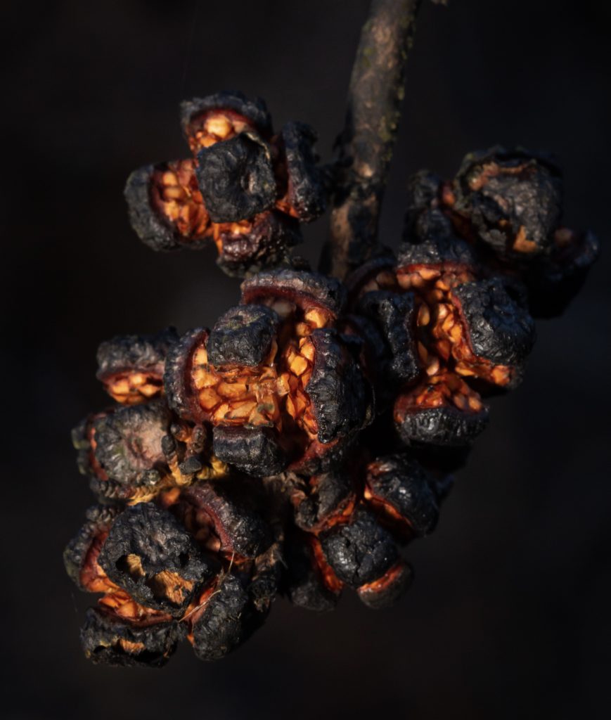
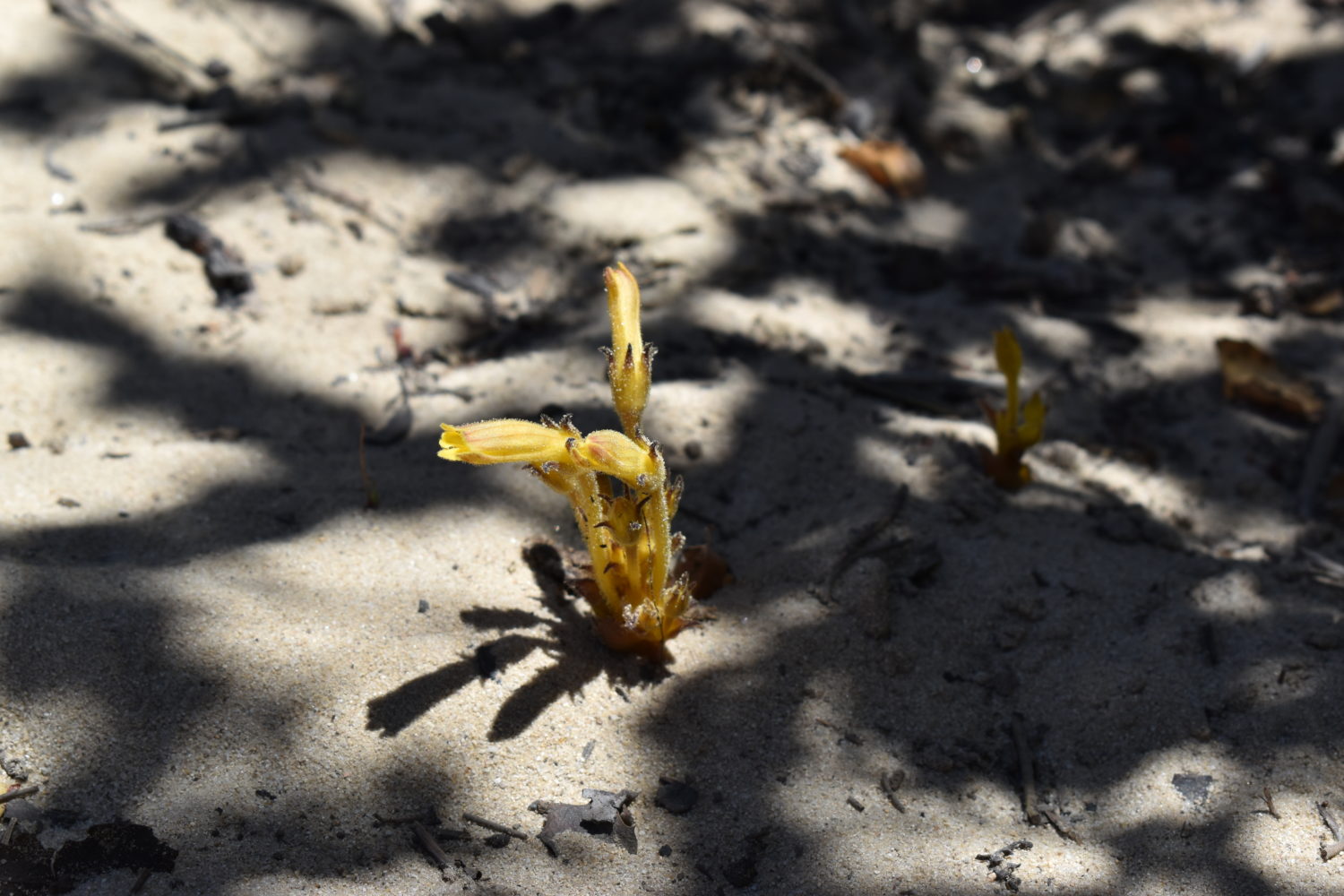
Santa Cruz Wallflower (Erysimum teretifolium)
Santa Cruz Cypress (Hesperocyparis abramsiana) Photo by Amy Patten
In August 2020, Northern California was ignited by a series of 650 wildfires spurred by dry lightning from rare, massive summer thunderstorms. Today, all of California is experiencing drought conditions and fire season is well underway.
On the one year anniversary of the lightning storms wildfire researcher and lightning scientist Chris Giesige presented on the weather and climate conditions that made the August 2020 lightning events possible and shared a peek at what the future may hold for wildfires in California. Explore how we classify the weather and atmospheric conditions that create fire weather and behavior, why those conditions aided the events of last August, and explore wildfire in California more generally.
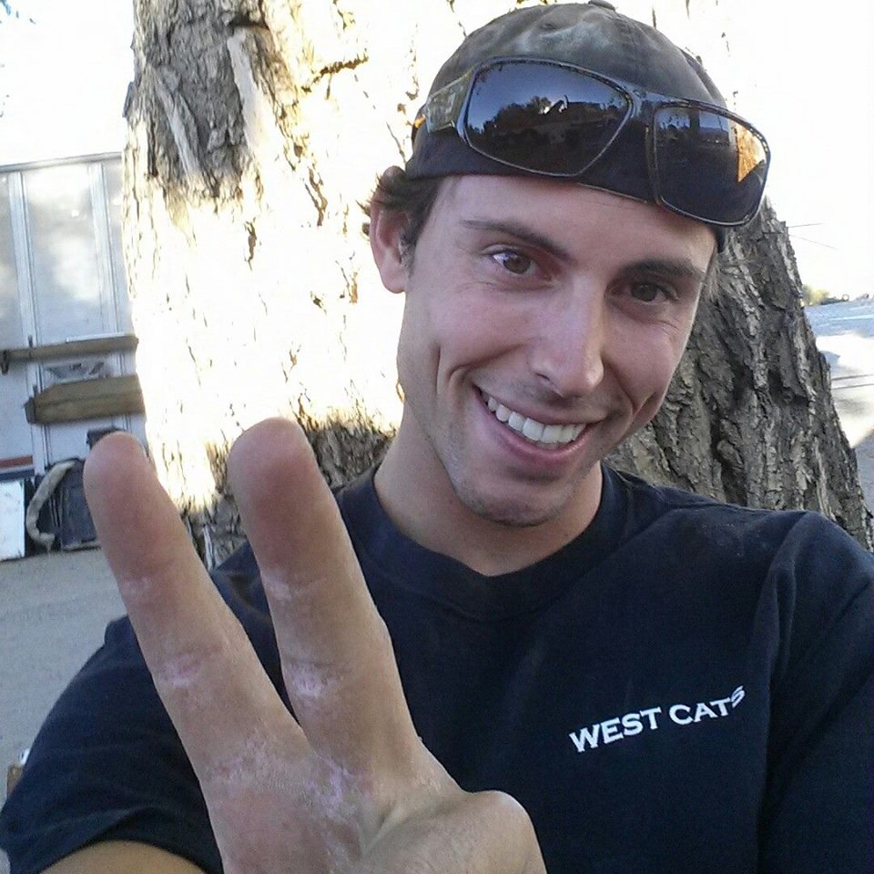
Chris Giesige has studied fire science and conducted lightning research for over a decade. His research is focused on wildfires and seasonal and short term lightning development during the summer through fall months. Through the WestCats Group, he and his team are currently working on developing a new sensor network for better lightning forecasting for wildfire events.