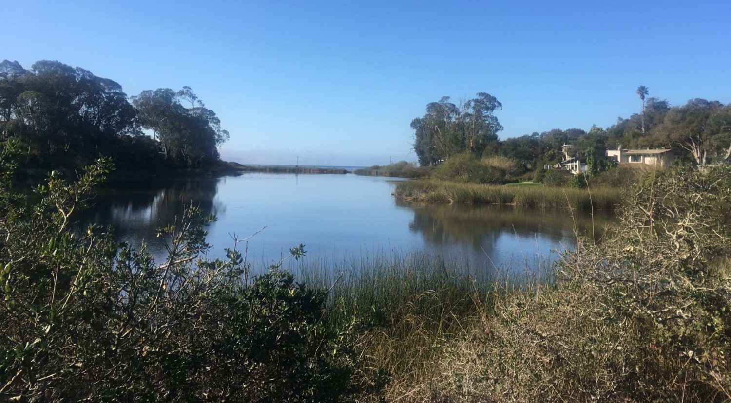
Did you know that the Simpkins Swim Center is the former site of a cement plant that manufactured the cement tetrapods used in the harbor jetty? In the back of their parking lot is access to a short set of trails managed by Twin Lakes State Park. These trails meander through sunny meadows and shady oaks and lead to views of the Pacific Ocean and Schwan Lake.
Historyof Schwan Lake Schwan Lake was once a lagoon that connected to the ocean and is named after Jacob Schwan, an immigrant from Germany who owned and farmed on the land in the 1860s. In the 1880s the lagoon had bridges and a railroad trestle crossing over it. After the construction of East Cliff Drive in the 1930s the lagoon was blocked from the ocean. This caused it to seasonally dry up and become very smelly. In 1977 a weir gate was installed so now the lagoon is a lake and never dries up! A weir gate is like a dam but it allows water to flow over the top of it once the lake reaches a certain water level.
The vernal equinox marks one of two moments per year when the sun is exactly above the equator and day and night are of equal length. This means that we exit the days of mostly darkness and enter a time of increasing light.
Spring is traditionally a season of transition and new birth: snow melts, seeds grow, and blossoms bloom. This year, the vernal equinox that marks the beginning of spring also represents one year since we began sheltering-in-place. Four seasons have passed and our community has experienced the ebb and flow of the pandemic in tandem with the natural cycles of the Earth.
As we prepare for this next transition, welcoming new growth in fire scarred areas and fresh nectar in our gardens, we also look forward to our own revitalization. The Museum is excited to reopen our doors this spring and host more programs outdoors and in nature than ever before. But we continue to straddle the line of branching out and keeping shelter as our community continues to be impacted by the COVID-19 pandemic. In addition to in-person opportunities, we will continue to offer virtual resources that bring the Museum to you.
And it is with this period of transition in mind that we bring you the Equinox Elixir: a curated cocktail that is equal parts dark and light. We used gin from Venus Spirits for this recipe, a local distillery that sponsored an event we were meant to host last year for the equinox, but had to cancel in an effort to stop the spread of the coronavirus. Today, we toast them and you as we prepare for brighter days ahead.
1.5 oz of cherry syrup (such as from a jar of Luxardo cherries)
The Equinox Elixir once mixed, combining the tart sweetness of the cherry syrup with the fresh botanical quality of Venus’s Gin No. 1.
Recipe
A layered cocktail utilizes liqueurs of slightly different densities to create visual layers in the drink, with the specific gravity of the liquid ingredients increasing from top to bottom. Water has a specific gravity of 1.0, whereas our thick syrup has a specific gravity of 1.8 and our gin is around .95.
Pour your ingredient with the higher specific gravity first (i.e. cherry syrup) into a martini glass, taking care to pour straight down the center so that the syrup doesn’t coat the walls of the glass where you don’t want it to. Then, shake your gin with an ice cub in a cocktail shaker vigorously for a few seconds. Turn a tablespoon upside down and place it just over the glass. Slowly pour the gin over the spoon so that it slowly spills into the glass without mixing with the syrup.
Marvel at its dichotomy and then give it a stir to mix the flavors together and enjoy!
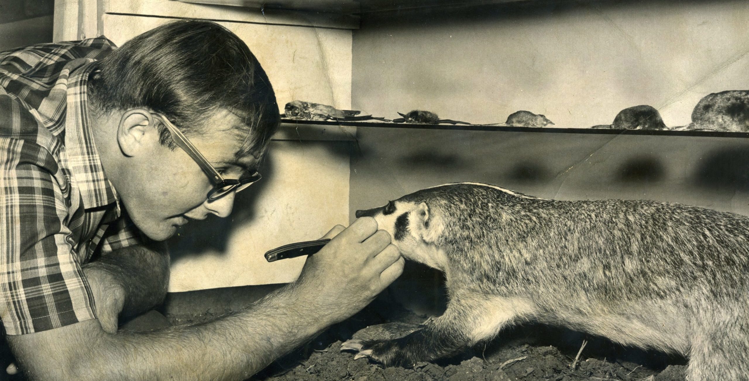
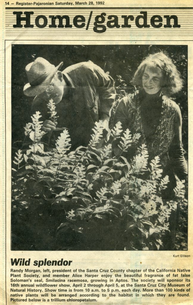
There are few names in our local naturalist community that are as universally revered as that of Randall Morgan. Also known as Randy or R, Morgan was a pillar of the local natural history community.
Though he passed away a few years ago, his influence on the natural world and those who celebrate it in Santa Cruz is evident from the the Sandhills that his activism helped to save, to the local chapter of the California Native Plant Society that he helped found, to the Santa Cruz Museum of Natural History where he worked as a taxidermist to pay for studying linguistics at UC Santa Cruz. His legacy also lives on in the collections of the Kenneth S. Norris Center for Natural History.
Join Kathleen Aston, Collections Manager at the Santa Cruz Museum of Natural History, and Chris Lay, Director of the Kenneth S. Norris Center for Natural History, for an exploration of Randall Morgans life and legacy, including his collections, taxidermy, and conservation efforts.
This month’s Collections Close-Up is in sponsorship of the exhibit Look. Act. Inspire., celebrating the naturalists of Santa Cruz County. It is presented in partnership between the Kenneth S. Norris Center for Natural History, the San Lorenzo Valley Museum, and the Santa Cruz Museum of Natural History.
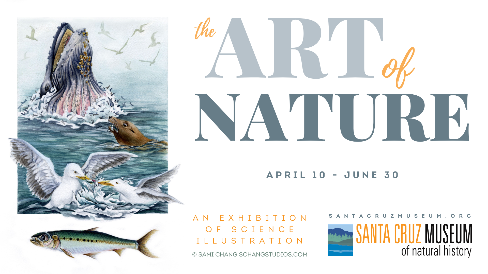
We’re celebrating 33 years of exhibiting science illustration at the Santa Cruz Museum of Natural History with an online opening reception for this year’s The Art of Nature.
Featuring staff exhibit curators Liz Broughton (Visitor Services Manager), Marisa Gomez (Public Programs Manager), and Felicia Van Stolk (Executive Director), as well as artists Sami Chang and Megan Gnekow (artist curator).
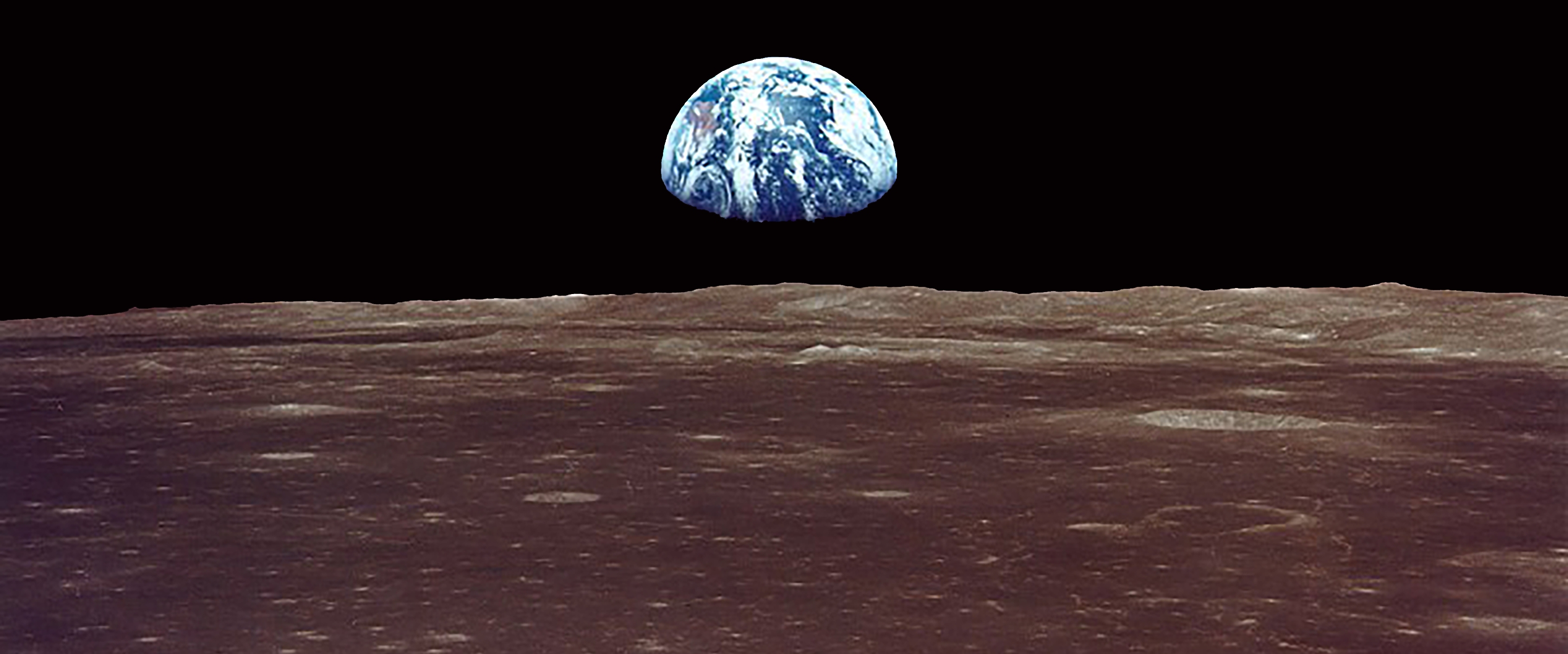
Geology literally means the study of the Earth, so why are we digging into the Moon for this month’s Rockin’ Pop-Up? Well, as the Geology Gents put it, “The moon is basically the Earth.” Say what? Don’t worry, all will be revealed. This month, learn about the formation of our moon and how scientists study it.
About the Series: Join the Geology Gents, Gavin and Graham, for monthly conversations about rocks live on Facebook. Each month we’ll explore a different geologic topic, from Santa Cruz formations to tips for being a more effective rockhound. Graham Edwards and Gavin Piccione are PhD candidates in geochronology with the Department of Earth and Planetary Sciences at UC Santa Cruz.
Submit your questions ahead of time by emailing events@santacruzmuseum.org and feel free to include pictures of rocks you’d like identified! Note: you do not need to have a Facebook account to be able to watch the program live.
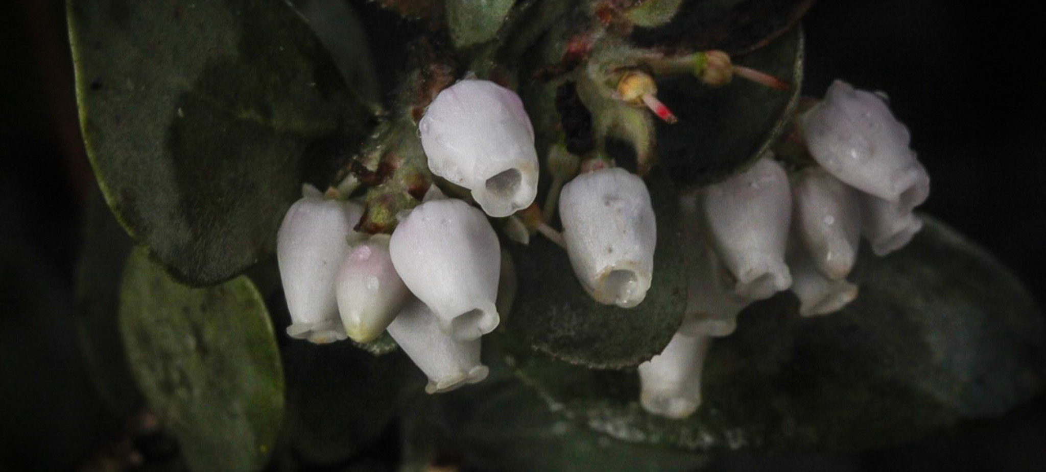
The area impacted by the CZU Lightning Complex Fires hosts a slew of rare plants. As we enter spring, the season of new growth, botanists will be paying close attention to these rare plants, but they’re not the only ones. A “community scientist” is anyone who makes and shares observations in an effort to contribute to scientific understanding — and we hope you will help us bring community science to the burn zone.
During this online training with Amy Patten, Rare Plant Treasure Hunt Manager for the California Native Plant Society, you’ll learn how you can search for and document rare plants as a community science volunteer. We’ll go over some of the fascinating and beautiful rare plants you can see in the burn area, as well as online tools you can use for survey efforts as part of the CZU Lightning Complex and Community Science Project.
Limited space is also available for in-person trainings on March 27 and April 15.
About the Speaker
Amy Patten works in the Rare Plant Program at the California Native Plant Society’s state office where she manages the Rare Plant Treasure Hunt project, a community science project that documents rare plant populations throughout California. Amy lives in Santa Cruz and is passionate about protecting the plants and wildlife of the Central Coast.
In this edition of Rock Record, the Geology Gents unearth a few key examples of how newly exposed outcrops have led to important geological insights, as well as some geologic exploration into freshly exposed rock and sediments exposed by the CZU Lightning Complex Fires.
By Graham Edwards and Gavin Piccione (aka the Geology Gents)
To reconstruct Earth history, geologists rely on the rock record: the accumulated rocks that, through their accumulation and formation, are relics of ancient geologic processes spanning geologic history. Such rocks provide a spyglass with which to peer into geologic history. But our view through this spyglass is limited to rocks that are both exposed at the Earth’s surface and have survived the effects of erosion.
As geologists, we often rely on Earth processes to expose new rocks and provide us fresh glimpses into Earth’s history. Since exposing fresh rock requires a lot of energy, natural disasters or extreme natural events can expose clues to this history through fresh rock surfaces. Human activities, such as construction or mining, can also expose new geological wonders.
In this edition of Rock Record, we’ll go through a few key examples of how newly exposed outcrops have led to important geological insights, as well as some geologic exploration into some freshly exposed rock and sediments exposed by the CZU Complex Fire.
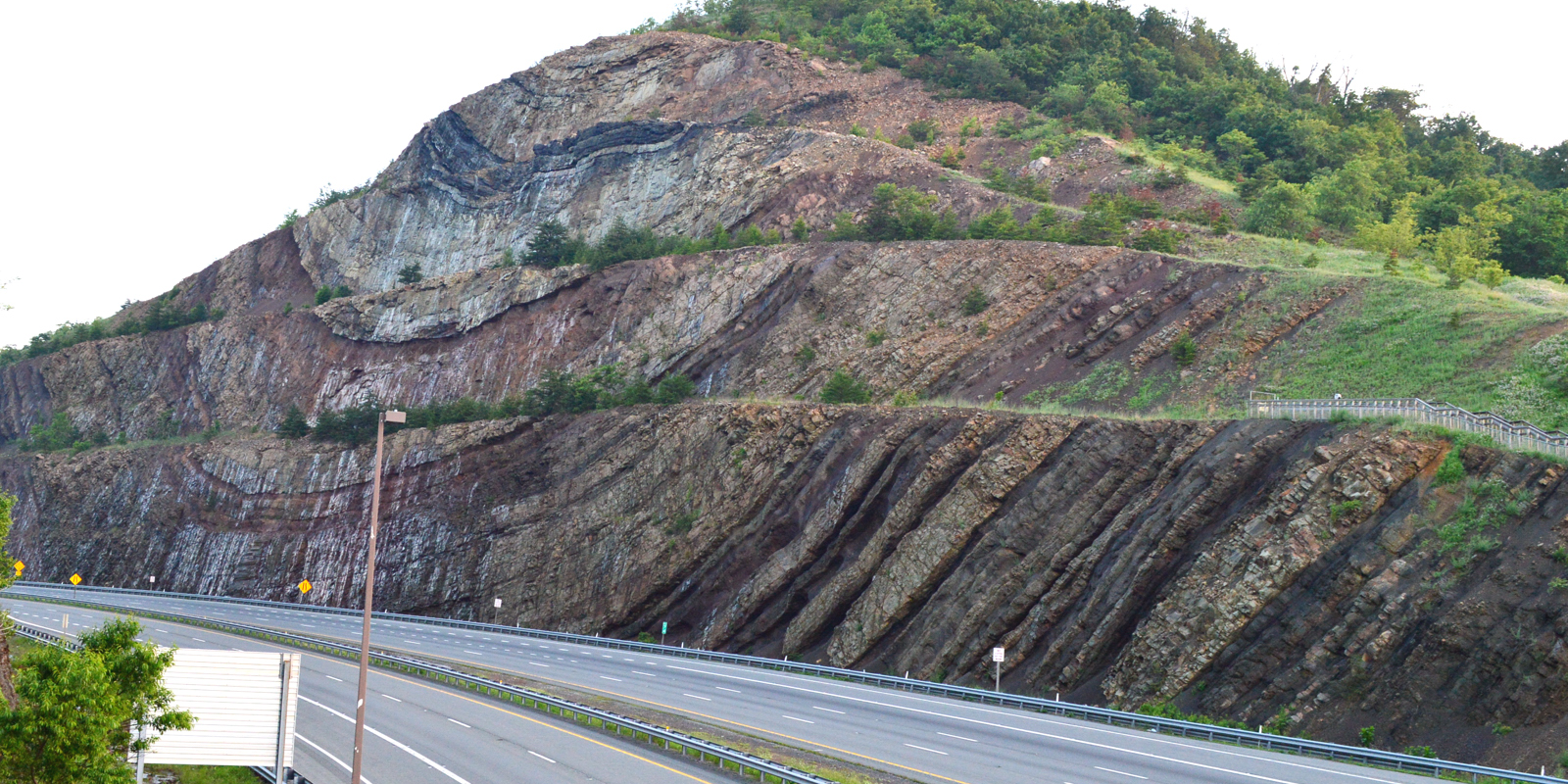
Roadcuts
Roadcut in Maryland exposing large folds. Image credit: Joel Duff, Naturalis Historia
The construction of roads often requires the removal of large sections of rock, leaving sheer rock faces on the sides of the road. Some of the most famous rock outcrops are ones exposed in roadcuts and these unique locations are a frequent destination for college geology classes.
As undergraduates, the Gents (i.e. Gavin and Graham) explored roadcuts in the Northeastern US, and learned about tectonic motion through the faults and folds exposed in roadcuts (like the one in the image to the right), about metamorphic rocks via roadcuts in Maine, and about large deep-sea sediment avalanches (called turbidites) from roadcuts in upstate New York. Rocks exposed on the sides of roads can also be significant for geologist’s understanding of the sequence of events in an area.
For instance, a roadcut in Owens valley (see image below), settled a longstanding debate amongst geologists about whether the Bishop Tuff was deposited before or after the first glaciations in the area. The exposed rock showed the Bishop Tuff sitting on top of the Sherwin Till glacial deposit, meaning that the tuff must have been deposited after the till.
Roadcut in Owens valley showing the Bishop Tuff overlying the Sherwin Till. Original image taken by James St. John
Fire
Forest fires are, in many cases, an important natural event for the health of a forest because they clear the forest floor of brush and dead vegetation. Through this process, fires also expose large portions of rock that would otherwise not be visible. For this addition of Rock Record, the Gents explored some areas of the Santa Cruz mountains that have been burned in the CZU Lightning Complex fires last August.
Taking Empire Grade North, areas of Cretaceous (145-66 million years before present) igneous and metamorphic rocks that were previously covered by vegetation are exposed in the burn zone of the recent fires.
The Gents explore freshly exposed rock in an area burned by the CZU Complex fire
Close up of freshly exposed Cretaceous igneous rocks
Weather
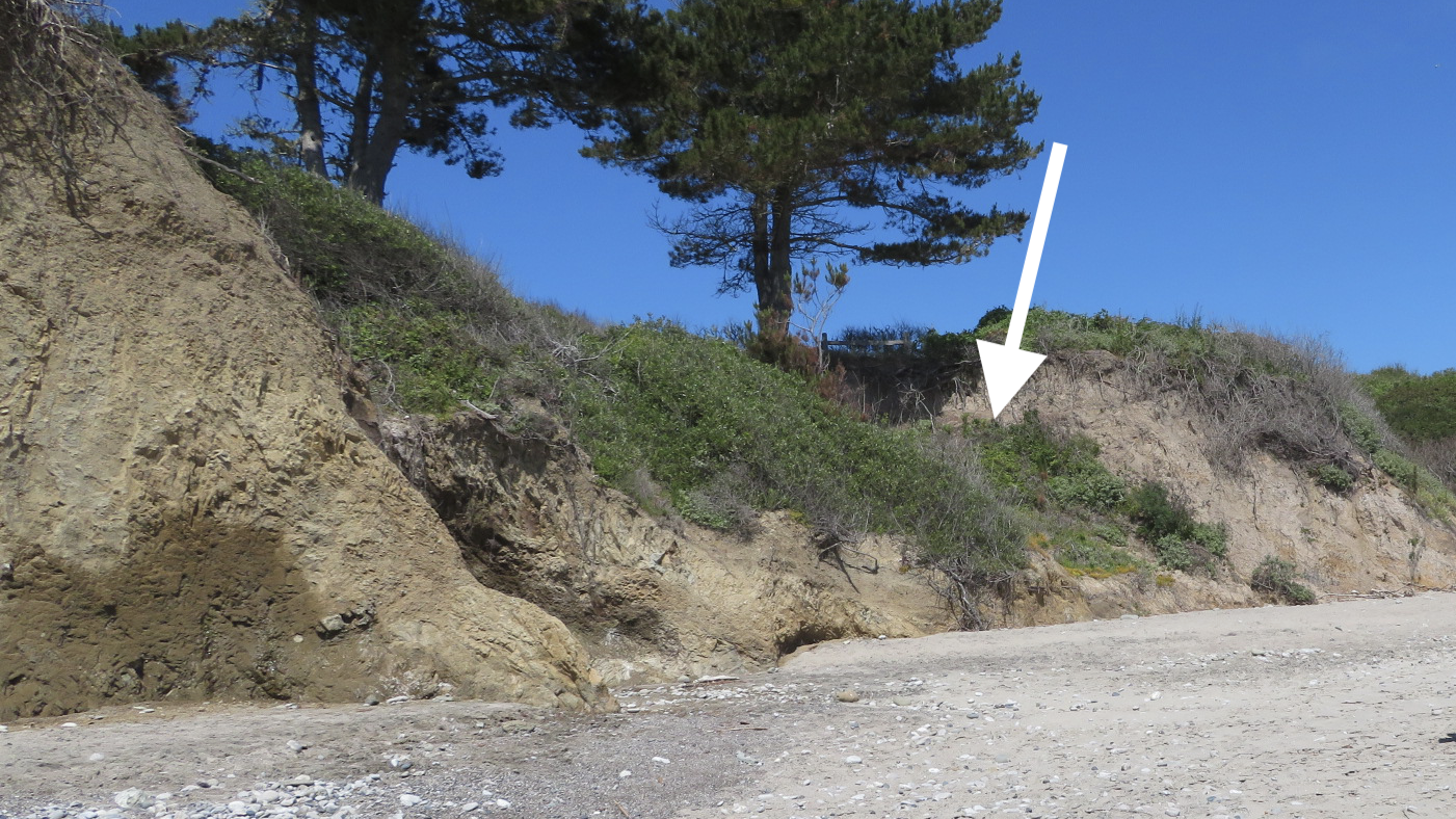
Sometimes extreme weather events can expose new outcrops or geologic features. For instance, the Frijoles Fault of a previous Rock Record post, The Faults that Shape Santa Cruz, was hidden behind trees and shrubs until a powerful storm event in the 1970s drove enough coastal erosion to expose the fault in the sea cliffs. Even more recently, heavy rains can cause landslides on the steep topography of the Santa Cruz Mountains and Santa Lucia Mountains of Big Sur. Each of these landslides exposes new surfaces that allow geologists and geomorphologists to study what causes landslides and the ways that massive amounts of Earth can be rapidly moved down hillslopes.
The exposed Frijoles fault contact, which was long hidden behind trees and shrubs before it was revealed by a storm in the 1970s.
Meteorites
Some rocks are truly out of this world! Rocks that formed beyond Earth and arrive on Earth are called meteorites. Most meteorites come from the asteroid belt, a ring of rocky debris that dwells between the orbits of Mars and Jupiter, while some meteorites come from Mars and the Moon. As any Earth dweller knows, meteorites are incredibly rare, but they are important samples of other celestial bodies and leftovers from planet formation that we can study in close detail here on Earth. So, a meteorite fall is an incredibly exciting event for planetary scientists and geologists, alike!
One of the most important meteorites ever to land on Earth was the Allende meteorite, which landed in 1969 near the town of Pueblito de Allende in the state of Chihuahua in northern Mexico. The stone broke into pieces before it landed on Earth, but the collected chunks of this meteorite total >4,000 pounds with more pieces still found today! Because there was so much meteorite to go around, many scientists have studied it, and since the Allende meteorite is made of some of the most ancient material in our solar system it has provided an invaluable window into the earliest moments of our solar system just after the Sun formed!
Slice of Allende meteorite (Wikipedia)
Lunar meteorite (American Museum of Natural History, www.amnh.org)
What mysteries do you suppose are hiding all around you, covered by trees, houses, or soil?
Rock Record is a monthly blog featuring musings on the mineral world from Gavin Piccione and Graham Edwards.
Graham Edwards and Gavin Piccione are PhD candidates in geochronology with the Department of Earth and Planetary Sciences at UC Santa Cruz. They also host our monthly Rockin’ Pop-Ups as “The Geology Gents”.
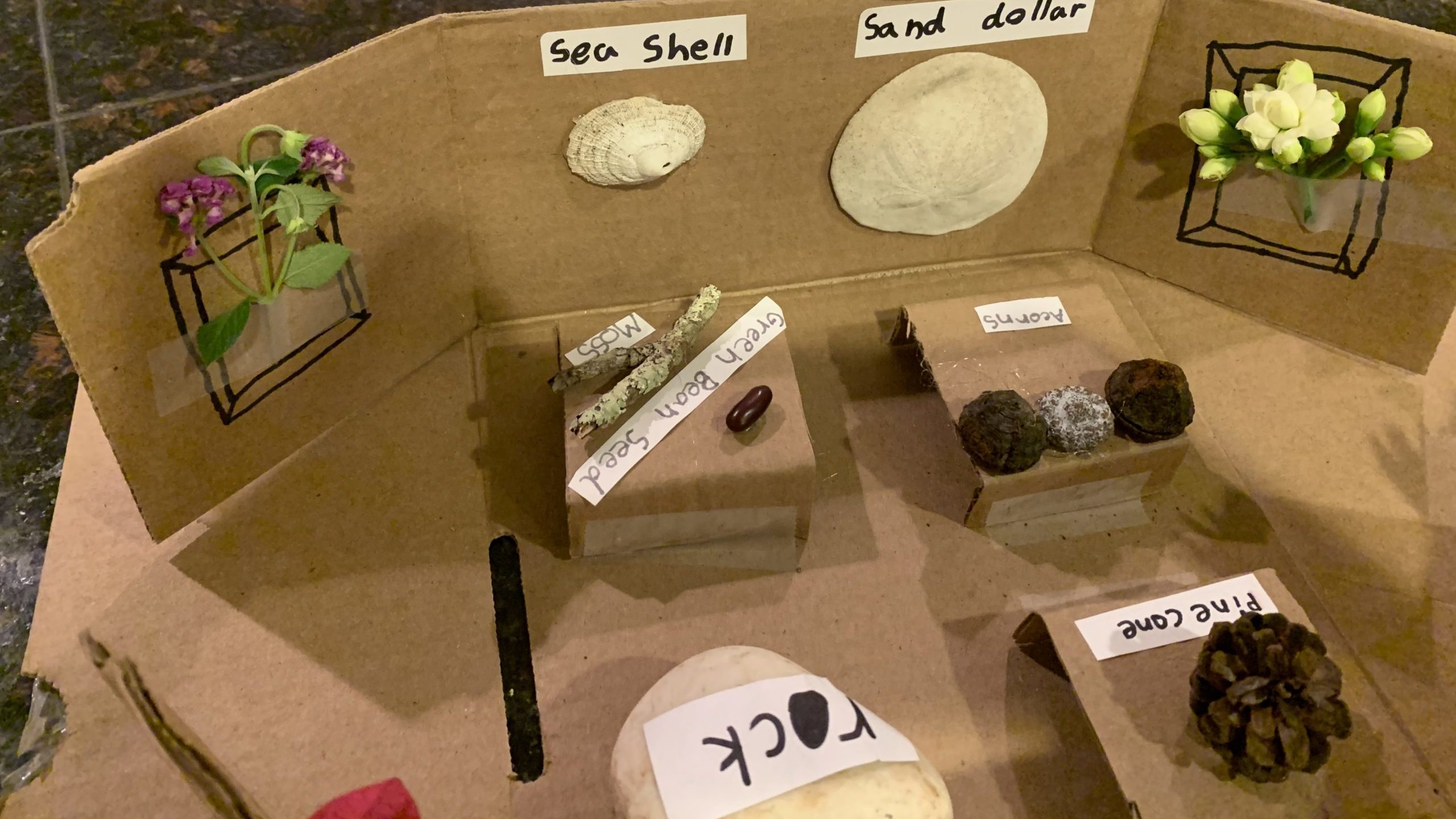
What kind of thinking goes into the design of a natural history exhibit? Over the course of three lessons, students deepen their observation-making abilities, learn about how to properly collect natural specimens, and create their own miniature museum exhibit. This project-based sequence will teach students how to interpret their findings and distinguish natural objects from one another based on their physical properties.
Santa Cruz County is home to marvelous wonders, from the shoreline to the summit — and every inch of this landscape was under the ocean mere millions of years ago. In an afternoon you can watch whales breach in the ocean and look at the fossilized remains of their ancestors on the beach (or high up in the mountains for that matter).
From mastodons to megalodons, this guide provides an overview of our local rock formations that feature fossils and how to dig deeper with the resources we’ve compiled.
Before you can understand the fossils of Santa Cruz County, you need to dig a little deeper into the rocks of Santa Cruz County.
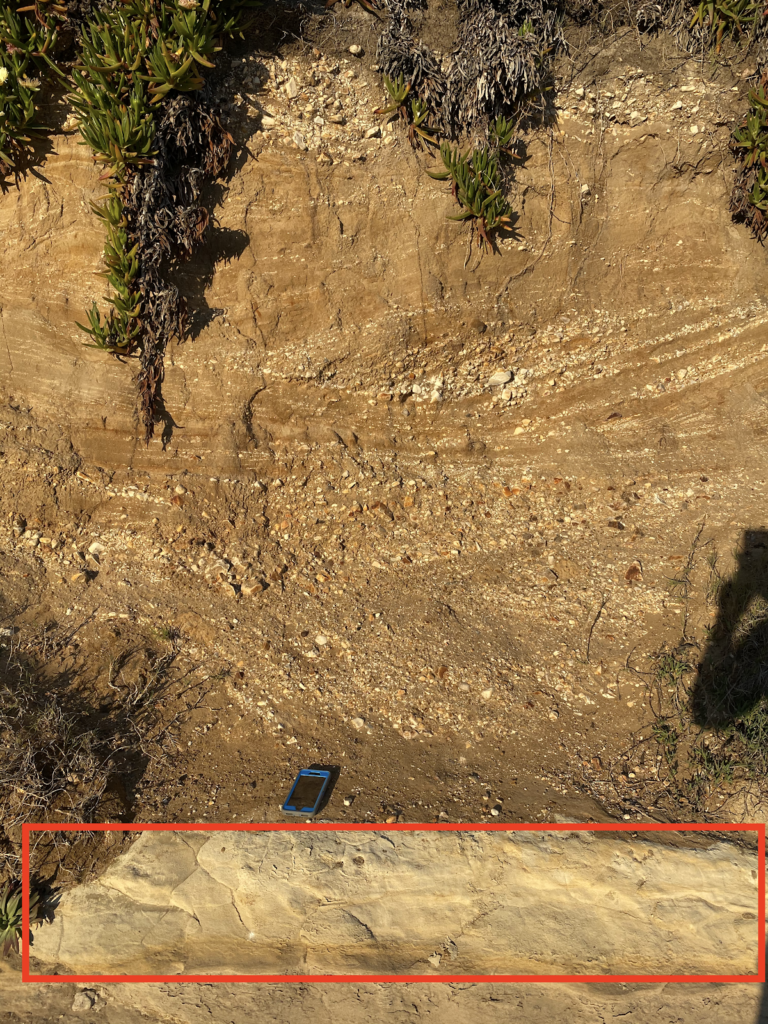
Purisima Formation (3-7 Ma)
This sandstone formation was deposited at shallow, near-shore conditions, which is why it has a coarser composition than the Santa Cruz Mudstone it followed. The blue-gray sandstone primarily consists of sediment deposited from rivers dumping into estuaries and bays.
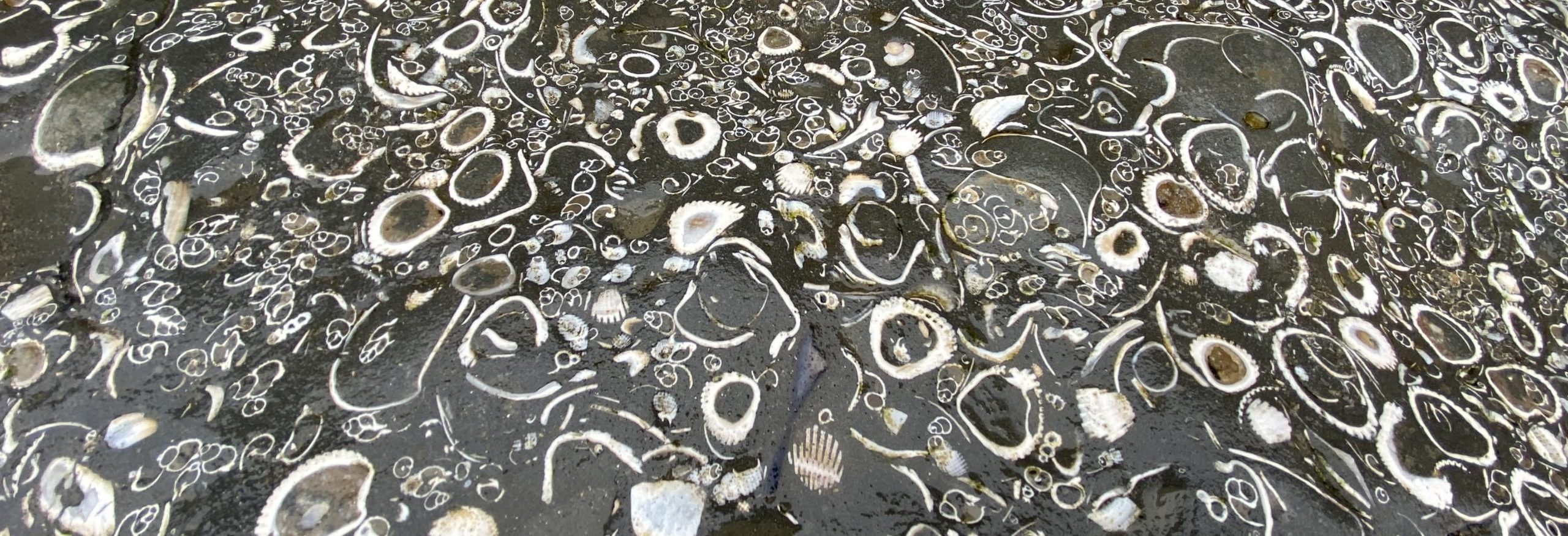
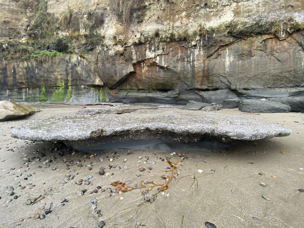
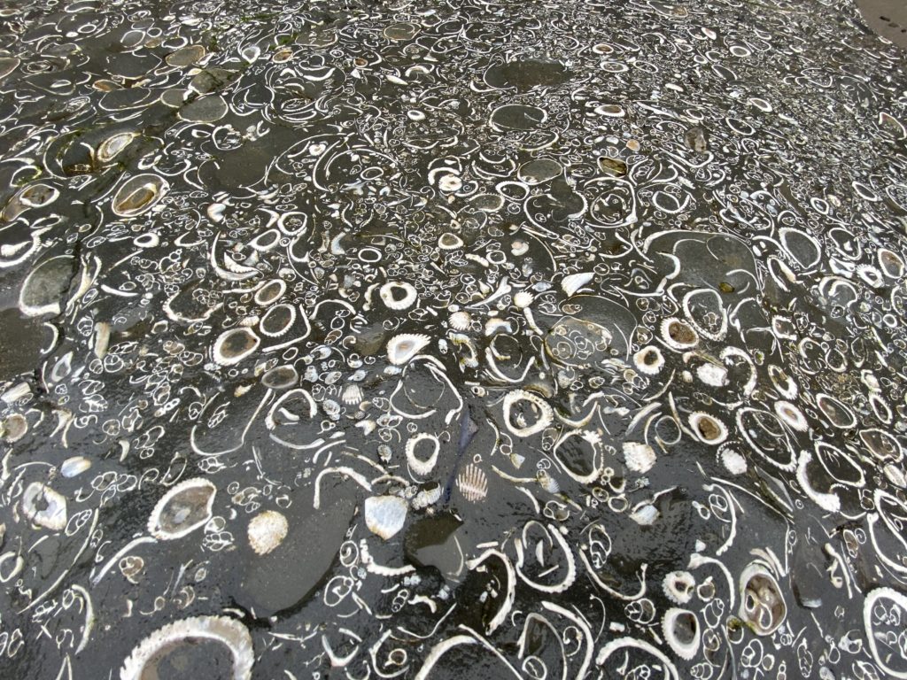
FOSSILS If you find a fossil on a beach in Santa Cruz County, it is most likely from this formation. The Purisima Formation features dozens of species of invertebrate fossils, especially mollusks, as well as cetaceans and pinnipeds (i.e. whales and seals).
WHERE Though there are outcrops of this formation north of Santa Cruz, within the County this formation can be found from where Merced Avenue intersects West Cliff Drive in Santa Cruz down to the cliffs of Seacliff State Beach. The best way to find fossils from this formation is at low tide on the beaches below Depot Hill in Capitola, between Capitola Beach and New Brighton Beach. Look to the cliff walls and through boulders and smaller rocks littering the sandy shore.
Santa Cruz Mudstone (7-9 Ma)
While the Purisima Formation formed from shallow-water sediment, the Santa Cruz Mudstone formed farther out at sea where the sediment consists of finer silt and clay. This formation has a more yellow tone and is often patterned with rusty red cracks, caused by methane seeping through the rock while it was still under water.
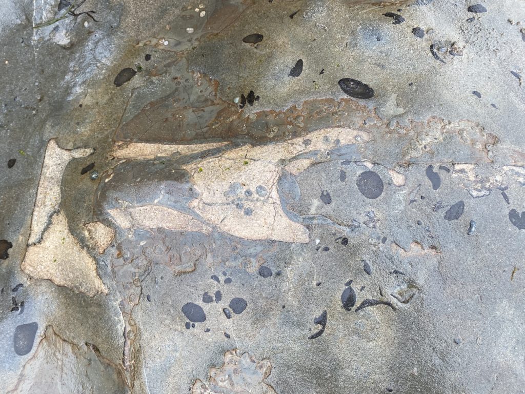
FOSSILS Finding a fossil in the Santa Cruz Mudstone formation is a much trickier task than the Purisima Formation that overlays it (in parts), but there are fossils to be found. While most are small bivalves (i.e. clams) and echinoids (i.e. sand dollars), O. megalodon teeth have been found in this Formation.
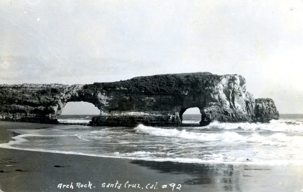
WHERE The arch at Natural Bridges State Beach is Santa Cruz Mudstone, as are all of the cliffs up the coast from there until just before Año Nuevo. Read our Guide to the Swift Street Outcrop to learn how to distinguish this mudstone from the Purisima Foundation sandstone.
The arch(es) at Natural Bridges State Beach have eroded over time so that now just one remains.
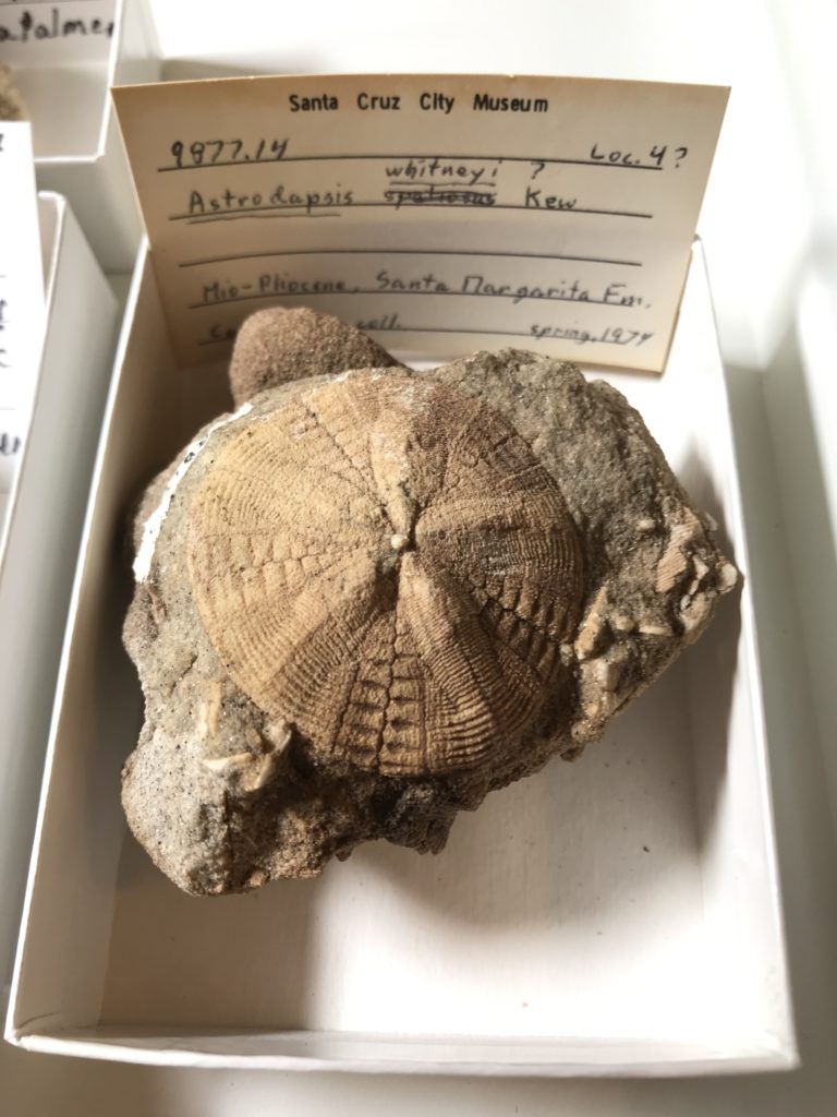
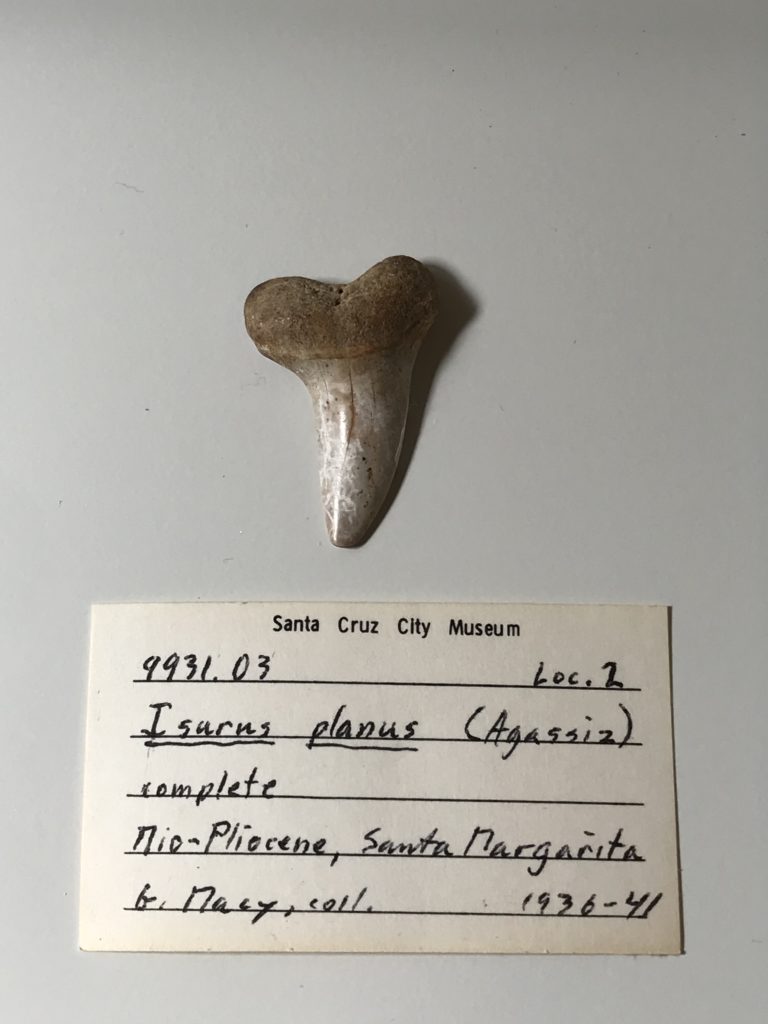
Santa Margarita Formation (10-12 Ma)
The Santa Margarita Formation is a marine deposit of Miocene sandstone and conglomerate. It is visible in areas of the southern Santa Cruz Mountains and you can spot it by its rough, chunky, and sparkling white appearance.
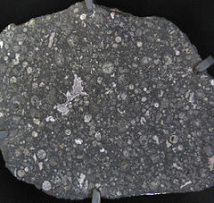
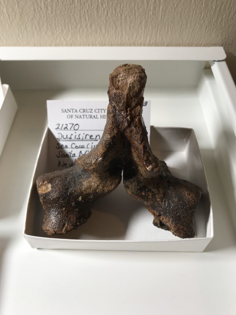
FOSSILS Some of Santa Cruz County’s most magnificent fossil finds have been unearthed from the Santa Margarita Formation. According to Frank Perry, “Fossils of at least 20 species of sharks and rays are present, as are remains of bony fishes, marine mammals such as sea cows and sea lions, and invertebrates including mollusks and sand dollars.”
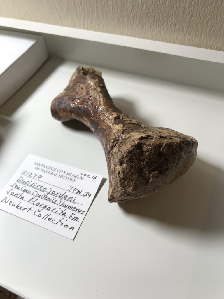
ON EXHIBIT Features from this formation on display in our exhibits are a cast of a fossil sea cow, an O. megalodon tooth, a jaw bone from a baleen whale, and a dig-box of sand dollars. We also have many more examples in our collections storage, such as the ones seen here.
WHERE There are outcrops of this formation in the lower parts of the Santa Cruz Mountains all the way up to Año Nuevo, but in Santa Cruz County we find it mostly north of Santa Cruz, through Scotts Valley and up to Boulder Creek. The rare Santa Cruz Sandhills habitat consists of sediment from this formation.
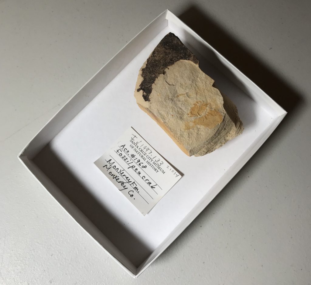
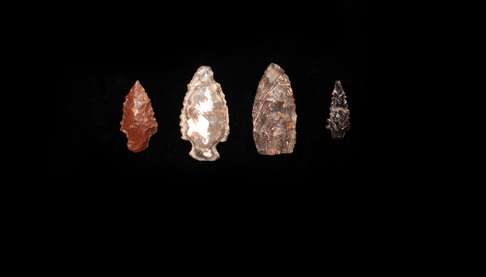
The Monterey Formation is a Miocene deposit rich in organic material. While it might not reveal fossils of charismatic megafauna like the Santa Margarita formation that followed, the Monterey formation has other interesting biotic features. Monterey Chert, used for tools by Indigenous peoples along the coast for thousands of years, is a feature of the Monterey formation. Chert is extremely diatomaceous (contains high quantities of organic material from plankton), and under other conditions could have become oil. Regularly occurring controversies regarding drilling for oil in the Monterey Bay are due to the presence of the diatom-rich Monterey Formation.
FOSSILS All of the above notwithstanding, there are micro-fossils to be found. Fossils of diatoms are only visible under a microscope, but fossils of some fish fragments and mollusks are (a little) easier to find. The example from our collections on the left is a fossil pea crab.
WHERE There are outcrops of this formation throughout the Santa Cruz Mountains — and throughout California. Oil drilling operations off the coast of Southern California and even inland are removing oil from the Monterey Formation. In Santa Cruz County, you can explore this type of rock on parts of Ben Lomond Mountain, along Lompico Creek, and at Majors Creek Canyon.
A variety of Awaswas stone points from present day Santa Cruz County, featuring chert.
FAQ
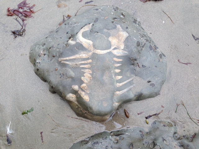
I think I found a dinosaur bone — did I?
That cool thing you found in Santa Cruz is undoubtedly cool, but we gotta tell you — it’s not a dinosaur. Our landscape in Santa Cruz was still millions of years away from forming when the dinosaurs were alive in the Mesozoic era, 248 to 65 million years ago.
So what did I find?
It could be a fossil bone or shell, or it could be a uniquely weathered stone. Explore the resources listed here or email a photo and detailed description to us at info@santacruzmuseum.org. You can help us identify your object if you:
Include a scale in your images, ideally not something that is relative in size like a hand or a banana, etc.
Take pictures or videos from multiple angles. For skulls, seeing the teeth is important.
Provide some general information on where you found it.
May I collect fossils?
Read our extensive guide on collecting ethics. When collecting anything from nature, always practice the “Know Before You Go” philosophy. Determine who manages the land you are on and their laws. For instance, State Parks do not allow collecting of any kind (plants, fossils, etc.), while National Forests do to an extent. Never collect without permission.
Is it a bone or a stone?
There are a few things to consider when determining if the object you have found is a (fossilized) bone or a stone.
Where was it found? If it was in your lawn, it’s probably a rock. Consider what rock formations are around you and how old they are.
Look at the texture. A rock will either be made up of packed sediment or crystalized minerals, whereas a fossilized bone will likely show evidence of the canals and webbing featured in actual bone.
Is it a modern bone or is it a fossilized bone?
Discarded bones have canals and webbing within them that are hollow. If the bone has fossilized, this texture will likely still be in evidence, but it will have been “filled” by mineralization. This also means that fossilized bones will likely feel heavier. Depending on how the bone fossilized, it may also have an altered color. BUT dark coloration does no necessarily mean it is a fossil — recent bones can also turn dark just by being under deep sand where the environment is anoxic.
Dig Deeper
Fossils at the Museum
On exhibit at the Museum
Cast of a fossil sea cow (Dusisiren jordani) excavated from the Santa Margarita Formation at a Zayante sand quarry in 1963.
Fossil skull of a Pacific Mastodon (Mammut pacificus) discovered in March 1980 by Aptos resident Jim Stanton. He spotted the giant molars protruding from a gravel bank along Aptos Creek.
Fossil jaw bone of a baleen whale from the Santa Margarita Formation in Scotts Valley.
An array of shark teeth (including Megalodon), bivalves, plants, and the skulls of a fossil dolphin, walrus, and sea lion, as well as microfossils.
Garden fossils: Take a stroll around the Museum’s Garden Learning Center and see if you can spot our large whale fossils.
Activities for kids: Multiple dig boxes features Santa Margarita Formation fossils of sand dollars and casts of a fossil sea cow.
Bring fossils home
Rent a kit to explore local fossils at home. Kit rentals are $10 per week and can be requested here (you do not need to be a teacher to request a rental).
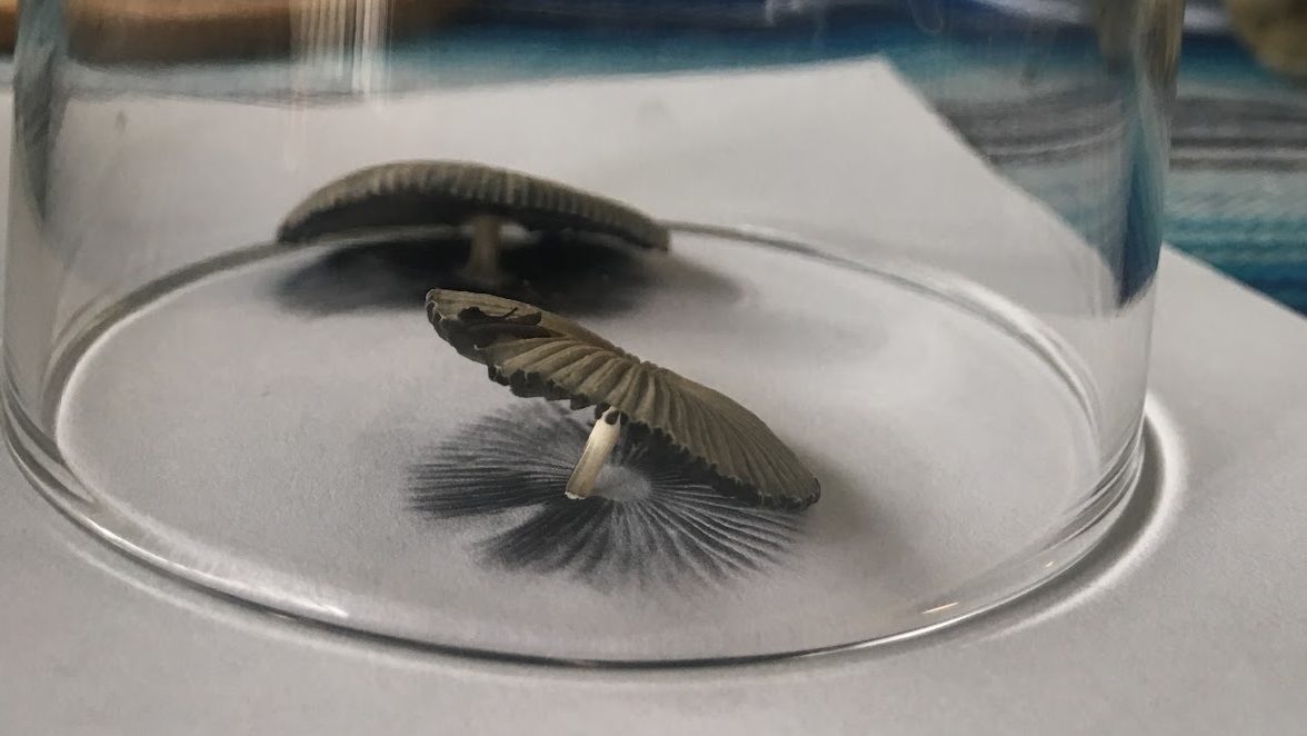
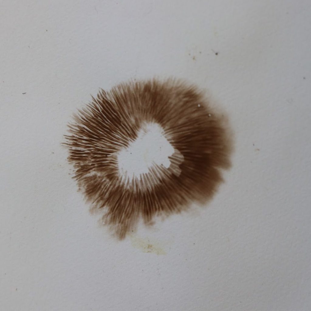
Sure, you can make beautiful pieces of art from the spores of a mushroom, but you can also learn more about the mushroom in the process, too!
Watch this video to learn how to make a spore print and explore more resources below.
Do you know what a spore is?
A spore is a reproductive cell. Some plants make them but bacteria, algae, and fungi make them too. Spores are to mushrooms as seeds are to plants. Spores are how mushrooms reproduce and make more mushrooms.
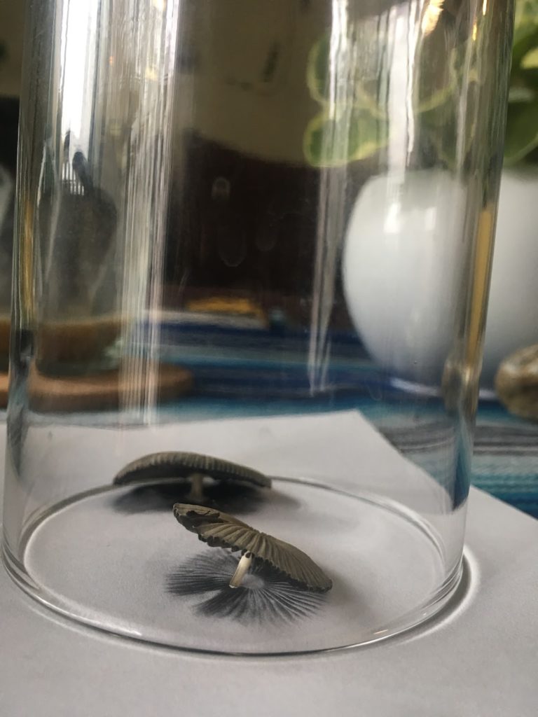
The first step to making a spore print is collecting a mushroom.
You can collect from:
Your yard
Your friend’s yard (with permission)
Local city park.
You cannot collect from:
Someone else’s property without permission
State parks
Please follow the rules of where you collect and make sure it is okay to collect from the area you are visiting.
Bring something to carry your mushroom with, like a basket or paper bag. You don’t want them to get squished in your pocket! Only pick the mushroom if there are a lot around because they are important for the environment.
Do you know why mushrooms are important?
Mushrooms are decomposers which means that they break down dead materials such as fallen leaves and logs to make soil and nutrients that help other living things survive. Remember to wash your hands after handling mushrooms!
Once back home:
Gather jars or containers big enough to place over the mushrooms. Gather white and black paper. It is okay if you only have white paper, but some mushroom spores are white and therefore they won’t show up on white paper that well.
Take the stems off the mushrooms using your hands or scissors.
Place the mushrooms with the gills or pores facing down onto the paper. Then place the container over the mushroom to create an airtight seal.
Leave the mushrooms covered anywhere from a couple hours to overnight based on how fresh the mushrooms are.
After you let the mushrooms sit for a while, carefully pick up the containers and the mushrooms to reveal the spore print. Spore prints are fragile, so try to avoid touching it.
Resources for identifying mushrooms
iNaturalist app for recording observations on your phone or desktop. Their algorithm suggests possible species.